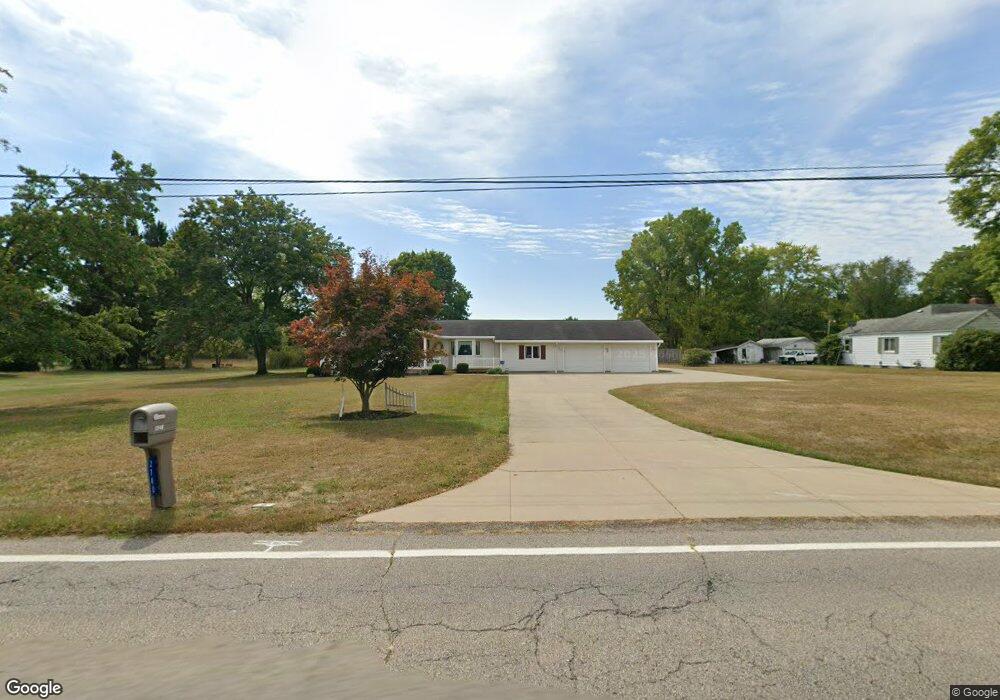
2740 Raber Rd Uniontown, OH 44685
Estimated Value: $284,000 - $307,000
3
Beds
2
Baths
1,782
Sq Ft
$167/Sq Ft
Est. Value
About This Home
This home is located at 2740 Raber Rd, Uniontown, OH 44685 and is currently estimated at $297,517, approximately $166 per square foot. 2740 Raber Rd is a home located in Summit County with nearby schools including Greenwood Elementary School, Green Primary School, and Green Intermediate Elementary School.
Ownership History
Date
Name
Owned For
Owner Type
Purchase Details
Closed on
May 8, 2021
Sold by
Dcs Development Corporation Inc
Bought by
Dcs Development Corporation Inc
Current Estimated Value
Purchase Details
Closed on
Jan 18, 2001
Sold by
Clark David W and Clark Catherine C
Bought by
Clark David W and Clark Catherine C
Create a Home Valuation Report for This Property
The Home Valuation Report is an in-depth analysis detailing your home's value as well as a comparison with similar homes in the area
Home Values in the Area
Average Home Value in this Area
Purchase History
| Date | Buyer | Sale Price | Title Company |
|---|---|---|---|
| Dcs Development Corporation Inc | -- | None Available | |
| Clark David W | -- | -- |
Source: Public Records
Tax History Compared to Growth
Tax History
| Year | Tax Paid | Tax Assessment Tax Assessment Total Assessment is a certain percentage of the fair market value that is determined by local assessors to be the total taxable value of land and additions on the property. | Land | Improvement |
|---|---|---|---|---|
| 2025 | $3,526 | $81,897 | $19,436 | $62,461 |
| 2024 | $3,526 | $81,897 | $19,436 | $62,461 |
| 2023 | $3,526 | $81,897 | $19,436 | $62,461 |
| 2022 | $3,088 | $65,713 | $15,425 | $50,288 |
| 2021 | $2,902 | $65,713 | $15,425 | $50,288 |
| 2020 | $2,848 | $65,720 | $15,430 | $50,290 |
| 2019 | $2,482 | $54,990 | $13,050 | $41,940 |
| 2018 | $2,536 | $54,990 | $13,050 | $41,940 |
| 2017 | $2,543 | $54,990 | $13,050 | $41,940 |
| 2016 | $2,531 | $52,300 | $13,050 | $39,250 |
| 2015 | $2,543 | $52,300 | $13,050 | $39,250 |
| 2014 | $2,528 | $52,300 | $13,050 | $39,250 |
| 2013 | $2,679 | $54,730 | $13,050 | $41,680 |
Source: Public Records
Map
Nearby Homes
- 3217 Deborah Ct
- 3212 Deborah Ct
- 3118 Kreighbaum Rd NW
- Sarasota Plan at Spring Hill - Spring Hill Villas
- Chester Plan at Spring Hill - Spring Hill Villas
- Kenai Plan at Spring Hill - Spring Hill Villas
- Holston Plan at Spring Hill - Spring Hill Villas
- Bradbern Plan at Spring Hill - Spring Hill Villas
- Northwood Plan at Spring Hill - Spring Hill Villas
- 2500 Marlborough Dr
- 2667 Spade Rd
- 2535 Royal County Down Unit B
- 2511 Royal County Down
- 3609 Glenshire Cir Unit 55B
- 3605 Elmhurst Cir
- 2185 Prestwick Dr
- 3648 Mulberry St NW
- 2694 Cardington Green Unit 23A
- 2186 Prestwick Dr
- 3979 Northdale St NW
- 2720 Raber Rd
- 2758 Raber Rd
- 2768 Raber Rd
- 2719 Raber Rd Unit 2721
- 2739 Raber Rd
- 2709 Raber Rd Unit 2711
- 2692 Raber Rd
- 2774 Raber Rd
- 2699 Raber Rd Unit 2701
- 89 Meadowbluff Dr
- 0 Myersville Rd Unit 220 3264904
- 0 Myersville Rd Unit 121 3264879
- 0 Myersville Rd Unit 219 3264927
- 0 Myersville Rd Unit 99 3264923
- 0 Myersville Rd Unit 3629159
- 0 Myersville Rd Unit 3629157
- 0 Myersville Rd Unit 3629151
- 0 Myersville Rd Unit 3629147
- 0 Myersville Rd Unit 3629121
- 0 Myersville Rd Unit 3680346