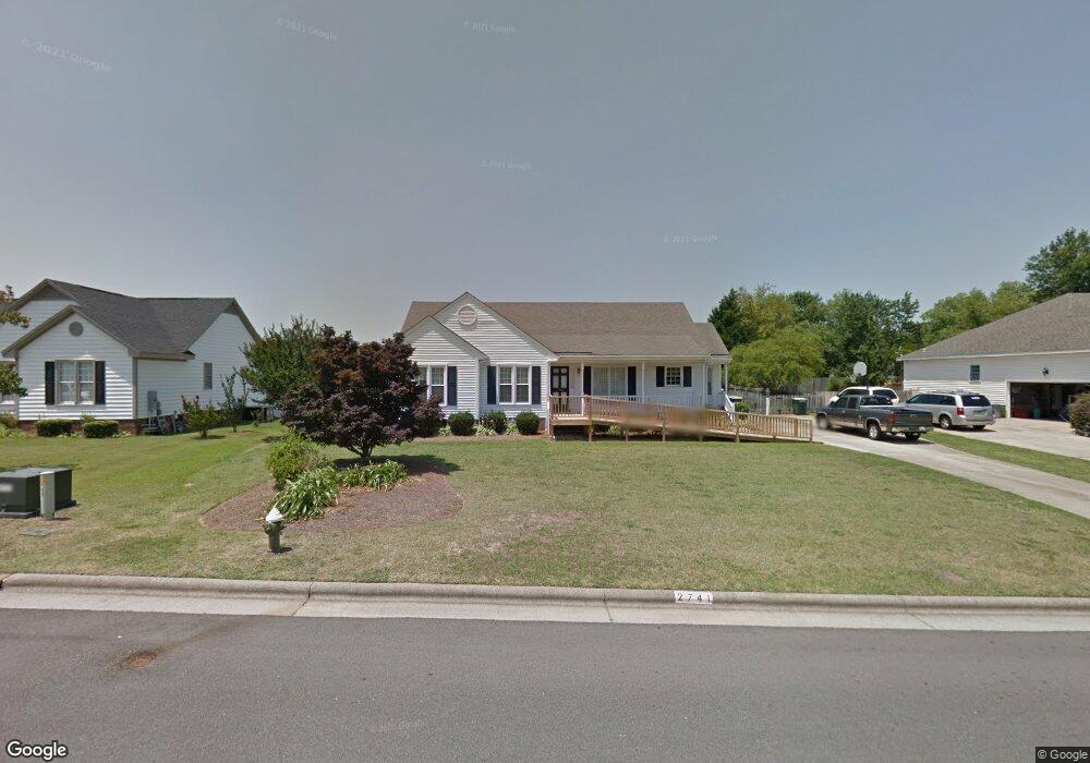
2741 Brentwood Dr N Wilson, NC 27896
Estimated Value: $277,522 - $326,000
3
Beds
2
Baths
1,777
Sq Ft
$167/Sq Ft
Est. Value
About This Home
This home is located at 2741 Brentwood Dr N, Wilson, NC 27896 and is currently estimated at $296,381, approximately $166 per square foot. 2741 Brentwood Dr N is a home located in Wilson County with nearby schools including Wells Elementary School, Toisnot Middle School, and Fike High School.
Ownership History
Date
Name
Owned For
Owner Type
Purchase Details
Closed on
Aug 30, 2021
Sold by
Mercer Debra M and Mercer Michael
Bought by
Miles Castanna M
Current Estimated Value
Home Financials for this Owner
Home Financials are based on the most recent Mortgage that was taken out on this home.
Original Mortgage
$216,015
Outstanding Balance
$196,558
Interest Rate
2.8%
Mortgage Type
FHA
Estimated Equity
$99,823
Purchase Details
Closed on
Nov 1, 2016
Sold by
Bunn Robert Ray and Bunn Garnett P
Bought by
Mercer Debra B and Bunn Michael Scott
Create a Home Valuation Report for This Property
The Home Valuation Report is an in-depth analysis detailing your home's value as well as a comparison with similar homes in the area
Home Values in the Area
Average Home Value in this Area
Purchase History
| Date | Buyer | Sale Price | Title Company |
|---|---|---|---|
| Miles Castanna M | $220,000 | None Available | |
| Mercer Debra B | -- | Attorney |
Source: Public Records
Mortgage History
| Date | Status | Borrower | Loan Amount |
|---|---|---|---|
| Open | Miles Castanna M | $216,015 |
Source: Public Records
Tax History Compared to Growth
Tax History
| Year | Tax Paid | Tax Assessment Tax Assessment Total Assessment is a certain percentage of the fair market value that is determined by local assessors to be the total taxable value of land and additions on the property. | Land | Improvement |
|---|---|---|---|---|
| 2025 | $3,051 | $272,366 | $45,000 | $227,366 |
| 2024 | $3,051 | $272,366 | $45,000 | $227,366 |
| 2023 | $2,035 | $155,930 | $33,000 | $122,930 |
| 2022 | $2,035 | $155,930 | $33,000 | $122,930 |
| 2021 | $0 | $155,930 | $33,000 | $122,930 |
| 2020 | $2,035 | $155,930 | $33,000 | $122,930 |
| 2019 | $2,035 | $155,930 | $33,000 | $122,930 |
| 2018 | $1,000 | $155,930 | $33,000 | $122,930 |
| 2017 | $2,004 | $155,930 | $33,000 | $122,930 |
| 2016 | $2,004 | $155,930 | $33,000 | $122,930 |
| 2014 | $2,013 | $161,699 | $33,000 | $128,699 |
Source: Public Records
Map
Nearby Homes
- 2906 Brentwood Dr N
- 2400 Bradford Dr N Unit 7b
- 2402 Bradford Dr N Unit 10A
- 2811 Deerfield Ln N
- 2560 Pond Dr N
- 2323 Alyson Dr N
- 2803 Ardsley Rd N
- 2917 Ward Blvd
- 2929 Ward Blvd
- 2311 Alyson Dr N
- 2214 Nash Place N
- 3217 Fieldstream Dr N
- 3202 Walbrook Place N
- 2405 Williamsburg Dr NW
- 401 Brentwood Dr N
- 3311 Westshire Dr
- 2313 Foxcroft Rd NW
- 3806 Wyattwood Dr N
- 3702 Arrowwood Dr N
- 1903 Anderson St NW
- 2739 Brentwood Dr N
- 2743 Brentwood Dr N
- 2822 Springflower Dr N
- 2737 Brentwood Dr N
- 2826 Springflower Dr N
- 2745 Brentwood Dr N
- 2802 Daisy Ln N
- 2742 Brentwood Dr N
- 2740 Brentwood Dr N
- 2744 Brentwood Dr N
- 2828 Springflower Dr N
- 2738 Brentwood Dr N
- 2747 Brentwood Dr N
- 2746 Brentwood Dr N
- 2830 Springflower Dr N
- 2730-8A Brentwood Dr
- 2801 Daisy Ln N
- 2825 Springflower Dr N
- 2823 Springflower Dr N
- 2804 Daisy Ln N