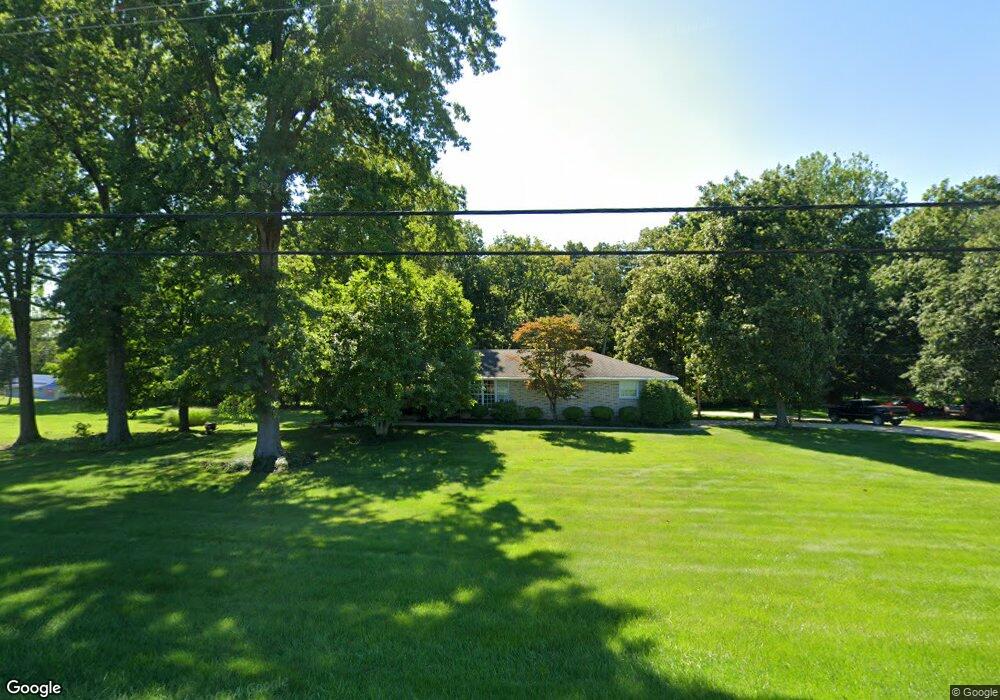
2741 State Route 83 Millersburg, OH 44654
Estimated Value: $270,590 - $377,000
3
Beds
2
Baths
1,680
Sq Ft
$195/Sq Ft
Est. Value
About This Home
This home is located at 2741 State Route 83, Millersburg, OH 44654 and is currently estimated at $328,148, approximately $195 per square foot. 2741 State Route 83 is a home located in Holmes County with nearby schools including West Holmes High School, Walnut Grove School C/O David L. Troyer, and Clark Valley.
Ownership History
Date
Name
Owned For
Owner Type
Purchase Details
Closed on
Mar 10, 2021
Sold by
Close Jack A and Close Beulah L
Bought by
Close Jack A and Close Beulah J
Current Estimated Value
Purchase Details
Closed on
Jan 1, 1990
Bought by
Close Jack A and Close Beulah L
Create a Home Valuation Report for This Property
The Home Valuation Report is an in-depth analysis detailing your home's value as well as a comparison with similar homes in the area
Home Values in the Area
Average Home Value in this Area
Purchase History
| Date | Buyer | Sale Price | Title Company |
|---|---|---|---|
| Close Jack A | -- | None Available | |
| Close Jack A | -- | -- |
Source: Public Records
Tax History Compared to Growth
Tax History
| Year | Tax Paid | Tax Assessment Tax Assessment Total Assessment is a certain percentage of the fair market value that is determined by local assessors to be the total taxable value of land and additions on the property. | Land | Improvement |
|---|---|---|---|---|
| 2024 | $2,062 | $64,300 | $15,890 | $48,410 |
| 2023 | $2,062 | $64,300 | $15,890 | $48,410 |
| 2022 | $2,180 | $64,300 | $15,890 | $48,410 |
| 2021 | $1,818 | $51,880 | $12,290 | $39,590 |
| 2020 | $1,777 | $51,880 | $12,290 | $39,590 |
| 2019 | $1,734 | $51,880 | $12,290 | $39,590 |
| 2018 | $1,507 | $44,940 | $9,450 | $35,490 |
| 2017 | $1,499 | $44,940 | $9,450 | $35,490 |
| 2016 | $1,500 | $44,940 | $9,450 | $35,490 |
| 2015 | $1,389 | $42,670 | $7,810 | $34,860 |
| 2014 | $1,396 | $42,670 | $7,810 | $34,860 |
| 2013 | $727 | $42,670 | $7,810 | $34,860 |
Source: Public Records
Map
Nearby Homes
- 7636 Arbon Dr Unit 1222
- 7675 Wild Horn Dr
- 118 Bern Dr
- 2770 Stammheim Dr
- 3190 Buckhorn Dr
- 0 Ohio 83
- 3515 County Road 58
- 1910 Susten Dr
- 3605 State Route 83
- 7771 Buckhorn Cove
- 7077 County Road 68
- 0 Berlin Township 309
- 6866 Township Road 310
- 241 Fairway Dr
- 6581 Township Road 310
- 8800 U S Highway 62
- 989 N Railroad St
- 70 S Alexander St
- 340 N Water St
- 0 Ohio 83
- 1222 Arbon Dr
- 1468 Arbon Dr
- 2901 Private Road 136
- 2699 State Route 83
- 7715 Arbon Dr Unit 1303
- 2791 State Route 83
- 2752 State Route 83
- 2693 State Route 83
- 2810 State Route 83
- 2746 Constance Dr
- 2817 State Route 83
- 2664 State Route 83
- 2686 State Route 83
- 0 Constance Dr Unit 3229071
- 0 Constance Dr Unit 3314354
- 1220 Miller Dr
- 1310 Constance Dr
- 2829 State Route 83
- 2658 State Route 83
- 2745 Constance Dr