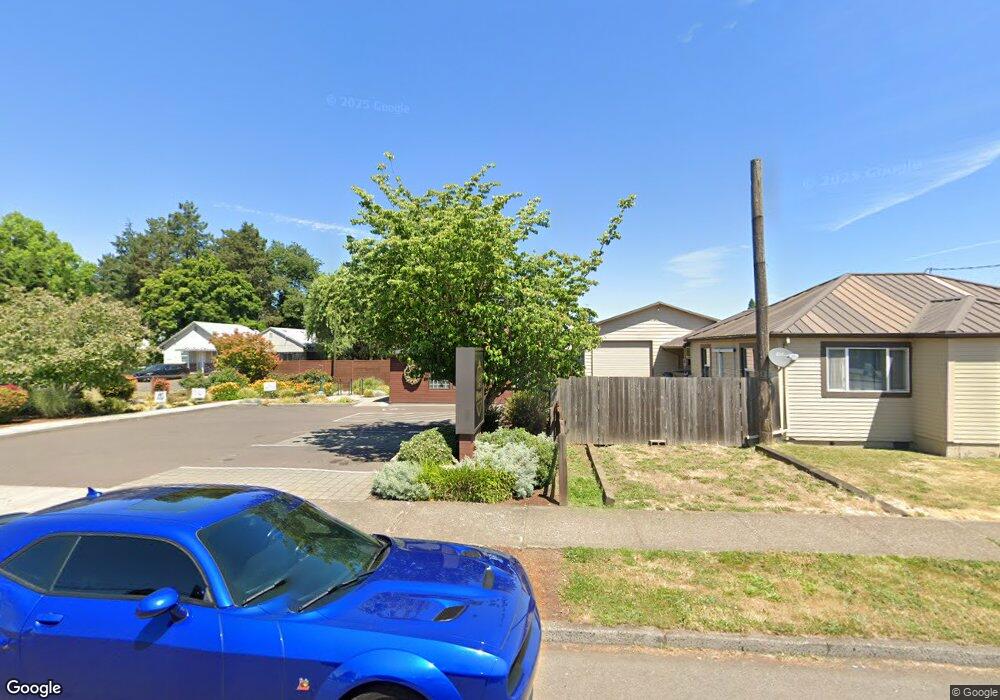
2743 19th Ave Forest Grove, OR 97116
Estimated Value: $438,959
1
Bed
1
Bath
1,004
Sq Ft
$437/Sq Ft
Est. Value
About This Home
This home is located at 2743 19th Ave, Forest Grove, OR 97116 and is currently estimated at $438,959, approximately $437 per square foot. 2743 19th Ave is a home located in Washington County with nearby schools including Joseph Gale Elementary School, Neil Armstrong Middle School, and Tom McCall Upper Elementary School.
Ownership History
Date
Name
Owned For
Owner Type
Purchase Details
Closed on
Oct 15, 2015
Sold by
Henry Micheal and Boland Rebecca
Bought by
Mile High Holdings Llc
Current Estimated Value
Purchase Details
Closed on
May 15, 2015
Sold by
Glynn Leona Jane
Bought by
Henry Michael and Boland Rebecca
Home Financials for this Owner
Home Financials are based on the most recent Mortgage that was taken out on this home.
Original Mortgage
$130,625
Interest Rate
3.67%
Mortgage Type
Commercial
Create a Home Valuation Report for This Property
The Home Valuation Report is an in-depth analysis detailing your home's value as well as a comparison with similar homes in the area
Home Values in the Area
Average Home Value in this Area
Purchase History
| Date | Buyer | Sale Price | Title Company |
|---|---|---|---|
| Mile High Holdings Llc | $245,000 | Wfg Title | |
| Henry Michael | $135,000 | Wfg Title |
Source: Public Records
Mortgage History
| Date | Status | Borrower | Loan Amount |
|---|---|---|---|
| Previous Owner | Henry Michael | $130,625 |
Source: Public Records
Tax History Compared to Growth
Tax History
| Year | Tax Paid | Tax Assessment Tax Assessment Total Assessment is a certain percentage of the fair market value that is determined by local assessors to be the total taxable value of land and additions on the property. | Land | Improvement |
|---|---|---|---|---|
| 2026 | $2,787 | $156,000 | -- | -- |
| 2025 | $2,787 | $148,900 | -- | -- |
| 2024 | $3,239 | $144,290 | -- | -- |
| 2023 | $3,239 | $172,530 | $0 | $0 |
| 2022 | $2,832 | $172,530 | $0 | $0 |
| 2021 | $2,795 | $162,640 | $0 | $0 |
| 2020 | $2,780 | $157,910 | $0 | $0 |
| 2019 | $2,719 | $153,320 | $0 | $0 |
| 2018 | $2,635 | $148,860 | $0 | $0 |
| 2017 | $2,554 | $144,530 | $0 | $0 |
| 2016 | $2,482 | $140,330 | $0 | $0 |
| 2015 | $1,079 | $61,570 | $0 | $0 |
| 2014 | -- | $59,780 | $0 | $0 |
Source: Public Records
Map
Nearby Homes
- 2824 19th Ave
- 2902 19th Ave
- 2815 18th Ave
- 1822 Hawthorne St
- 1813 Filbert St
- 2828 22nd Ave Unit 3
- 2828 22nd Ave Unit 5
- 0 Kingwood St
- 2743 15th Place
- 2366 Kingwood St
- 3128 Brittany Dr
- 0 Crescent Dr
- 2321 Annie Lou Ct
- 2323 19th Ave
- 2820 23rd Place
- 3404 19th Ave Unit 103
- 3404 19th Ave Unit 215
- 3213 Maple Place
- 2358 Kingwood St
- 2837 25th Place
- 2803 19th Ave
- 2737 19th Ave
- 2742 19th Place
- 2738 19th Place
- 0 19th Ave
- 2728 19th Place
- 2811 19th Ave Unit 1
- 2811 19th Ave Unit B
- 2722 19th Place
- 2812 19th Ave
- 2716 19th Place
- 2717 19th Ave
- 2716 19th Ave
- 2820 19th Ave
- 2806 19th Ave
- 2720 19th Ave
- 1911 Hawthorne St
- 1903 Hawthorne St Unit A
- 1903 Hawthorne St
- 2835 19th Ave