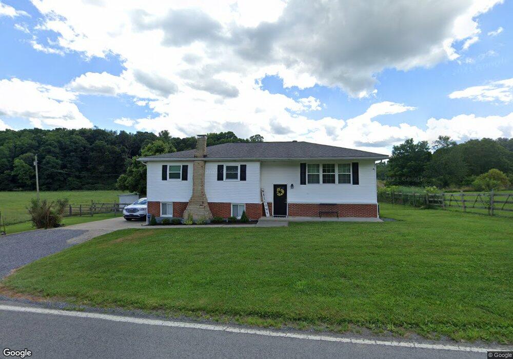
2744 Brushy Fork Rd Bridgeport, WV 26330
Estimated Value: $249,000 - $373,000
3
Beds
2
Baths
2,496
Sq Ft
$118/Sq Ft
Est. Value
About This Home
This home is located at 2744 Brushy Fork Rd, Bridgeport, WV 26330 and is currently estimated at $293,962, approximately $117 per square foot. 2744 Brushy Fork Rd is a home.
Ownership History
Date
Name
Owned For
Owner Type
Purchase Details
Closed on
Jul 23, 2019
Sold by
Faber Pamela S
Bought by
Mcculley Ryan M
Current Estimated Value
Home Financials for this Owner
Home Financials are based on the most recent Mortgage that was taken out on this home.
Original Mortgage
$5,000
Outstanding Balance
$3,249
Interest Rate
3.73%
Mortgage Type
New Conventional
Estimated Equity
$290,713
Purchase Details
Closed on
Jun 30, 2017
Sold by
Steadman Richard K and Steadman Susan J
Bought by
Faber Robert S and Faber Pamela S
Home Financials for this Owner
Home Financials are based on the most recent Mortgage that was taken out on this home.
Original Mortgage
$135,000
Interest Rate
3.94%
Mortgage Type
New Conventional
Purchase Details
Closed on
Sep 13, 2005
Sold by
Hofer Barbara J
Bought by
Steadman Richard K and Steadman Susan J
Create a Home Valuation Report for This Property
The Home Valuation Report is an in-depth analysis detailing your home's value as well as a comparison with similar homes in the area
Home Values in the Area
Average Home Value in this Area
Purchase History
| Date | Buyer | Sale Price | Title Company |
|---|---|---|---|
| Mcculley Ryan M | $210,000 | None Available | |
| Faber Robert S | $185,000 | -- | |
| Steadman Richard K | $115,000 | None Available |
Source: Public Records
Mortgage History
| Date | Status | Borrower | Loan Amount |
|---|---|---|---|
| Open | Mcculley Ryan M | $5,000 | |
| Open | Mcculley Ryan M | $203,700 | |
| Previous Owner | Faber Robert S | $135,000 |
Source: Public Records
Tax History Compared to Growth
Tax History
| Year | Tax Paid | Tax Assessment Tax Assessment Total Assessment is a certain percentage of the fair market value that is determined by local assessors to be the total taxable value of land and additions on the property. | Land | Improvement |
|---|---|---|---|---|
| 2025 | $1,169 | $100,380 | $16,380 | $84,000 |
| 2024 | $1,169 | $95,400 | $16,380 | $79,020 |
| 2023 | $1,094 | $101,640 | $16,380 | $85,260 |
| 2022 | $1,203 | $102,120 | $16,380 | $85,740 |
| 2021 | $1,176 | $100,980 | $16,380 | $84,600 |
| 2020 | $953 | $82,680 | $16,380 | $66,300 |
| 2019 | $950 | $82,380 | $16,380 | $66,000 |
| 2018 | $942 | $82,080 | $15,960 | $66,120 |
| 2017 | $713 | $62,400 | $15,480 | $46,920 |
| 2016 | $693 | $61,380 | $14,580 | $46,800 |
| 2015 | $674 | $59,340 | $13,680 | $45,660 |
| 2014 | $657 | $57,960 | $12,300 | $45,660 |
Source: Public Records
Map
Nearby Homes
- 542 Brushy Fork Rd
- TBD Coplin Run Rd
- 516 Brushy Fork Rd
- 131 Frisco Ln
- TBD Benedum Run Rd
- TBD Sterling Dr
- 4950 Buckhannon Pike
- 7 Mayflower Ln
- 332 Timberbrook Ln
- 54 Church St
- 0 Stouts Run Rd
- 7644 Buckhannon Pike
- TBD Hinkle Lake Rd
- TBD N 24th St
- 210 Frisco Ln
- 2589 Philippi Pike
- 113 Frisco Ln
- 111 Frisco Ln
- 8688 Cost Ave
- 8037 Maple Ave
- 2827 Brushy Fork Rd
- 2869 Brushy Fork Rd
- 2556 Brushy Fork Rd
- 2455 Brushy Fork Rd
- 2477 Brushy Fork Rd
- 2389 Brushy Fork Rd
- 2591 Brushy Fork Rd
- 2339 Brushy Fork Rd
- 0 Brushy Fork Rd Unit 11183255
- 58 Half and Half Dr
- 348 Gould Farm Rd
- 157 Sigley Rd
- 3363 Route 23 Rd
- 126 Half and Half Dr
- 299 Confederate Dr
- 286 Oake Den Farme Ln
- 217 Ruffed Grouse Dr
- 3119 Hinkle Lake Rd
- 243 Ruffed Grouse Dr
- 388 Ruffed Grouse Dr