Estimated Value: $298,803 - $659,000
--
Bed
--
Bath
--
Sq Ft
4,400
Sq Ft Lot
About This Home
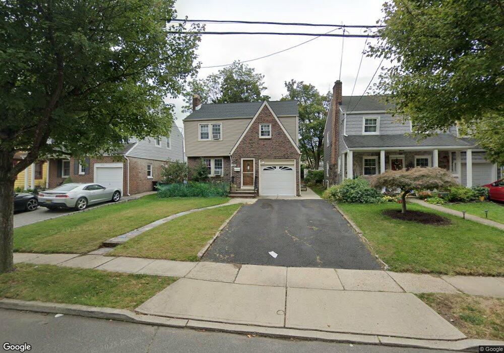
This home is located at 2744 Carol Rd, Union, NJ 07083 and is currently estimated at $551,201. 2744 Carol Rd is a home located in Union County with nearby schools including Battle Hill Elementary School, Burnet Middle School, and Union High School.
Ownership History
Date
Name
Owned For
Owner Type
Purchase Details
Closed on
Oct 4, 2001
Sold by
Feiwus Ada
Bought by
Nebedum Steve M and Nebedum Emelda N
Current Estimated Value
Home Financials for this Owner
Home Financials are based on the most recent Mortgage that was taken out on this home.
Original Mortgage
$203,200
Outstanding Balance
$79,772
Interest Rate
6.93%
Estimated Equity
$471,429
Create a Home Valuation Report for This Property
The Home Valuation Report is an in-depth analysis detailing your home's value as well as a comparison with similar homes in the area
Home Values in the Area
Average Home Value in this Area
Purchase History
| Date | Buyer | Sale Price | Title Company |
|---|---|---|---|
| Nebedum Steve M | $254,000 | -- |
Source: Public Records
Mortgage History
| Date | Status | Borrower | Loan Amount |
|---|---|---|---|
| Open | Nebedum Steve M | $203,200 |
Source: Public Records
Tax History Compared to Growth
Tax History
| Year | Tax Paid | Tax Assessment Tax Assessment Total Assessment is a certain percentage of the fair market value that is determined by local assessors to be the total taxable value of land and additions on the property. | Land | Improvement |
|---|---|---|---|---|
| 2025 | $10,796 | $48,300 | $16,600 | $31,700 |
| 2024 | $10,466 | $48,300 | $16,600 | $31,700 |
| 2023 | $10,466 | $48,300 | $16,600 | $31,700 |
| 2022 | $10,102 | $48,300 | $16,600 | $31,700 |
| 2021 | $9,858 | $48,300 | $16,600 | $31,700 |
| 2020 | $9,661 | $48,300 | $16,600 | $31,700 |
| 2019 | $9,531 | $48,300 | $16,600 | $31,700 |
| 2018 | $9,369 | $48,300 | $16,600 | $31,700 |
| 2017 | $9,230 | $48,300 | $16,600 | $31,700 |
| 2016 | $9,005 | $48,300 | $16,600 | $31,700 |
| 2015 | $8,856 | $48,300 | $16,600 | $31,700 |
| 2014 | $8,657 | $48,300 | $16,600 | $31,700 |
Source: Public Records
Map
Nearby Homes
- 1071 Battle Hill Terrace
- 1042 Battle Hill Terrace
- 2785 Larchmont Rd
- 2641 Burns Place
- 2620 Eleanor Terrace
- 2615 Burns Place
- 980 Moessner Ave
- 960 Moessner Ave
- 2 Bashford-B Unit B
- 1214 Carlton Terrace
- 2636 Frederick Terrace
- 8 Bashford Ave Unit 8
- 2535 Standish Ave
- 1239 Rony Rd
- 1270 Carlton Terrace
- 2510 Crane Place
- 2505 Girard Place
- 30 Washington Ave
- 1114 Elker Rd
- 1163 Burnet Ave
- 2746 Carol Rd
- 2740 Carol Rd
- 2734 Carol Rd
- 1095 Kensington Terrace
- 1085 Kensington Terrace
- 1084 Nicholas Ave
- 1094 Nicholas Ave
- 1081 Kensington Terrace
- 1080 Nicholas Ave
- 1079 Kensington Terrace
- 1094 Kensington Terrace
- 2747 Carol Rd
- 2751 Carol Rd
- 2743 Carol Rd
- 1076 Nicholas Ave
- 2737 Carol Rd
- 2753 Carol Rd
- 1073 Kensington Terrace
- 2764 Carol Rd
- 1104 Nicholas Ave