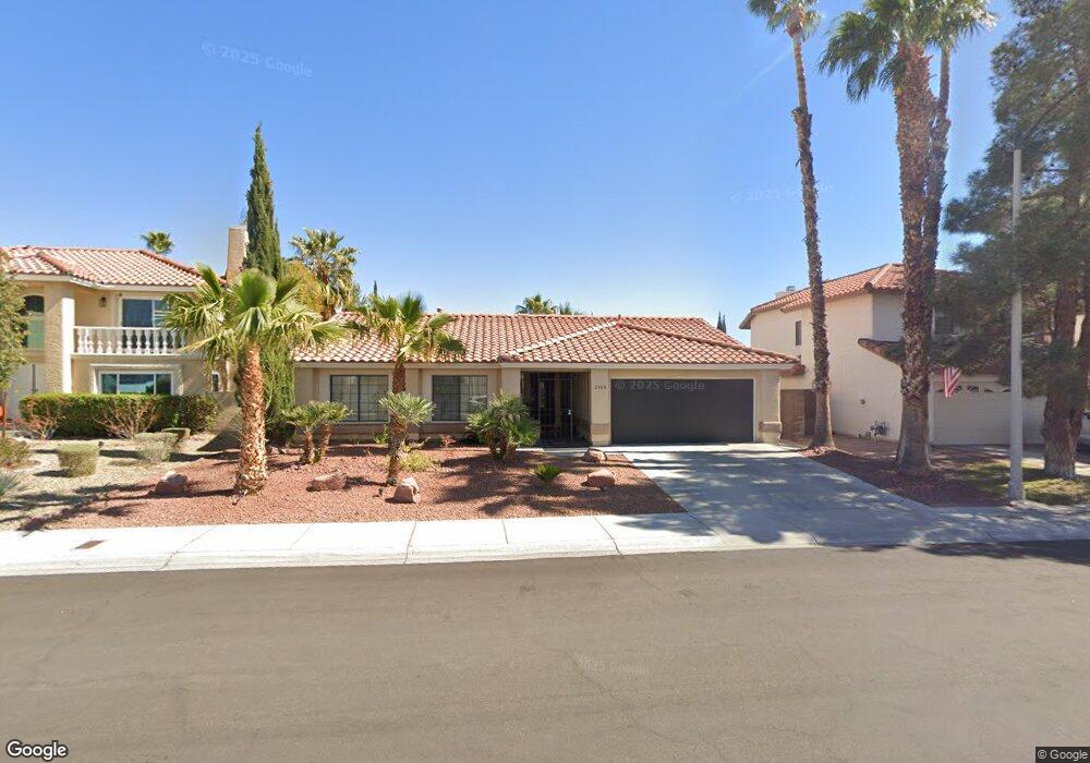
2744 Lodestone Dr Unit 50 Las Vegas, NV 89117
The Lakes NeighborhoodEstimated Value: $224,000 - $328,000
2
Beds
2
Baths
1,005
Sq Ft
$281/Sq Ft
Est. Value
About This Home
This home is located at 2744 Lodestone Dr Unit 50, Las Vegas, NV 89117 and is currently estimated at $282,254, approximately $280 per square foot. 2744 Lodestone Dr Unit 50 is a home located in Clark County with nearby schools including M J Christensen Elementary School, Clifford J Lawrence Junior High School, and Spring Valley High School.
Ownership History
Date
Name
Owned For
Owner Type
Purchase Details
Closed on
Aug 20, 2010
Sold by
Premsrirut Puonyarat K and Premsrirut Rutt K
Bought by
Caramanica Lillian Vallerie
Current Estimated Value
Purchase Details
Closed on
Jul 6, 2010
Sold by
Johnson Lloyd D and Johnson Linda R
Bought by
The Prem Deferred Trust
Purchase Details
Closed on
Feb 15, 2005
Sold by
Johnson Lloyd D
Bought by
Johnson Lloyd D and Johnson Linda R
Purchase Details
Closed on
Sep 23, 2004
Sold by
Johnson Lloyd Dale and Johnson Frances M
Bought by
Johnson Lloyd D
Purchase Details
Closed on
Dec 29, 2003
Sold by
Sarro Richard J
Bought by
Johnson Lloyd Dale and Johnson Frances Marie
Home Financials for this Owner
Home Financials are based on the most recent Mortgage that was taken out on this home.
Original Mortgage
$117,000
Interest Rate
5.81%
Mortgage Type
Purchase Money Mortgage
Purchase Details
Closed on
Feb 13, 2002
Sold by
Camerota Robert A and Camerota Doreen M
Bought by
Sarro Richard J
Purchase Details
Closed on
Oct 5, 2001
Sold by
Camerota Robert Anthony
Bought by
Camerota Robert Anthony and Camerota Doreen M
Home Financials for this Owner
Home Financials are based on the most recent Mortgage that was taken out on this home.
Original Mortgage
$82,600
Interest Rate
6.91%
Mortgage Type
Purchase Money Mortgage
Purchase Details
Closed on
May 12, 1994
Sold by
Mitchell Debra A
Bought by
Camerota Robert Anthony
Home Financials for this Owner
Home Financials are based on the most recent Mortgage that was taken out on this home.
Original Mortgage
$84,550
Interest Rate
8.3%
Mortgage Type
Purchase Money Mortgage
Create a Home Valuation Report for This Property
The Home Valuation Report is an in-depth analysis detailing your home's value as well as a comparison with similar homes in the area
Home Values in the Area
Average Home Value in this Area
Purchase History
| Date | Buyer | Sale Price | Title Company |
|---|---|---|---|
| Caramanica Lillian Vallerie | $65,000 | Direct Title Insurance Agen | |
| The Prem Deferred Trust | $48,000 | None Available | |
| Johnson Lloyd D | -- | -- | |
| Johnson Lloyd D | -- | -- | |
| Johnson Lloyd Dale | $130,000 | Nevada Title Company | |
| Sarro Richard J | $100,000 | Stewart Title | |
| Camerota Robert Anthony | -- | Lawyers Title | |
| Camerota Robert Anthony | $89,000 | Nevada Title Company |
Source: Public Records
Mortgage History
| Date | Status | Borrower | Loan Amount |
|---|---|---|---|
| Previous Owner | Johnson Lloyd Dale | $117,000 | |
| Previous Owner | Camerota Robert Anthony | $82,600 | |
| Previous Owner | Camerota Robert Anthony | $84,550 |
Source: Public Records
Tax History Compared to Growth
Tax History
| Year | Tax Paid | Tax Assessment Tax Assessment Total Assessment is a certain percentage of the fair market value that is determined by local assessors to be the total taxable value of land and additions on the property. | Land | Improvement |
|---|---|---|---|---|
| 2025 | $1,132 | $63,630 | $28,000 | $35,630 |
| 2024 | $1,049 | $63,630 | $28,000 | $35,630 |
| 2023 | $1,049 | $65,672 | $32,550 | $33,122 |
| 2022 | $972 | $57,890 | $26,250 | $31,640 |
| 2021 | $900 | $49,815 | $23,100 | $26,715 |
| 2020 | $833 | $44,382 | $22,750 | $21,632 |
| 2019 | $780 | $41,227 | $19,600 | $21,627 |
| 2018 | $745 | $32,108 | $10,850 | $21,258 |
| 2017 | $1,037 | $31,617 | $9,800 | $21,817 |
| 2016 | $656 | $30,635 | $8,400 | $22,235 |
| 2015 | $696 | $27,176 | $6,300 | $20,876 |
| 2014 | $634 | $23,006 | $5,250 | $17,756 |
Source: Public Records
Map
Nearby Homes
- 8961 Clairton Ct Unit 101
- 8932 Antioch Way
- 2761 Lodestone Dr Unit 63
- 2709 Otter Creek Ct Unit 201
- 2724 Otter Creek Ct Unit 101
- 2705 Beaver Creek Ct Unit 101
- 2701 Brookstone Ct
- 8804 River Pines Ct Unit 202
- 9021 Feather River Ct
- 8848 Rainbow Ridge Dr
- 2712 Quail Roost Way
- 8924 Sail Bay Dr
- 9100 Shelter Cove Ct
- 9109 Anchor Cove Ct
- 9113 Anchor Cove Ct
- 9305 Hollycrest Dr
- 2300 Glenbrook Way
- 2024 Bay Hill Dr
- 2200 S Fort Apache Rd Unit 2133
- 2200 S Fort Apache Rd Unit 2044
- 2760 Lodestone Dr Unit 54
- 2760 Lodestone Dr
- 2700 Lodestone Dr
- 2765 Ferrin Rd
- 8973 Clairton Ct Unit 104
- 2764 Lodestone Dr
- 2765 Ferrin Rd Unit 1
- 2700 Lodestone Dr Unit 39
- 2700 Lodestone Dr Unit WOW
- 2772 Lodestone Dr
- 2772 Lodestone Dr Unit 57
- 8957 Clairton Ct Unit 100
- 2736 Ferrin Rd Unit 88
- 2713 Ferrin Rd
- 2709 Ferrin Rd
- 2740 Ferrin Rd Unit 87
- 2705 Ferrin Rd
- 2768 Lodestone Dr
- 8905 Antioch Way
- 8900 Antioch Way