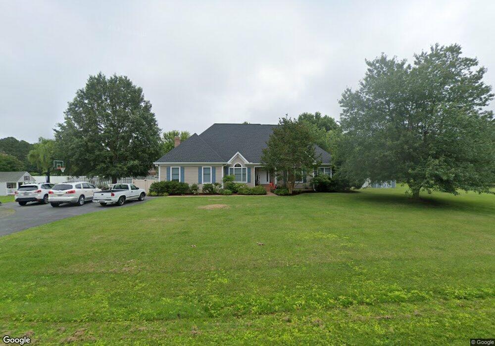
27475 Wrights Rest Ln Easton, MD 21601
Estimated Value: $1,042,748 - $1,693,000
--
Bed
4
Baths
4,085
Sq Ft
$324/Sq Ft
Est. Value
About This Home
This home is located at 27475 Wrights Rest Ln, Easton, MD 21601 and is currently estimated at $1,323,437, approximately $323 per square foot. 27475 Wrights Rest Ln is a home located in Talbot County with nearby schools including St. Michaels Elementary School, St. Michaels Middle/High School, and Easton High School.
Ownership History
Date
Name
Owned For
Owner Type
Purchase Details
Closed on
Mar 2, 1999
Sold by
Wright Joint Venture Llc
Bought by
Troshinsky Matthew B
Current Estimated Value
Purchase Details
Closed on
Sep 14, 1998
Sold by
Wright Joint Venture Llc
Bought by
Richardson Donald J
Purchase Details
Closed on
Feb 14, 1997
Sold by
Kemp Robert L
Bought by
Wright Joint Venture Llc
Purchase Details
Closed on
Dec 31, 1996
Sold by
Rest Joint Venture The
Bought by
Kemp Robert L
Create a Home Valuation Report for This Property
The Home Valuation Report is an in-depth analysis detailing your home's value as well as a comparison with similar homes in the area
Home Values in the Area
Average Home Value in this Area
Purchase History
| Date | Buyer | Sale Price | Title Company |
|---|---|---|---|
| Troshinsky Matthew B | $303,000 | -- | |
| Richardson Donald J | $55,000 | -- | |
| Wright Joint Venture Llc | $45,000 | -- | |
| Wright Joint Venture Llc | $12,000 | -- | |
| Kemp Robert L | -- | -- |
Source: Public Records
Mortgage History
| Date | Status | Borrower | Loan Amount |
|---|---|---|---|
| Closed | Wright Joint Venture Llc | -- |
Source: Public Records
Tax History Compared to Growth
Tax History
| Year | Tax Paid | Tax Assessment Tax Assessment Total Assessment is a certain percentage of the fair market value that is determined by local assessors to be the total taxable value of land and additions on the property. | Land | Improvement |
|---|---|---|---|---|
| 2025 | $3,323 | $663,133 | $0 | $0 |
| 2024 | $3,323 | $630,700 | $205,900 | $424,800 |
| 2023 | $3,127 | $625,300 | $0 | $0 |
| 2022 | $2,959 | $619,900 | $0 | $0 |
| 2021 | $2,784 | $614,500 | $205,200 | $409,300 |
| 2020 | $2,784 | $593,033 | $0 | $0 |
| 2019 | $2,760 | $571,567 | $0 | $0 |
| 2018 | $2,655 | $550,100 | $205,200 | $344,900 |
| 2017 | $2,527 | $538,667 | $0 | $0 |
| 2016 | $2,370 | $527,233 | $0 | $0 |
| 2015 | $2,140 | $515,800 | $0 | $0 |
| 2014 | $2,140 | $515,800 | $0 | $0 |
Source: Public Records
Map
Nearby Homes
- 27240 Hayward Trail
- 27232 Hayward Trail
- 28092 Glebe Rd
- 0 Unionville Rd Unit MDTA2008824
- 9361 Woodstock Ln
- 28309 Village Lake Way
- 8095 N Fork Blvd
- 0 Lot 16 N Unit MDTA2012070
- 8014 Easton Village Dr
- 66 Johnson St
- 7852 Woodland Cir
- 8210 Ingleton Cir
- 26698 Arcadia Shores Rd
- 222 W Dover St
- 220 W Dover St
- 305 Port St
- 28522 Waterview Dr
- 365 Glebe Rd
- 209 Tubman Dr
- 304 Wheatley Dr
- 27506 Rest Cir
- 27488 Rest Cir
- 27522 Rest Cir
- 27478 Rest Cir
- 27441 Wrights Rest Ln
- 27322 Rest Cir
- 27330 Rest Cir
- 0 Rest Cir
- 27332 Rest Cir
- 27435 Wrights Rest Ln
- 27442 Rest Cir
- 27422 Rest Cir
- 27459 Rest Cir
- 27338 Rest Cir
- 8845 Teal Point Rd
- 27329 Rest Cir
- 27318 Rest Cir
- 27406 Rest Cir
- 27333 Rest Cir
- 27342 Rest Cir