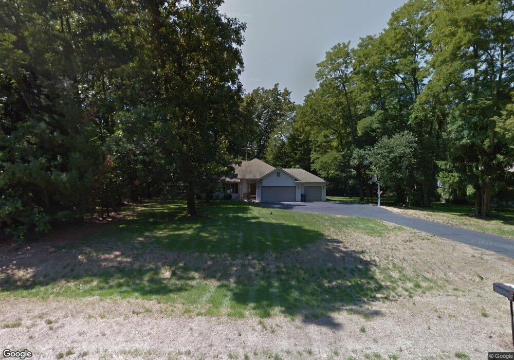
27478 Rolling Pines Ct Lawton, MI 49065
Estimated Value: $302,000 - $380,000
3
Beds
2
Baths
1,640
Sq Ft
$206/Sq Ft
Est. Value
About This Home
This home is located at 27478 Rolling Pines Ct, Lawton, MI 49065 and is currently estimated at $338,303, approximately $206 per square foot. 27478 Rolling Pines Ct is a home located in Van Buren County with nearby schools including Mattawan Early Elementary School, Mattawan Later Elementary School, and Mattawan Early Childhood Education Center.
Ownership History
Date
Name
Owned For
Owner Type
Purchase Details
Closed on
Nov 13, 2001
Sold by
Roselli William M and Roselli Cynthia L
Bought by
Bolton Donald S
Current Estimated Value
Purchase Details
Closed on
Nov 17, 2000
Sold by
Hazzard John W
Bought by
Roselli William M and Roselli Cynthia L
Purchase Details
Closed on
May 1, 1996
Sold by
Visser Henry W and Visser Clarine J
Bought by
Hazzard John and Hazzard Karen
Create a Home Valuation Report for This Property
The Home Valuation Report is an in-depth analysis detailing your home's value as well as a comparison with similar homes in the area
Home Values in the Area
Average Home Value in this Area
Purchase History
| Date | Buyer | Sale Price | Title Company |
|---|---|---|---|
| Bolton Donald S | $168,000 | -- | |
| Roselli William M | $160,400 | -- | |
| Hazzard John | $160,000 | -- |
Source: Public Records
Tax History Compared to Growth
Tax History
| Year | Tax Paid | Tax Assessment Tax Assessment Total Assessment is a certain percentage of the fair market value that is determined by local assessors to be the total taxable value of land and additions on the property. | Land | Improvement |
|---|---|---|---|---|
| 2025 | $1,294 | $158,600 | $0 | $0 |
| 2024 | $1,294 | $146,900 | $0 | $0 |
| 2023 | $1,232 | $144,800 | $0 | $0 |
| 2022 | $3,945 | $142,700 | $0 | $0 |
| 2021 | $3,799 | $138,100 | $15,000 | $123,100 |
| 2020 | $3,747 | $141,400 | $15,000 | $126,400 |
| 2019 | $3,473 | $128,000 | $128,000 | $0 |
| 2018 | $3,397 | $109,100 | $109,100 | $0 |
| 2017 | $3,276 | $109,700 | $0 | $0 |
| 2016 | $3,303 | $102,400 | $0 | $0 |
| 2015 | $2,911 | $102,400 | $0 | $0 |
| 2014 | $2,894 | $105,200 | $0 | $0 |
| 2013 | -- | $95,500 | $95,500 | $0 |
Source: Public Records
Map
Nearby Homes
- 28302 Springbrook Dr
- 28313 58th Ave
- 61121 Airpark Ln
- 59134 Whitewood Dr
- 59103 Silvergrass Dr
- 58640 Swenson St
- 58913 Swenson St
- 29698 Jewells Dr
- 58664 Swenson St
- 59037 Norton St
- 59075 Norton St
- 58606 Interlaken St
- Elements 1870 Plan at Concord Farms
- Traditions 1600 V8.0b Plan at Concord Farms - Traditions
- Elements 2100 Plan at Concord Farms
- Integrity 2060 Plan at Concord Farms - Integrity
- Elements 2390 Plan at Concord Farms
- Integrity 1460 Plan at Concord Farms - Integrity
- Integrity 1880 Plan at Concord Farms - Integrity
- Elements 1800 Plan at Concord Farms
- 27466 Rolling Pines Ct
- 27490 Rolling Pines Ct
- 5 Rolling Pines Ct
- 21 Rolling Pines Ct
- 10 Rolling Pines Ct
- 7 Rolling Pines Ct
- 4 Rolling Pines Ct
- 18 Rolling Pines Ct
- 19 Rolling Pines Ct
- 27475 Rolling Pines Ct
- 61023 County Road 657
- 61155 County Road 657
- 27454 Rolling Pines Ct
- 27502 Rolling Pines Ct
- 27467 Rolling Pines Ct
- 60891 County Road 657
- 27459 Rolling Pines Ct
- 27514 Rolling Pines Ct
- 27921 Rolling Pines Ct
- 27555 Rolling Pines Ct