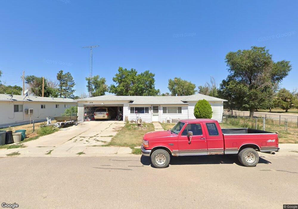
275 Birch St Deer Trail, CO 80105
Estimated Value: $300,000 - $373,000
3
Beds
1
Bath
1,896
Sq Ft
$181/Sq Ft
Est. Value
About This Home
This home is located at 275 Birch St, Deer Trail, CO 80105 and is currently estimated at $343,124, approximately $180 per square foot. 275 Birch St is a home with nearby schools including Deer Trail Elementary School and Deer Trail Junior/Senior High School.
Ownership History
Date
Name
Owned For
Owner Type
Purchase Details
Closed on
Dec 14, 2010
Sold by
Estate Of Nancy L Johnson
Bought by
Johnson William Elbert
Current Estimated Value
Purchase Details
Closed on
Nov 24, 1993
Sold by
Johnson William E
Bought by
Johnson William E and Johnson Nancy L
Home Financials for this Owner
Home Financials are based on the most recent Mortgage that was taken out on this home.
Original Mortgage
$15,667
Interest Rate
7.19%
Purchase Details
Closed on
Jul 4, 1776
Bought by
Conversion Arapco
Create a Home Valuation Report for This Property
The Home Valuation Report is an in-depth analysis detailing your home's value as well as a comparison with similar homes in the area
Home Values in the Area
Average Home Value in this Area
Purchase History
| Date | Buyer | Sale Price | Title Company |
|---|---|---|---|
| Johnson William Elbert | -- | None Available | |
| Johnson William E | -- | Title America | |
| Conversion Arapco | -- | -- |
Source: Public Records
Mortgage History
| Date | Status | Borrower | Loan Amount |
|---|---|---|---|
| Closed | Johnson William E | $15,667 |
Source: Public Records
Tax History Compared to Growth
Tax History
| Year | Tax Paid | Tax Assessment Tax Assessment Total Assessment is a certain percentage of the fair market value that is determined by local assessors to be the total taxable value of land and additions on the property. | Land | Improvement |
|---|---|---|---|---|
| 2024 | $1,297 | $17,259 | -- | -- |
| 2023 | $1,297 | $17,259 | $0 | $0 |
| 2022 | $1,090 | $14,574 | $0 | $0 |
| 2021 | $1,141 | $14,574 | $0 | $0 |
| 2020 | $1,264 | $16,017 | $0 | $0 |
| 2019 | $1,247 | $16,017 | $0 | $0 |
| 2018 | $1,387 | $16,495 | $0 | $0 |
| 2017 | $1,388 | $16,495 | $0 | $0 |
| 2016 | $397 | $11,176 | $0 | $0 |
| 2015 | $389 | $11,176 | $0 | $0 |
| 2014 | $307 | $8,406 | $0 | $0 |
| 2013 | -- | $7,960 | $0 | $0 |
Source: Public Records
Map
Nearby Homes
- 444 3rd Ave
- 329 4th Ave
- 505 2nd Ave
- 805 Cedar St
- 0 7th Ave
- 54 S 4th Place
- 84 S 4th Ave
- Vacant land 7 11th Ave
- Vacant Land 5 11th Ave
- 0 Vacant Land 6 Unit 6 REC6098118
- 262 S 4th Ct
- 265 S 4th Ct
- 281 S 3rd Ave
- 301 S 4th Ct
- 310 S 4th Ct
- 436 S 3rd Ave
- 1334 4th Ave
- 217 S Price Rd
- 2520 Peoria Rd
- 29295 County Road 190