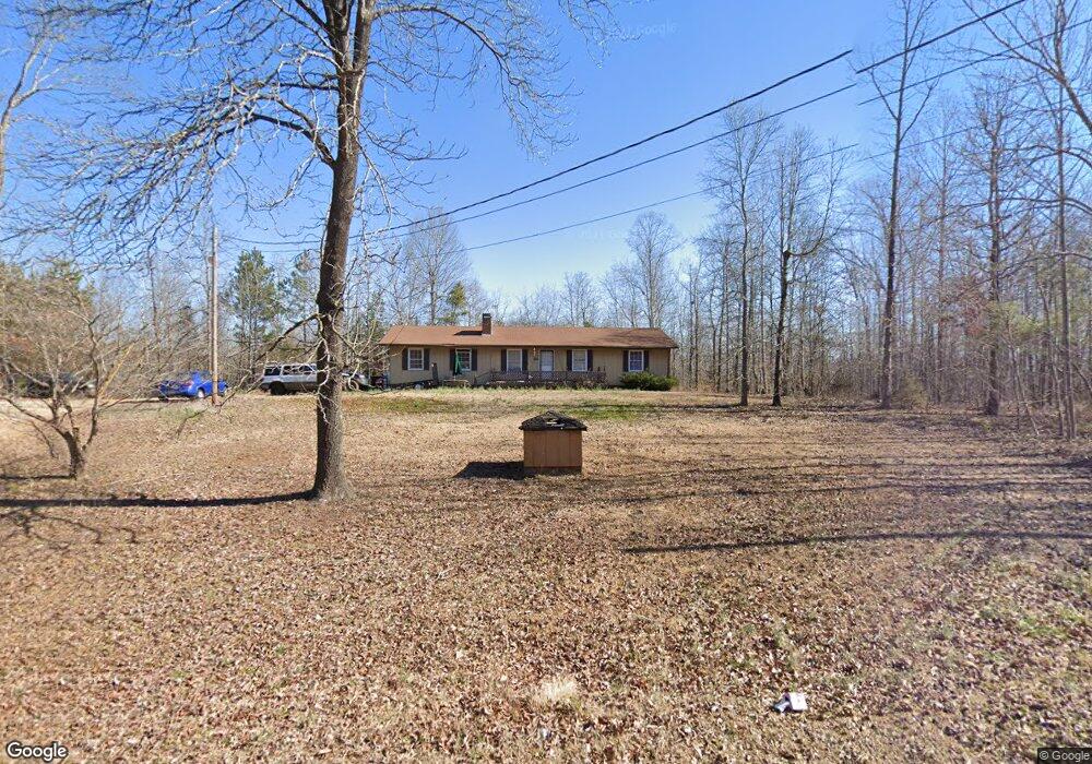
275 Defoor Rd Toccoa, GA 30577
Estimated Value: $144,000 - $279,000
2
Beds
2
Baths
1,179
Sq Ft
$190/Sq Ft
Est. Value
About This Home
This home is located at 275 Defoor Rd, Toccoa, GA 30577 and is currently estimated at $223,433, approximately $189 per square foot. 275 Defoor Rd is a home located in Stephens County with nearby schools including Stephens County High School.
Ownership History
Date
Name
Owned For
Owner Type
Purchase Details
Closed on
Jan 9, 2014
Sold by
Free Deborah Elaine
Bought by
Free Deborah Elaine and Free Terry Daniel
Current Estimated Value
Purchase Details
Closed on
May 18, 2011
Sold by
Stephens Federal Bank
Bought by
Heaton Jerry
Purchase Details
Closed on
Mar 1, 2011
Sold by
Abshire Mason J
Bought by
Stephens Federal Bank
Purchase Details
Closed on
Jul 23, 2004
Bought by
Abshire Mason J
Purchase Details
Closed on
Jun 28, 2002
Bought by
<Buyer Info Not Present>
Purchase Details
Closed on
Jun 1, 1987
Bought by
<Buyer Info Not Present>
Create a Home Valuation Report for This Property
The Home Valuation Report is an in-depth analysis detailing your home's value as well as a comparison with similar homes in the area
Purchase History
| Date | Buyer | Sale Price | Title Company |
|---|---|---|---|
| Free Deborah Elaine | -- | -- | |
| Heaton Jerry | $38,000 | -- | |
| Stephens Federal Bank | -- | -- | |
| Abshire Mason J | $77,500 | -- | |
| <Buyer Info Not Present> | $68,500 | -- | |
| <Buyer Info Not Present> | $43,000 | -- |
Source: Public Records
Tax History
| Year | Tax Paid | Tax Assessment Tax Assessment Total Assessment is a certain percentage of the fair market value that is determined by local assessors to be the total taxable value of land and additions on the property. | Land | Improvement |
|---|---|---|---|---|
| 2025 | $1,082 | $39,400 | $3,923 | $35,477 |
| 2024 | $842 | $27,658 | $3,923 | $23,735 |
| 2023 | $792 | $26,012 | $3,923 | $22,089 |
| 2022 | $742 | $24,911 | $3,923 | $20,988 |
| 2021 | $731 | $23,367 | $3,923 | $19,444 |
| 2020 | $737 | $23,325 | $3,923 | $19,402 |
| 2019 | $684 | $21,576 | $3,736 | $17,840 |
| 2018 | $684 | $21,576 | $3,736 | $17,840 |
| 2017 | $695 | $21,576 | $3,736 | $17,840 |
| 2016 | $684 | $21,575 | $3,735 | $17,839 |
| 2015 | $717 | $21,575 | $3,735 | $17,839 |
| 2014 | $728 | $21,575 | $3,736 | $17,840 |
| 2013 | -- | $22,897 | $4,670 | $18,227 |
Source: Public Records
Map
Nearby Homes
- 451 Defoor Rd
- 900 Defoor Rd
- 3.35 ACRES Keener Rd
- 0 Davis Rd Unit 10694033
- 545 Shady Ln
- 46 Cedar Ridge Dr
- 5.10 ACRES Hwy 123
- 513 S Red Rock Rd
- Lot 21 Deer Chase
- 535 Deer Chase
- 0 Scott Rd Unit 10702484
- 0 Hickory Log Cir Unit 7723744
- 0 Hickory Log Cir Unit 7723737
- 0 Hickory Log Cir Unit 10696877
- 0 Hickory Log Cir Unit 10696890
- 0 Hickory Log Cir Unit CL349707
- 0 Hickory Log Cir Unit 10696864
- 0 Hickory Log Cir Unit 7723742
- 0 Hickory Log Cir Unit CL349704
- 0 Hickory Log Cir Unit CL349705
- 339 Defoor Rd
- 0 Defoor Rd Unit 37 & 38 8301522
- 0 Defoor Rd Unit 2678179
- 0 Defoor Rd Unit 7122091
- 0 Defoor Rd Unit CM225481
- 233 Defoor Rd
- 364 Defoor Rd
- 208 Defoor Rd
- 208 Defoor Rd Unit 2-8
- 300 Sweetgum Rd
- 181 Defoor Rd
- 162 Foxglove Rd
- 398 Defoor Rd
- 427 Defoor Rd
- 172 Defoor Rd
- 127 Dogwood Rd
- 86 Foxglove Rd
- 299 Sweetgum Rd
- 149 Dubignon Dr
- 359 Sweetgum Rd
Your Personal Tour Guide
Ask me questions while you tour the home.