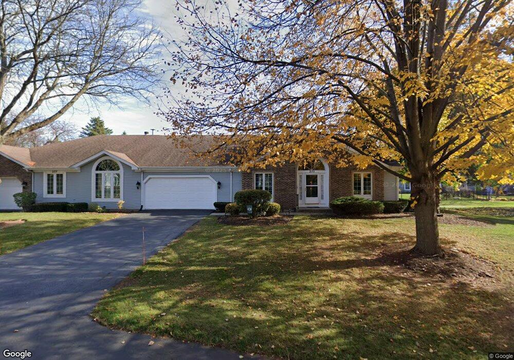
275 Governors Ln Elgin, IL 60123
North Country Knolls NeighborhoodEstimated Value: $358,035 - $395,000
2
Beds
2
Baths
1,858
Sq Ft
$207/Sq Ft
Est. Value
About This Home
This home is located at 275 Governors Ln, Elgin, IL 60123 and is currently estimated at $384,759, approximately $207 per square foot. 275 Governors Ln is a home located in Kane County with nearby schools including Hillcrest Elementary School, Kimball Middle School, and Larkin High School.
Ownership History
Date
Name
Owned For
Owner Type
Purchase Details
Closed on
Sep 14, 2022
Sold by
Anderson Family Trust
Bought by
Simon V Anderson And Nancy C Anderson Trust
Current Estimated Value
Purchase Details
Closed on
Jun 1, 2011
Sold by
Anderson Simon V and Anderson Nancy
Bought by
Anderson Family Trust
Purchase Details
Closed on
Oct 27, 2010
Sold by
Meyer Richard B and Sarvas Judith A
Bought by
Anderson Simon and Anderson Nancy
Home Financials for this Owner
Home Financials are based on the most recent Mortgage that was taken out on this home.
Original Mortgage
$144,000
Interest Rate
4.37%
Mortgage Type
New Conventional
Create a Home Valuation Report for This Property
The Home Valuation Report is an in-depth analysis detailing your home's value as well as a comparison with similar homes in the area
Home Values in the Area
Average Home Value in this Area
Purchase History
| Date | Buyer | Sale Price | Title Company |
|---|---|---|---|
| Simon V Anderson And Nancy C Anderson Trust | -- | -- | |
| Anderson Family Trust | -- | None Available | |
| Anderson Simon | $180,000 | Fidelity Natl Title Ins Co |
Source: Public Records
Mortgage History
| Date | Status | Borrower | Loan Amount |
|---|---|---|---|
| Previous Owner | Anderson Simon | $144,000 |
Source: Public Records
Tax History
| Year | Tax Paid | Tax Assessment Tax Assessment Total Assessment is a certain percentage of the fair market value that is determined by local assessors to be the total taxable value of land and additions on the property. | Land | Improvement |
|---|---|---|---|---|
| 2024 | $7,325 | $107,536 | $28,523 | $79,013 |
| 2023 | $6,918 | $97,150 | $25,768 | $71,382 |
| 2022 | $6,727 | $88,584 | $23,496 | $65,088 |
| 2021 | $6,408 | $82,820 | $21,967 | $60,853 |
| 2020 | $6,208 | $79,065 | $20,971 | $58,094 |
| 2019 | $6,007 | $75,314 | $19,976 | $55,338 |
| 2018 | $5,927 | $70,951 | $18,819 | $52,132 |
| 2017 | $5,767 | $67,074 | $17,791 | $49,283 |
| 2016 | $5,463 | $62,226 | $16,505 | $45,721 |
| 2015 | -- | $54,745 | $15,128 | $39,617 |
| 2014 | -- | $49,410 | $14,941 | $34,469 |
| 2013 | -- | $50,713 | $15,335 | $35,378 |
Source: Public Records
Map
Nearby Homes
- 2022 Torino Dr
- 512 Shenandoah Trail
- 92 N Airlite St
- 550 Madison Ln
- 1630 Maple Ln
- 221 Heine Ave
- Lot 1 Highland Springs Dr
- 640 Highland Springs Dr
- 40 Acres Randall Rd
- 2214 Colorado Ave Unit 4
- 682 Alice Place
- 1419 Harlan Ave
- 519 Shagbark Dr
- 308 N Clifton Ave
- 207 Second St
- 660 Robin Ridge
- 764 Scott Dr
- 215 Second St
- 10N866 Hawthorne St
- 906 Carol Ave
- 277 Governors Ln
- 273 Governors Ln
- 220 Coventry Ct
- 210 Coventry Ct
- 281 Governors Ln
- 276 Governors Ln
- 280 Governors Ln
- 270 Governors Ln
- 270 Governors Ln Unit 270
- 271 Governors Ln
- 230 Coventry Ct
- 283 Governors Ln
- 200 Coventry Ct
- 282 Governors Ln
- 293 Presidential Ln
- 297 Presidential Ln
- 291 Presidential Ln
- 240 Coventry Ct
- 290 Governors Ln
- 1970 Salem Rd
Your Personal Tour Guide
Ask me questions while you tour the home.