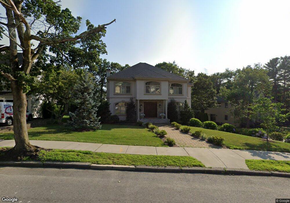
275 Hartman Rd Newton Center, MA 02459
Oak Hill NeighborhoodEstimated Value: $3,347,028 - $3,816,000
5
Beds
6
Baths
5,700
Sq Ft
$631/Sq Ft
Est. Value
About This Home
This home is located at 275 Hartman Rd, Newton Center, MA 02459 and is currently estimated at $3,596,757, approximately $631 per square foot. 275 Hartman Rd is a home located in Middlesex County with nearby schools including Memorial Spaulding Elementary School, Oak Hill Middle School, and Newton South High School.
Ownership History
Date
Name
Owned For
Owner Type
Purchase Details
Closed on
Aug 1, 2012
Sold by
275 Hartman Road Llc
Bought by
Gaba Alejandro E and Lachner Marianne
Current Estimated Value
Home Financials for this Owner
Home Financials are based on the most recent Mortgage that was taken out on this home.
Original Mortgage
$1,499,250
Outstanding Balance
$1,036,380
Interest Rate
3.7%
Mortgage Type
Purchase Money Mortgage
Estimated Equity
$2,560,377
Purchase Details
Closed on
Jul 8, 1994
Sold by
Mcwhorter C Bruce and Mcwhorter Katherine F
Bought by
Ringvald Miguel and Ringvald Vardit
Home Financials for this Owner
Home Financials are based on the most recent Mortgage that was taken out on this home.
Original Mortgage
$202,500
Interest Rate
8.51%
Mortgage Type
Purchase Money Mortgage
Create a Home Valuation Report for This Property
The Home Valuation Report is an in-depth analysis detailing your home's value as well as a comparison with similar homes in the area
Home Values in the Area
Average Home Value in this Area
Purchase History
| Date | Buyer | Sale Price | Title Company |
|---|---|---|---|
| Gaba Alejandro E | $1,999,000 | -- | |
| Ringvald Miguel | $262,500 | -- |
Source: Public Records
Mortgage History
| Date | Status | Borrower | Loan Amount |
|---|---|---|---|
| Open | Gaba Alejandro E | $1,499,250 | |
| Previous Owner | Ringvald Miguel | $202,500 |
Source: Public Records
Tax History Compared to Growth
Tax History
| Year | Tax Paid | Tax Assessment Tax Assessment Total Assessment is a certain percentage of the fair market value that is determined by local assessors to be the total taxable value of land and additions on the property. | Land | Improvement |
|---|---|---|---|---|
| 2025 | $30,227 | $3,084,400 | $1,336,800 | $1,747,600 |
| 2024 | $29,227 | $2,994,600 | $1,297,900 | $1,696,700 |
| 2023 | $28,336 | $2,783,500 | $1,015,400 | $1,768,100 |
| 2022 | $27,113 | $2,577,300 | $940,200 | $1,637,100 |
| 2021 | $26,162 | $2,431,400 | $887,000 | $1,544,400 |
| 2020 | $28,239 | $2,704,900 | $806,400 | $1,898,500 |
| 2019 | $27,443 | $2,626,100 | $782,900 | $1,843,200 |
| 2018 | $26,754 | $2,472,600 | $706,000 | $1,766,600 |
| 2017 | $25,939 | $2,332,600 | $666,000 | $1,666,600 |
| 2016 | $24,808 | $2,180,000 | $622,400 | $1,557,600 |
| 2015 | $23,654 | $2,037,400 | $581,700 | $1,455,700 |
Source: Public Records
Map
Nearby Homes
- 63 Drumlin Rd
- 99 Baldpate Hill Rd
- 21 Lovett Rd
- 44 Lovett Rd
- 135 Hartman Rd
- 41 Juniper Ln
- 36 Ober Rd
- 59 Deborah Rd
- 56 Cynthia Rd
- 70 Pond Brook Rd
- 133 Oak Hill St
- 853 Dedham St
- 109 Harwich Rd
- 1307 Lagrange St Unit 1307
- 14 Rolling Ln
- 65 Levbert Rd
- 30 Esty Farm Rd
- 544 Saw Mill Brook Pkwy
- 44 Broadlawn Park Unit 22
- 42 Bryon Rd Unit 6
- 275 Hartman Rd Unit 275
- 287 Hartman Rd
- 267 Hartman Rd
- 282 Hartman Rd
- 37 Westgate Rd
- 35 Westgate Rd Unit 5-35
- 293 Hartman Rd
- 45 Westgate Rd
- 29 Westgate Rd
- 280 Hartman Rd
- 31 Westgate Rd Unit 5
- 259 Hartman Rd
- 29 Westgate Rd Unit 6
- 29 Westgate Rd Unit 3
- 29 Westgate Rd
- 29 Westgate Rd Unit 2
- 29 Westgate Rd
- 11 Jacobs Terrace
- 290 Hartman Rd
- 10 Sycamore Rd