Estimated Value: $768,523 - $1,109,000
Studio
--
Bath
1,501
Sq Ft
$593/Sq Ft
Est. Value
About This Home
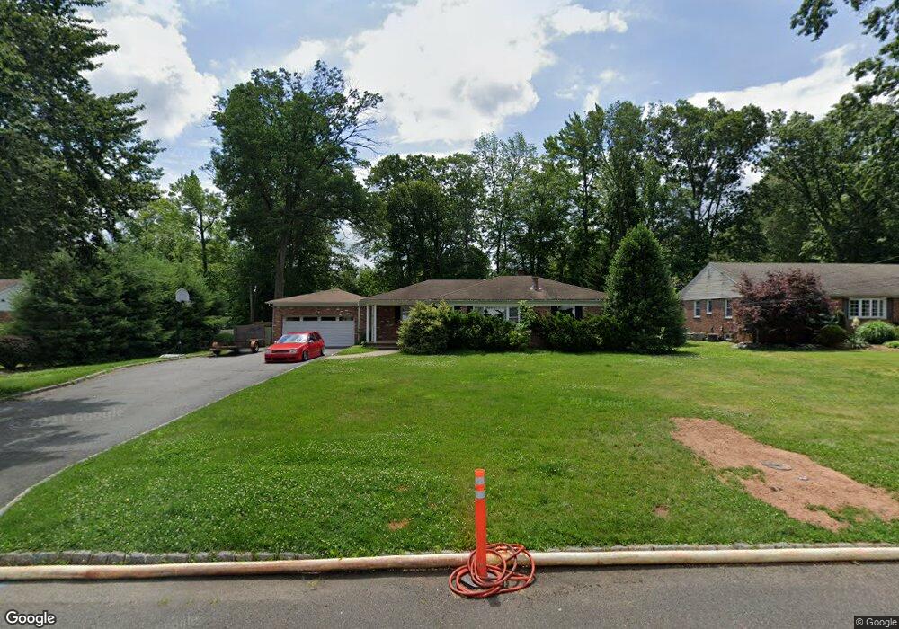
This home is located at 275 Laurel Ln, Clark, NJ 07066 and is currently estimated at $890,631, approximately $593 per square foot. 275 Laurel Ln is a home located in Union County with nearby schools including Frank K. Hehnly Elementary School, Carl H. Kumpf Middle School, and Arthur L. Johnson High School.
Ownership History
Date
Name
Owned For
Owner Type
Purchase Details
Closed on
Dec 1, 2000
Sold by
Roncaioli Andrew A and Roncaioli Donna A
Bought by
Azydzik Joseph T and Azydzik Peggy A
Current Estimated Value
Home Financials for this Owner
Home Financials are based on the most recent Mortgage that was taken out on this home.
Original Mortgage
$50,000
Outstanding Balance
$18,346
Interest Rate
7.64%
Mortgage Type
Stand Alone First
Estimated Equity
$872,285
Purchase Details
Closed on
Oct 1, 1993
Sold by
Garibaldi Jos D
Bought by
Roncaioli Andrew A and Roncaioli Donna
Home Financials for this Owner
Home Financials are based on the most recent Mortgage that was taken out on this home.
Original Mortgage
$173,000
Interest Rate
6.87%
Create a Home Valuation Report for This Property
The Home Valuation Report is an in-depth analysis detailing your home's value as well as a comparison with similar homes in the area
Home Values in the Area
Average Home Value in this Area
Purchase History
| Date | Buyer | Sale Price | Title Company |
|---|---|---|---|
| Azydzik Joseph T | $295,000 | -- | |
| Roncaioli Andrew A | $217,000 | -- |
Source: Public Records
Mortgage History
| Date | Status | Borrower | Loan Amount |
|---|---|---|---|
| Open | Azydzik Joseph T | $50,000 | |
| Previous Owner | Roncaioli Andrew A | $173,000 |
Source: Public Records
Tax History
| Year | Tax Paid | Tax Assessment Tax Assessment Total Assessment is a certain percentage of the fair market value that is determined by local assessors to be the total taxable value of land and additions on the property. | Land | Improvement |
|---|---|---|---|---|
| 2025 | $12,788 | $577,600 | $326,400 | $251,200 |
| 2024 | $12,597 | $577,600 | $326,400 | $251,200 |
| 2023 | $12,597 | $577,600 | $326,400 | $251,200 |
| 2022 | $12,234 | $577,600 | $326,400 | $251,200 |
| 2021 | $12,695 | $142,800 | $55,200 | $87,600 |
| 2020 | $12,488 | $142,800 | $55,200 | $87,600 |
| 2019 | $12,362 | $142,800 | $55,200 | $87,600 |
| 2018 | $12,214 | $142,800 | $55,200 | $87,600 |
| 2017 | $12,018 | $142,800 | $55,200 | $87,600 |
| 2016 | $11,705 | $144,400 | $55,200 | $89,200 |
| 2015 | $11,587 | $144,400 | $55,200 | $89,200 |
| 2014 | $11,343 | $144,400 | $55,200 | $89,200 |
Source: Public Records
Map
Nearby Homes
- 372 Willow Way
- 24 Woodland Rd
- 172 Briarheath Ln
- 34 E Prescott Ave
- 8 Normandy Rd
- 64 William St
- 131 Morningside Rd
- 125 Kimberly Rd
- 265 W Prescott Ave
- 973 Ellis Pkwy
- 868 Inman Ave
- 1033 Cellar Ave Unit 1033
- 17 Thelma Ct
- 6 Tulip Ct
- 53 Jordan Rd
- 8 Maddaket
- 155 Meadow Rd
- 675 Raritan Rd Unit 12
- 990 Inman Ave
- 1995 Winding Brook Way
Your Personal Tour Guide
Ask me questions while you tour the home.