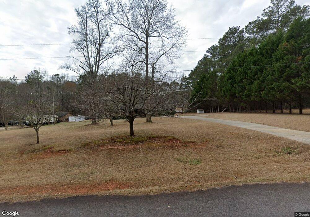
275 Mcintosh Cir Jackson, GA 30233
Southwest Butts NeighborhoodEstimated Value: $272,000 - $301,000
--
Bed
2
Baths
1,860
Sq Ft
$152/Sq Ft
Est. Value
About This Home
This home is located at 275 Mcintosh Cir, Jackson, GA 30233 and is currently estimated at $283,307, approximately $152 per square foot. 275 Mcintosh Cir is a home located in Butts County with nearby schools including Jackson High School.
Ownership History
Date
Name
Owned For
Owner Type
Purchase Details
Closed on
Feb 21, 2006
Sold by
Not Provided
Bought by
Barge Stanley D and Barge Danielle E
Current Estimated Value
Home Financials for this Owner
Home Financials are based on the most recent Mortgage that was taken out on this home.
Original Mortgage
$151,700
Outstanding Balance
$84,640
Interest Rate
6.05%
Mortgage Type
New Conventional
Estimated Equity
$198,667
Create a Home Valuation Report for This Property
The Home Valuation Report is an in-depth analysis detailing your home's value as well as a comparison with similar homes in the area
Home Values in the Area
Average Home Value in this Area
Purchase History
| Date | Buyer | Sale Price | Title Company |
|---|---|---|---|
| Barge Stanley D | $152,900 | -- | |
| Barge Stanley D | -- | -- |
Source: Public Records
Mortgage History
| Date | Status | Borrower | Loan Amount |
|---|---|---|---|
| Open | Barge Stanley D | $151,700 | |
| Closed | Barge Stanley D | $151,700 |
Source: Public Records
Tax History Compared to Growth
Tax History
| Year | Tax Paid | Tax Assessment Tax Assessment Total Assessment is a certain percentage of the fair market value that is determined by local assessors to be the total taxable value of land and additions on the property. | Land | Improvement |
|---|---|---|---|---|
| 2024 | $1,852 | $80,678 | $9,550 | $71,128 |
| 2023 | $1,899 | $70,310 | $6,876 | $63,434 |
| 2022 | $1,383 | $52,953 | $6,876 | $46,077 |
| 2021 | $1,340 | $48,122 | $6,876 | $41,246 |
| 2020 | $1,391 | $48,122 | $6,876 | $41,246 |
| 2019 | $1,137 | $40,992 | $6,876 | $34,116 |
| 2018 | $1,028 | $35,788 | $6,876 | $28,912 |
| 2017 | $1,071 | $36,584 | $6,876 | $29,708 |
| 2016 | $1,099 | $36,584 | $6,876 | $29,708 |
| 2015 | $1,084 | $36,584 | $6,876 | $29,708 |
| 2014 | $1,089 | $34,626 | $6,876 | $27,750 |
Source: Public Records
Map
Nearby Homes
- 138 Lewis Rd
- 235 Harkness Rd
- 0 White Tail Hills Dr Unit 10537889
- 148 White Tail Hills Dr
- 262 Windy Ln
- 209 Windy Ln
- 240 Harkness Rd
- 0 Coyote Trail Unit 10553352
- 539 Levi Barnes Rd
- 434 Barnes Rd
- 0 Dean Patrick Rd Unit 10453817
- 113 Truman Ct
- 137 Kennedy Blvd
- 2040 Ga-16
- 141 High Ridge Trail
- 251 Weavers Lakefront Rd
- 251 Weavers Lake Front Rd
- 106 Big Buck Ct
- 237 Weavers Lakefront Rd
- 446 High Falls Rd
- 201 Mcintosh Cir
- 278 Mcintosh Cir
- 108 Mcintosh Cir
- 108 Mcintosh Cir
- 119 Mcintosh Cir
- 142 Mcintosh Cir
- 261 Mcintosh Cir
- 433 Colwell Rd
- 17 Mcintosh Cir
- 139 Mcintosh Cir
- 369 Colwell Rd
- 0 Old McIntosh Cir Unit 7607126
- 0 Old McIntosh Cir
- 392 Colwell Rd
- 437 Colwell Rd
- 170 Mcintosh Cir
- 384 Colwell Rd
- 228 Mcintosh Cir
- 441 Colwell Rd
- 268 Mcintosh Cir
