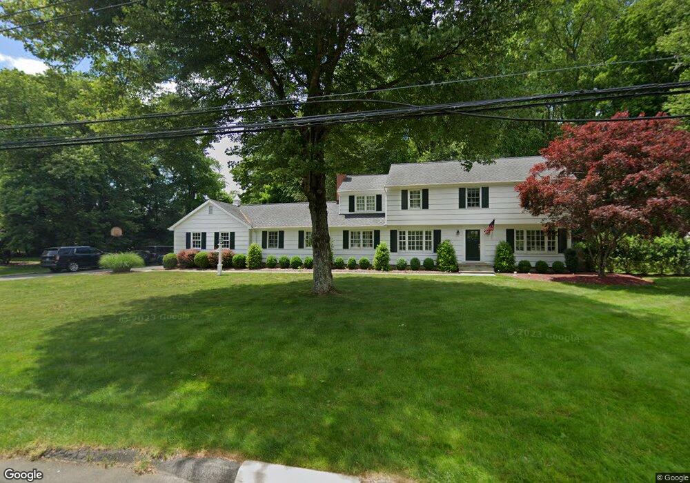
275 Mountain Laurel Rd Fairfield, CT 06824
Greenfield Hill NeighborhoodEstimated Value: $1,320,159 - $1,485,000
4
Beds
4
Baths
3,006
Sq Ft
$477/Sq Ft
Est. Value
About This Home
This home is located at 275 Mountain Laurel Rd, Fairfield, CT 06824 and is currently estimated at $1,435,040, approximately $477 per square foot. 275 Mountain Laurel Rd is a home located in Fairfield County with nearby schools including Burr Elementary School, Tomlinson Middle School, and Fairfield Warde High School.
Ownership History
Date
Name
Owned For
Owner Type
Purchase Details
Closed on
Sep 13, 2004
Sold by
Mullen David F and Mullen Michelle J
Bought by
Cerminard Michael T and Cerminaro Julie E
Current Estimated Value
Home Financials for this Owner
Home Financials are based on the most recent Mortgage that was taken out on this home.
Original Mortgage
$400,000
Outstanding Balance
$200,809
Interest Rate
6.08%
Estimated Equity
$1,234,231
Purchase Details
Closed on
Jun 27, 2000
Sold by
Meyer Richard W and Meyer Lisa K
Bought by
Mullen David F and Mullen Michelle J
Purchase Details
Closed on
Jul 31, 1995
Sold by
Sullivan Brian W and Sullivan Elizabeth K
Bought by
Meyer Richard W and Meyer Lisa K
Purchase Details
Closed on
May 17, 1988
Sold by
Frambes Robert C
Bought by
Sullivan Brian W
Create a Home Valuation Report for This Property
The Home Valuation Report is an in-depth analysis detailing your home's value as well as a comparison with similar homes in the area
Home Values in the Area
Average Home Value in this Area
Purchase History
| Date | Buyer | Sale Price | Title Company |
|---|---|---|---|
| Cerminard Michael T | $905,000 | -- | |
| Cerminard Michael T | $905,000 | -- | |
| Mullen David F | $602,000 | -- | |
| Mullen David F | $602,000 | -- | |
| Meyer Richard W | $400,000 | -- | |
| Meyer Richard W | $400,000 | -- | |
| Sullivan Brian W | $339,100 | -- |
Source: Public Records
Mortgage History
| Date | Status | Borrower | Loan Amount |
|---|---|---|---|
| Open | Sullivan Brian W | $400,000 | |
| Closed | Sullivan Brian W | $400,000 |
Source: Public Records
Tax History
| Year | Tax Paid | Tax Assessment Tax Assessment Total Assessment is a certain percentage of the fair market value that is determined by local assessors to be the total taxable value of land and additions on the property. | Land | Improvement |
|---|---|---|---|---|
| 2025 | $13,844 | $487,620 | $216,580 | $271,040 |
| 2024 | $13,605 | $487,620 | $216,580 | $271,040 |
| 2023 | $13,414 | $487,620 | $216,580 | $271,040 |
| 2022 | $13,283 | $487,620 | $216,580 | $271,040 |
| 2021 | $13,156 | $487,620 | $216,580 | $271,040 |
| 2020 | $13,414 | $500,710 | $187,950 | $312,760 |
| 2019 | $13,414 | $500,710 | $187,950 | $312,760 |
| 2018 | $13,199 | $500,710 | $187,950 | $312,760 |
| 2017 | $12,928 | $500,710 | $187,950 | $312,760 |
| 2016 | $12,743 | $500,710 | $187,950 | $312,760 |
| 2015 | $12,751 | $514,360 | $208,040 | $306,320 |
| 2014 | $12,550 | $514,360 | $208,040 | $306,320 |
Source: Public Records
Map
Nearby Homes
- 54 Ridgedale Rd
- 210 Pansy Rd
- 218 Lower Farm Rd
- 706 Judd St
- 148 Millspaugh Dr
- 106 Stillson Rd
- 115 Mayfair Rd
- 288 Melody Ln
- 359 Reid St
- 164 Farist Rd
- 109 Katona Dr Unit 18
- 245 Reid St
- 196 Robin Ln
- 12 Sugar Plum Ln
- 42 Robin Cir
- 360 Duck Farm Rd
- 217 Fairland Dr
- 175 Winnepoge Dr
- 204 Glen Ridge Rd
- 41 Pepperbush Ln
- 241 Mountain Laurel Rd
- 250 Mountain Laurel Rd
- 286 Mountain Laurel Rd
- 44 Wyncum Valley Rd
- 201 Mountain Laurel Rd
- 305 Mountain Laurel Rd
- 20 Trillium Rd
- 320 Mountain Laurel Rd
- 48 Trillium Rd
- 335 Mountain Laurel Rd
- 276 Galloping Hill Rd
- 66 Trillium Rd
- 162 Mountain Laurel Rd
- 352 Mountain Laurel Rd
- 338 Galloping Hill Rd
- 25 Wyncum Valley Rd
- 310 Galloping Hill Rd
- 244 Galloping Hill Rd
- 145 Mountain Laurel Rd
- 200 Galloping Hill Rd
Your Personal Tour Guide
Ask me questions while you tour the home.