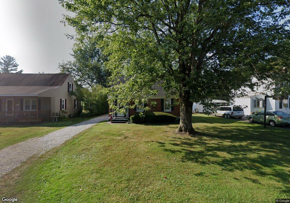
275 Pierson Blvd Newark, OH 43055
Estimated Value: $207,825 - $252,000
3
Beds
1
Bath
1,054
Sq Ft
$216/Sq Ft
Est. Value
About This Home
This home is located at 275 Pierson Blvd, Newark, OH 43055 and is currently estimated at $227,706, approximately $216 per square foot. 275 Pierson Blvd is a home located in Licking County with nearby schools including John Clem Elementary School, Liberty Middle School, and Newark High School.
Ownership History
Date
Name
Owned For
Owner Type
Purchase Details
Closed on
Apr 27, 2005
Sold by
Toomey Gail L and Spring Gail L
Bought by
Spring Stephen and Spring Gail L
Current Estimated Value
Home Financials for this Owner
Home Financials are based on the most recent Mortgage that was taken out on this home.
Original Mortgage
$97,600
Interest Rate
6.49%
Mortgage Type
New Conventional
Create a Home Valuation Report for This Property
The Home Valuation Report is an in-depth analysis detailing your home's value as well as a comparison with similar homes in the area
Home Values in the Area
Average Home Value in this Area
Purchase History
| Date | Buyer | Sale Price | Title Company |
|---|---|---|---|
| Spring Stephen | -- | First Nations Title Agency L |
Source: Public Records
Mortgage History
| Date | Status | Borrower | Loan Amount |
|---|---|---|---|
| Closed | Spring Stephen | $97,600 | |
| Closed | Spring Stephen | $24,400 |
Source: Public Records
Tax History Compared to Growth
Tax History
| Year | Tax Paid | Tax Assessment Tax Assessment Total Assessment is a certain percentage of the fair market value that is determined by local assessors to be the total taxable value of land and additions on the property. | Land | Improvement |
|---|---|---|---|---|
| 2024 | $1,938 | $54,190 | $15,580 | $38,610 |
| 2023 | $1,934 | $54,190 | $15,580 | $38,610 |
| 2022 | $1,433 | $35,700 | $8,890 | $26,810 |
| 2021 | $1,503 | $35,700 | $8,890 | $26,810 |
| 2020 | $1,537 | $35,700 | $8,890 | $26,810 |
| 2019 | $1,320 | $29,510 | $8,890 | $20,620 |
| 2018 | $1,321 | $0 | $0 | $0 |
| 2017 | $1,265 | $0 | $0 | $0 |
| 2016 | $1,378 | $0 | $0 | $0 |
| 2015 | $1,408 | $0 | $0 | $0 |
| 2014 | $1,803 | $0 | $0 | $0 |
| 2013 | $1,375 | $0 | $0 | $0 |
Source: Public Records
Map
Nearby Homes
- 227 N Quentin Rd
- 262 S Quentin Rd
- 988 Mount Vernon Rd
- 440 Reverie Place
- 189 N Quentin Rd
- 245 Rugg Ave
- 473 Meadowbrook Dr
- 181 S Quentin Rd
- 11 Waterworks Rd
- 584 Moull St Unit A
- 567 Kibler Ave
- 168 Waterworks Rd
- 1006 Kingsbury Ct Unit 1006
- 229 Greenfield Ave
- 188 Meadow Dr
- 184 Meadow Dr
- 160 E Channel St
- 440 Eddy St
- 709 Meadow Dr
- 376 Woods Ave
- 269 Pierson Blvd
- 281 Pierson Blvd
- 287 Pierson Blvd
- 263 Pierson Blvd
- 276 Stare Rd
- 293 Pierson Blvd
- 257 Pierson Blvd
- 270 Stare Rd
- 282 Stare Rd
- 264 Stare Rd
- 288 Stare Rd
- 276 Pierson Blvd
- 282 Pierson Blvd
- 270 Pierson Blvd
- 251 Pierson Blvd
- 264 Pierson Blvd
- 294 Stare Rd
- 258 Stare Rd
- 294 Pierson Blvd
- 260 Pierson Blvd