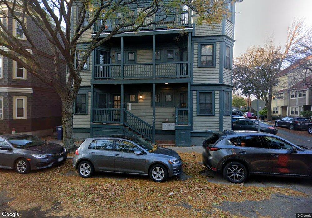
275 River St Unit 1 Cambridge, MA 02139
Riverside NeighborhoodEstimated Value: $1,070,850 - $1,234,000
3
Beds
2
Baths
1,283
Sq Ft
$897/Sq Ft
Est. Value
About This Home
This home is located at 275 River St Unit 1, Cambridge, MA 02139 and is currently estimated at $1,150,713, approximately $896 per square foot. 275 River St Unit 1 is a home located in Middlesex County with nearby schools including Saint Paul's Choir School, St Herman Of Alaska Christian School, and Boston University Academy.
Ownership History
Date
Name
Owned For
Owner Type
Purchase Details
Closed on
Jul 2, 2007
Sold by
Hur Chin and Lee Hye-Chun
Bought by
Miller Mark A and Miller Sharon H
Current Estimated Value
Home Financials for this Owner
Home Financials are based on the most recent Mortgage that was taken out on this home.
Original Mortgage
$380,000
Interest Rate
6.24%
Mortgage Type
Purchase Money Mortgage
Create a Home Valuation Report for This Property
The Home Valuation Report is an in-depth analysis detailing your home's value as well as a comparison with similar homes in the area
Home Values in the Area
Average Home Value in this Area
Purchase History
| Date | Buyer | Sale Price | Title Company |
|---|---|---|---|
| Miller Mark A | $475,000 | -- | |
| Miller Mark A | $475,000 | -- |
Source: Public Records
Mortgage History
| Date | Status | Borrower | Loan Amount |
|---|---|---|---|
| Open | Miller Mark A | $368,000 | |
| Closed | Miller Mark A | $380,000 | |
| Previous Owner | Miller Mark A | $234,500 |
Source: Public Records
Tax History Compared to Growth
Tax History
| Year | Tax Paid | Tax Assessment Tax Assessment Total Assessment is a certain percentage of the fair market value that is determined by local assessors to be the total taxable value of land and additions on the property. | Land | Improvement |
|---|---|---|---|---|
| 2025 | $5,560 | $875,600 | $0 | $875,600 |
| 2024 | $5,194 | $877,400 | $0 | $877,400 |
| 2023 | $4,887 | $834,000 | $0 | $834,000 |
| 2022 | $4,868 | $822,300 | $0 | $822,300 |
| 2021 | $4,764 | $814,400 | $0 | $814,400 |
| 2020 | $4,522 | $786,400 | $0 | $786,400 |
| 2019 | $4,333 | $729,400 | $0 | $729,400 |
| 2018 | $4,209 | $669,100 | $0 | $669,100 |
| 2017 | $4,066 | $626,500 | $0 | $626,500 |
| 2016 | $3,996 | $571,700 | $0 | $571,700 |
| 2015 | $3,958 | $506,200 | $0 | $506,200 |
| 2014 | $3,763 | $449,000 | $0 | $449,000 |
Source: Public Records
Map
Nearby Homes
- 1 Jay St
- 2 Hingham St
- 53 Jay St Unit 2
- 214 Allston St
- 73 River St Unit 4B
- 174 Hamilton St
- 161 Hamilton St
- 300 Franklin St Unit 5
- 300 Franklin St Unit 1
- 300 Franklin St Unit 2
- 515 Franklin St Unit 4
- 131 Erie St Unit 3
- 131 Erie St
- 125 Brookline St Unit 4
- 930 Massachusetts Ave
- 950 Massachusetts Ave Unit 418
- 950 Massachusetts Ave Unit 512
- 950 Massachusetts Ave Unit 504
- 950 Massachusetts Ave Unit 417
- 6-8 Watson St Unit 8
- 275 River St Unit 2
- 277 River St Unit 3
- 277 River St Unit 2
- 277 River St Unit 1
- 279 River St
- 279 River St Unit 2
- 268 River St Unit 6
- 268 River St Unit 5
- 268 River St Unit 4
- 268 River St Unit 3
- 268 River St Unit 2
- 268 River St Unit 1
- 268 River St Unit 1,268
- 268 River St Unit 3,268
- 268 River St
- 268 River St
- 280 River St Unit 4
- 280 River St Unit 3
- 280 River St Unit 2
- 280 River St Unit 1