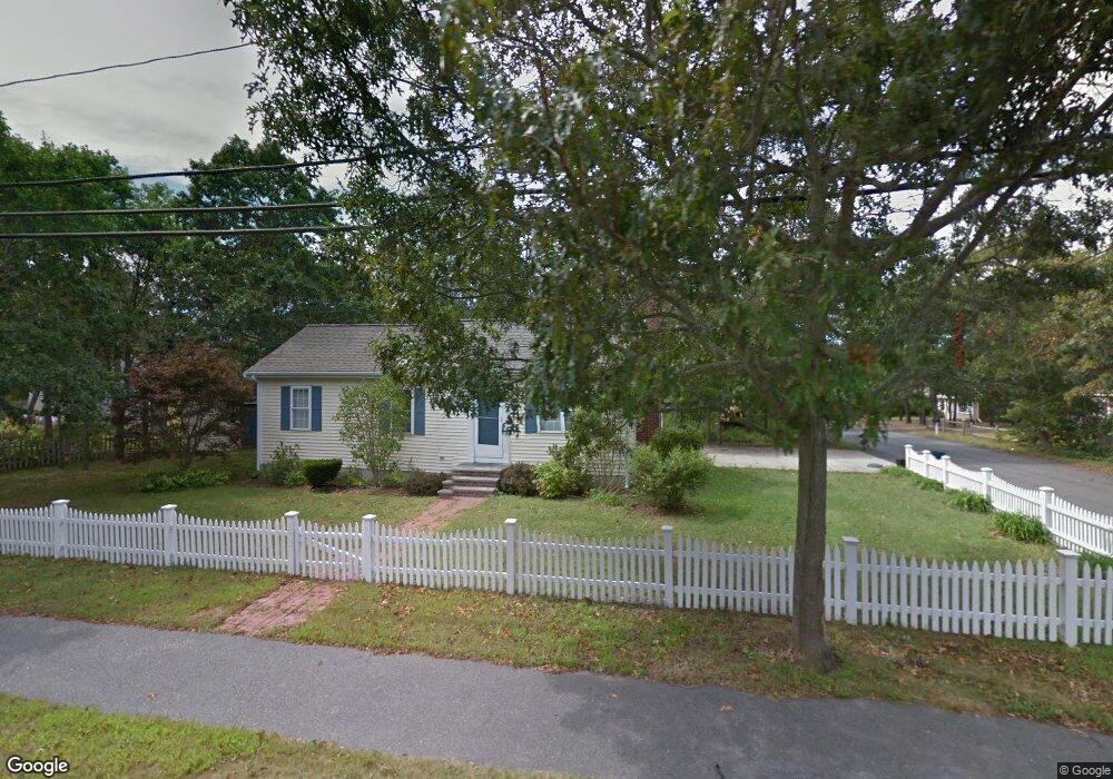
275 Seacoast Shores Blvd East Falmouth, MA 02536
East Falmouth NeighborhoodEstimated Value: $478,475 - $592,000
2
Beds
1
Bath
800
Sq Ft
$653/Sq Ft
Est. Value
About This Home
This home is located at 275 Seacoast Shores Blvd, East Falmouth, MA 02536 and is currently estimated at $522,369, approximately $652 per square foot. 275 Seacoast Shores Blvd is a home located in Barnstable County with nearby schools including East Falmouth Elementary School, Morse Pond School, and Lawrence School.
Ownership History
Date
Name
Owned For
Owner Type
Purchase Details
Closed on
Sep 2, 1999
Sold by
Perry Leonard S and Perry Muriel A
Bought by
Abair Linda P and Abair Peter J
Current Estimated Value
Home Financials for this Owner
Home Financials are based on the most recent Mortgage that was taken out on this home.
Original Mortgage
$117,000
Interest Rate
7.5%
Mortgage Type
Purchase Money Mortgage
Purchase Details
Closed on
Oct 28, 1996
Sold by
Rogers Janet M
Bought by
Perry Leonard S and Perry Muriel A
Create a Home Valuation Report for This Property
The Home Valuation Report is an in-depth analysis detailing your home's value as well as a comparison with similar homes in the area
Home Values in the Area
Average Home Value in this Area
Purchase History
| Date | Buyer | Sale Price | Title Company |
|---|---|---|---|
| Abair Linda P | $130,000 | -- | |
| Abair Linda P | $130,000 | -- | |
| Perry Leonard S | $40,000 | -- | |
| Ljp Rt | $20,000 | -- | |
| Perry Leonard S | $40,000 | -- |
Source: Public Records
Mortgage History
| Date | Status | Borrower | Loan Amount |
|---|---|---|---|
| Open | Perry Leonard S | $105,000 | |
| Closed | Perry Leonard S | $113,500 | |
| Closed | Perry Leonard S | $117,000 |
Source: Public Records
Tax History Compared to Growth
Tax History
| Year | Tax Paid | Tax Assessment Tax Assessment Total Assessment is a certain percentage of the fair market value that is determined by local assessors to be the total taxable value of land and additions on the property. | Land | Improvement |
|---|---|---|---|---|
| 2025 | $2,229 | $379,700 | $157,500 | $222,200 |
| 2024 | $2,173 | $346,000 | $143,200 | $202,800 |
| 2023 | $2,207 | $319,000 | $143,200 | $175,800 |
| 2022 | $2,091 | $259,800 | $110,000 | $149,800 |
| 2021 | $2,042 | $240,200 | $105,200 | $135,000 |
| 2020 | $1,981 | $230,600 | $95,600 | $135,000 |
| 2019 | $1,627 | $190,100 | $95,600 | $94,500 |
| 2018 | $1,594 | $185,300 | $95,600 | $89,700 |
| 2017 | $1,545 | $181,100 | $95,600 | $85,500 |
| 2016 | $1,516 | $181,100 | $95,600 | $85,500 |
| 2015 | $1,483 | $181,100 | $95,600 | $85,500 |
| 2014 | $1,516 | $186,000 | $100,600 | $85,400 |
Source: Public Records
Map
Nearby Homes
- 15 Ovington Dr
- 285 Edgewater Dr W
- 231 Edgewater Dr W
- 0 Tobey Ln
- 381 Seacoast Shores Blvd
- 53 Eel River Rd
- 15 Pershing Dr
- 11 Pershing Dr
- 7 Yale Dr
- 23 N Bournes Pond Rd
- 23 N Bournes Pond Rd
- 42 Hanson Cir
- 23 Meadowood Ln
- 52 Bacon Farm Rd
- 27 Emerald Ln
- 30 Weatherglass Ln
- 68 Baptiste Ln
- 0 Elsies Way Unit 22505181
- 0 Elsies Way Unit 73443603
- 50 Rivers Edge Rd
- 0 Ellsworth Dr
- 37 Ellsworth Dr
- 279 Seacoast Shores Blvd
- 278 Seacoast Shores Blvd
- 38 Ovington Dr
- 269 Seacoast Shores Blvd
- 33 Ellsworth Dr
- 282 Seacoast Shores Blvd
- 36 Ellsworth Dr
- 34 Ovington Dr
- 47 Ovington Dr
- 46 Ellsworth Dr
- 49 Ellsworth Dr
- 34 Ellsworth Dr
- 50 Ovington Dr
- 27 Ellsworth Dr
- 30 Ovington Dr
- 261 Seacoast Shores Blvd
- 41 Ovington Dr
- 33 Winthrop Dr