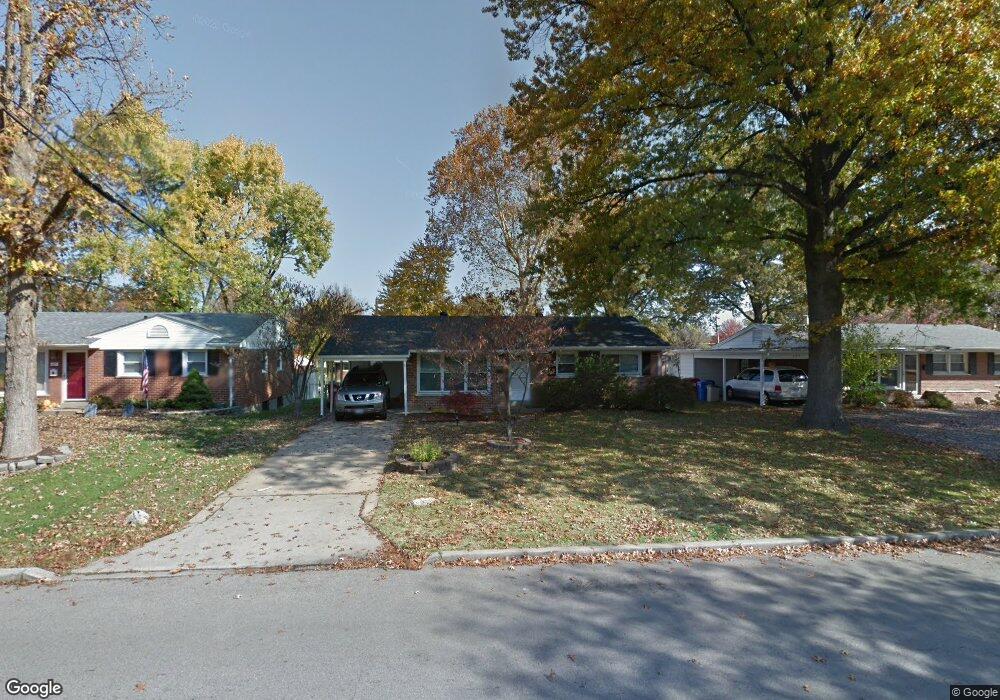
275 W Saint Anthony Ln Florissant, MO 63031
Estimated Value: $148,911 - $171,000
3
Beds
1
Bath
1,050
Sq Ft
$152/Sq Ft
Est. Value
About This Home
This home is located at 275 W Saint Anthony Ln, Florissant, MO 63031 and is currently estimated at $159,728, approximately $152 per square foot. 275 W Saint Anthony Ln is a home located in St. Louis County with nearby schools including Duchesne Elementary School, Cross Keys Middle School, and McCluer North High School.
Ownership History
Date
Name
Owned For
Owner Type
Purchase Details
Closed on
Sep 2, 2014
Sold by
Omahony Kevin and Omahony Andrea
Bought by
A & K Real Estate Properties Llc
Current Estimated Value
Purchase Details
Closed on
Jan 28, 2013
Sold by
A & K Real Estate Properties Llc
Bought by
Omahony Kevin and Omahony Andre
Purchase Details
Closed on
Feb 25, 2009
Sold by
Omahony Kevin G and Omahony Andrea L
Bought by
A & K Real Estate Properties Llc
Purchase Details
Closed on
Feb 11, 2008
Sold by
Gander Deborah J
Bought by
Omahony Kevin G and Omahony Andrea L
Home Financials for this Owner
Home Financials are based on the most recent Mortgage that was taken out on this home.
Original Mortgage
$59,850
Interest Rate
6.07%
Mortgage Type
Purchase Money Mortgage
Purchase Details
Closed on
Jun 23, 1999
Sold by
Collins Debra A and Collins Bret K
Bought by
Gander Deborah J
Home Financials for this Owner
Home Financials are based on the most recent Mortgage that was taken out on this home.
Original Mortgage
$68,681
Interest Rate
7.21%
Mortgage Type
FHA
Create a Home Valuation Report for This Property
The Home Valuation Report is an in-depth analysis detailing your home's value as well as a comparison with similar homes in the area
Home Values in the Area
Average Home Value in this Area
Purchase History
| Date | Buyer | Sale Price | Title Company |
|---|---|---|---|
| A & K Real Estate Properties Llc | -- | None Available | |
| Omahony Kevin | -- | None Available | |
| A & K Real Estate Properties Llc | -- | Ort | |
| Omahony Kevin G | $66,500 | Ort | |
| Gander Deborah J | $69,000 | -- |
Source: Public Records
Mortgage History
| Date | Status | Borrower | Loan Amount |
|---|---|---|---|
| Previous Owner | Omahony Kevin G | $59,850 | |
| Previous Owner | Gander Deborah J | $68,681 |
Source: Public Records
Tax History Compared to Growth
Tax History
| Year | Tax Paid | Tax Assessment Tax Assessment Total Assessment is a certain percentage of the fair market value that is determined by local assessors to be the total taxable value of land and additions on the property. | Land | Improvement |
|---|---|---|---|---|
| 2025 | $1,879 | $27,820 | $4,980 | $22,840 |
| 2024 | $1,879 | $24,150 | $4,310 | $19,840 |
| 2023 | $1,872 | $24,150 | $4,310 | $19,840 |
| 2022 | $1,598 | $18,060 | $3,330 | $14,730 |
| 2021 | $1,571 | $18,060 | $3,330 | $14,730 |
| 2020 | $1,555 | $16,870 | $3,820 | $13,050 |
| 2019 | $1,525 | $16,870 | $3,820 | $13,050 |
| 2018 | $1,283 | $12,640 | $2,130 | $10,510 |
| 2017 | $1,276 | $12,640 | $2,130 | $10,510 |
| 2016 | $1,237 | $11,930 | $2,510 | $9,420 |
| 2015 | $1,244 | $11,930 | $2,510 | $9,420 |
| 2014 | $1,611 | $16,040 | $3,500 | $12,540 |
Source: Public Records
Map
Nearby Homes
- 270 W Saint Anthony Ln
- 215 Maple Dr
- 250 Maple Dr
- 38 Spring Dr
- 24 Valley Dr
- 150 Saint Daniel Ln
- 540 S Jefferson St
- 50 Saint Walter Ln
- 305 S Lafayette St
- 215 Derhake Rd
- 630 Graham Rd
- 1205 Saint Matthew Dr
- 15 Henson Ln
- 940 Harrison St
- 175 Clark St
- 840 Pershall Rd
- 1375 S New Florissant Rd
- 580 Saint Marie St
- 7450 Sieloff Dr Unit B
- 7446 Sieloff Dr Unit H
- 265 W Saint Anthony Ln
- 285 W Saint Anthony Ln
- 285 W St Anthony Ln
- 245 W Saint Anthony Ln
- 295 W Saint Anthony Ln
- 320 Saint Patrick Ln
- 330 Saint Patrick Ln
- 310 Saint Patrick Ln
- 340 Saint Patrick Ln
- 220 W Saint Anthony Ln
- 235 W Saint Anthony Ln
- 305 W Saint Anthony Ln
- 1 Saint Rose Ct
- 300 Saint Patrick Ln
- 350 Saint Patrick Ln
- 230 W Saint Anthony Ln
- 225 W Saint Anthony Ln
- 240 W Saint Anthony Ln
- 250 W Saint Anthony Ln
- 2 Saint Rose Ct