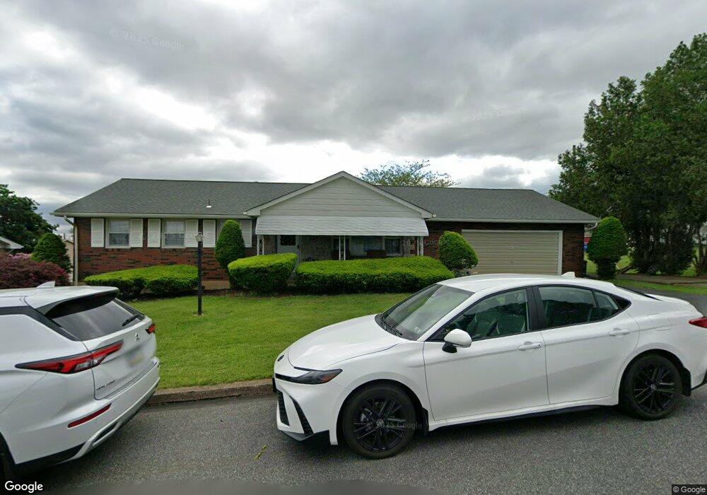
275 Walnut St Alburtis, PA 18011
Lower Macungie Township West NeighborhoodEstimated Value: $262,000 - $352,000
3
Beds
1
Bath
1,305
Sq Ft
$235/Sq Ft
Est. Value
About This Home
This home is located at 275 Walnut St, Alburtis, PA 18011 and is currently estimated at $307,124, approximately $235 per square foot. 275 Walnut St is a home with nearby schools including Alburtis Elementary School, Lower Macungie Middle School, and Emmaus High School.
Ownership History
Date
Name
Owned For
Owner Type
Purchase Details
Closed on
Nov 26, 2003
Sold by
Hillegass Norman L and Hillegas Betty J
Bought by
Wippel Stephen S and Wippel Brenda J
Current Estimated Value
Home Financials for this Owner
Home Financials are based on the most recent Mortgage that was taken out on this home.
Original Mortgage
$135,920
Outstanding Balance
$63,905
Interest Rate
6.09%
Mortgage Type
Purchase Money Mortgage
Estimated Equity
$243,219
Purchase Details
Closed on
Aug 14, 1990
Sold by
Adams Mae R
Bought by
Hillegass Norman L and Hillegass Betty J
Purchase Details
Closed on
Sep 20, 1988
Sold by
Adams Raymond W
Bought by
Adams Mae R
Create a Home Valuation Report for This Property
The Home Valuation Report is an in-depth analysis detailing your home's value as well as a comparison with similar homes in the area
Home Values in the Area
Average Home Value in this Area
Purchase History
| Date | Buyer | Sale Price | Title Company |
|---|---|---|---|
| Wippel Stephen S | $169,900 | Penn Title Inc | |
| Hillegass Norman L | $119,000 | -- | |
| Adams Mae R | -- | -- |
Source: Public Records
Mortgage History
| Date | Status | Borrower | Loan Amount |
|---|---|---|---|
| Open | Wippel Stephen S | $135,920 |
Source: Public Records
Tax History Compared to Growth
Tax History
| Year | Tax Paid | Tax Assessment Tax Assessment Total Assessment is a certain percentage of the fair market value that is determined by local assessors to be the total taxable value of land and additions on the property. | Land | Improvement |
|---|---|---|---|---|
| 2025 | $4,809 | $163,800 | $34,600 | $129,200 |
| 2024 | $4,686 | $163,800 | $34,600 | $129,200 |
| 2023 | $4,470 | $163,800 | $34,600 | $129,200 |
| 2022 | $4,376 | $163,800 | $129,200 | $34,600 |
| 2021 | $4,293 | $163,800 | $34,600 | $129,200 |
| 2020 | $4,257 | $163,800 | $34,600 | $129,200 |
| 2019 | $4,234 | $163,800 | $34,600 | $129,200 |
| 2018 | $4,186 | $163,800 | $34,600 | $129,200 |
| 2017 | $4,122 | $163,800 | $34,600 | $129,200 |
| 2016 | -- | $163,800 | $34,600 | $129,200 |
| 2015 | -- | $163,800 | $34,600 | $129,200 |
| 2014 | -- | $163,800 | $34,600 | $129,200 |
Source: Public Records
Map
Nearby Homes
- 241 Flint Hill Rd
- 121 S Main St Unit 123
- 354 W 2nd St
- 428 Thomas St
- 3371 Mathews Ln
- 317 Lockridge Ln
- 31 Barbara Dr
- 8312 Mertztown Rd
- 8975 Mertztown Rd
- 1108 S Barbara Dr
- 7318 Sauerkraut Ln Unit E
- 1716 Brookstone Dr
- 8051 Heritage Dr
- 7528 Buttercup Rd
- 7699 Catalpa Dr
- 7687 Catalpa Dr
- 0 Clauss Hunt Knight Dr Unit 10 Units 763578
- 1649 Thorndale Rd
- 1649 Thorndale Rd Unit LOT 70
- 6903 Lincoln Dr