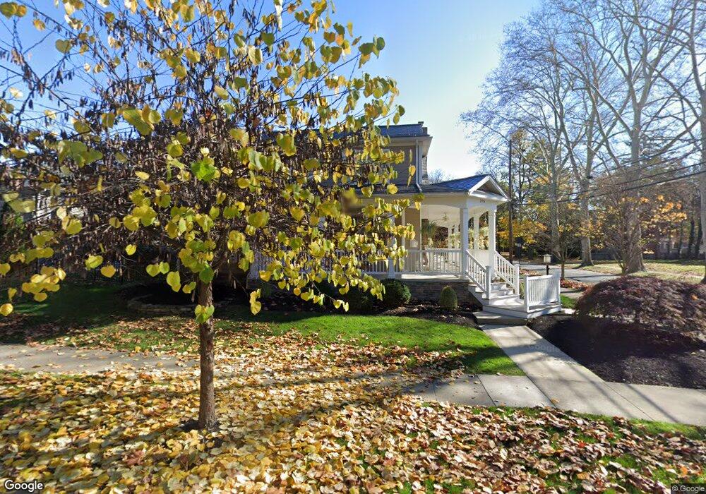
275 Wilson St Carlisle, PA 17013
Estimated Value: $600,000 - $905,000
3
Beds
4
Baths
3,788
Sq Ft
$205/Sq Ft
Est. Value
About This Home
This home is located at 275 Wilson St, Carlisle, PA 17013 and is currently estimated at $775,179, approximately $204 per square foot. 275 Wilson St is a home located in Cumberland County with nearby schools including Mooreland Elementary School, Lamberton Middle School, and Carlisle Area High School.
Ownership History
Date
Name
Owned For
Owner Type
Purchase Details
Closed on
Dec 10, 2009
Sold by
Moreland Federal Dev L L C
Bought by
Doulgeris John
Current Estimated Value
Purchase Details
Closed on
Oct 31, 2007
Sold by
Mooreland Federal Dev
Bought by
Layman Joseph A
Home Financials for this Owner
Home Financials are based on the most recent Mortgage that was taken out on this home.
Original Mortgage
$100,000
Interest Rate
6.43%
Mortgage Type
New Conventional
Purchase Details
Closed on
Oct 29, 2007
Sold by
Mooreland Fed'L Dev
Bought by
Canfield Joseph D
Home Financials for this Owner
Home Financials are based on the most recent Mortgage that was taken out on this home.
Original Mortgage
$100,000
Interest Rate
6.43%
Mortgage Type
New Conventional
Create a Home Valuation Report for This Property
The Home Valuation Report is an in-depth analysis detailing your home's value as well as a comparison with similar homes in the area
Home Values in the Area
Average Home Value in this Area
Purchase History
| Date | Buyer | Sale Price | Title Company |
|---|---|---|---|
| Doulgeris John | $115,000 | -- | |
| Layman Joseph A | $125,000 | -- | |
| Canfield Joseph D | $125,000 | -- |
Source: Public Records
Mortgage History
| Date | Status | Borrower | Loan Amount |
|---|---|---|---|
| Previous Owner | Layman Joseph A | $100,000 |
Source: Public Records
Tax History Compared to Growth
Tax History
| Year | Tax Paid | Tax Assessment Tax Assessment Total Assessment is a certain percentage of the fair market value that is determined by local assessors to be the total taxable value of land and additions on the property. | Land | Improvement |
|---|---|---|---|---|
| 2025 | $13,168 | $559,200 | $129,200 | $430,000 |
| 2024 | $12,790 | $559,200 | $129,200 | $430,000 |
| 2023 | $12,207 | $559,200 | $129,200 | $430,000 |
| 2022 | $12,032 | $559,200 | $129,200 | $430,000 |
| 2021 | $11,860 | $559,200 | $129,200 | $430,000 |
| 2020 | $11,610 | $559,200 | $129,200 | $430,000 |
| 2019 | $11,367 | $559,200 | $129,200 | $430,000 |
| 2018 | $11,124 | $559,200 | $129,200 | $430,000 |
| 2017 | $10,903 | $559,200 | $129,200 | $430,000 |
| 2016 | -- | $559,200 | $129,200 | $430,000 |
| 2015 | -- | $559,200 | $129,200 | $430,000 |
| 2014 | -- | $559,200 | $129,200 | $430,000 |
Source: Public Records
Map
Nearby Homes
- 250 Mooreland Ave
- 412 W South St
- 808 Walnut Ln
- 124 Conway St
- Carter Plan at Grange - Single Family
- Corby Plan at Grange - Single Family
- Arundel Plan at Grange - Single Family
- Royston Plan at Grange - Single Family
- Elgin Plan at Grange - Single Family
- Anders Plan at Grange - Single Family
- Darby Plan at Grange - Single Family
- Ashby Plan at Grange - Single Family
- Marlow Plan at Grange - Single Family
- Dundee Plan at Grange - Single Family
- Andover Plan at Grange - Single Family
- 500 Belvedere St
- 911 Walnut St
- 628 Belvedere St
- 222 W Pomfret St
- 670 W Louther St