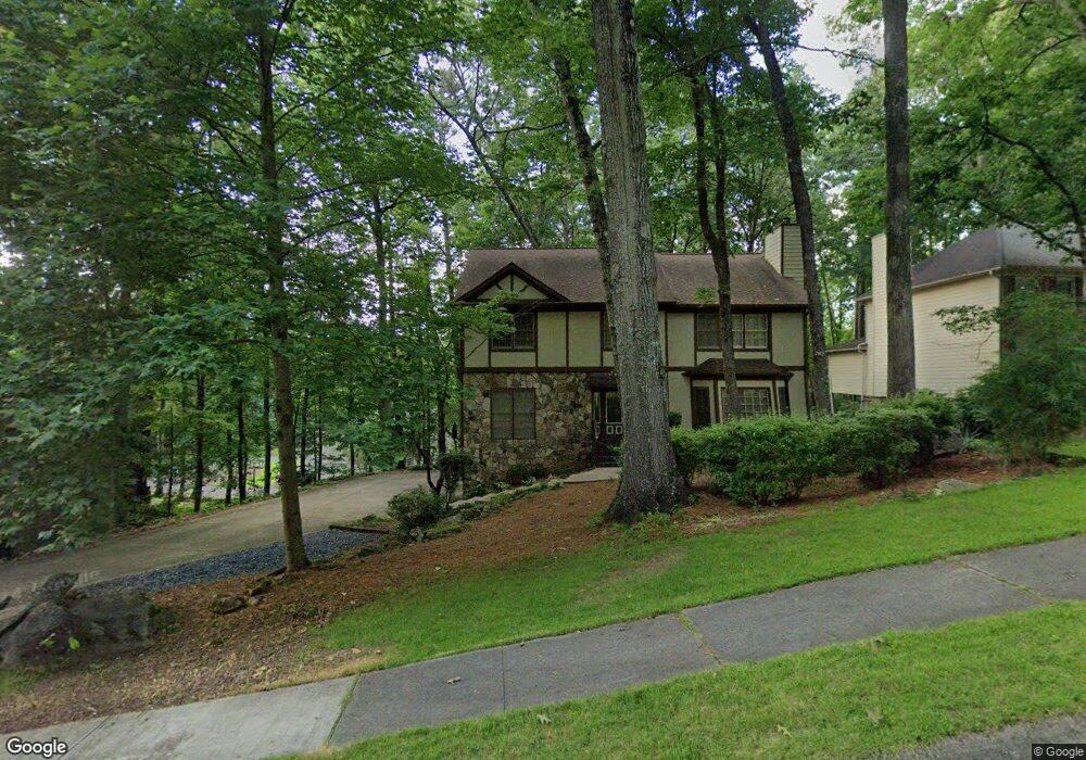
2752 Long Lake Dr NE Unit 1 Roswell, GA 30075
East Cobb NeighborhoodEstimated Value: $616,000 - $760,000
4
Beds
3
Baths
2,604
Sq Ft
$260/Sq Ft
Est. Value
About This Home
This home is located at 2752 Long Lake Dr NE Unit 1, Roswell, GA 30075 and is currently estimated at $677,407, approximately $260 per square foot. 2752 Long Lake Dr NE Unit 1 is a home located in Cobb County with nearby schools including Tritt Elementary School, Hightower Trail Middle School, and Pope High School.
Ownership History
Date
Name
Owned For
Owner Type
Purchase Details
Closed on
Sep 1, 2023
Sold by
Douglass John H and Douglass Maryann K
Bought by
Douglass Family Trust and Douglass
Current Estimated Value
Purchase Details
Closed on
Feb 13, 1997
Sold by
Anderson David C Kathleen A
Bought by
Douglas John H Maryann K
Create a Home Valuation Report for This Property
The Home Valuation Report is an in-depth analysis detailing your home's value as well as a comparison with similar homes in the area
Home Values in the Area
Average Home Value in this Area
Purchase History
| Date | Buyer | Sale Price | Title Company |
|---|---|---|---|
| Douglass Family Trust | -- | None Listed On Document | |
| Douglas John H Maryann K | $172,800 | -- |
Source: Public Records
Mortgage History
| Date | Status | Borrower | Loan Amount |
|---|---|---|---|
| Closed | Douglas John H Maryann K | $0 |
Source: Public Records
Tax History Compared to Growth
Tax History
| Year | Tax Paid | Tax Assessment Tax Assessment Total Assessment is a certain percentage of the fair market value that is determined by local assessors to be the total taxable value of land and additions on the property. | Land | Improvement |
|---|---|---|---|---|
| 2025 | $1,308 | $254,004 | $80,000 | $174,004 |
| 2024 | $1,274 | $240,928 | $64,000 | $176,928 |
| 2023 | $920 | $191,356 | $42,000 | $149,356 |
| 2022 | $1,126 | $191,356 | $42,000 | $149,356 |
| 2021 | $3,893 | $161,176 | $40,000 | $121,176 |
| 2020 | $3,893 | $161,176 | $40,000 | $121,176 |
| 2019 | $3,697 | $152,236 | $34,400 | $117,836 |
| 2018 | $3,697 | $152,236 | $34,400 | $117,836 |
| 2017 | $2,805 | $116,036 | $36,400 | $79,636 |
| 2016 | $2,810 | $116,036 | $36,400 | $79,636 |
| 2015 | $2,582 | $103,196 | $32,000 | $71,196 |
| 2014 | $2,600 | $103,196 | $0 | $0 |
Source: Public Records
Map
Nearby Homes
- 2696 Long Lake Terrace NE
- 2779 Horseshoe Knoll Ln NE
- 2482 N Forest Dr
- 2661 Sandpoint Way NE
- 110 Boulder Dr
- 2859 Tynewick Dr NE
- 5108 Nicolet Ct
- 2655 Boulder Creek Dr NE
- 2990 Mountain Trace NE
- 2743 Chimney Springs Dr
- 2212 Heritage Trace View
- 3025 Creek Ct NE
- 230 Tynebrae Place Unit 1
- 1215 Ridgefield Dr
- 4574 Woodland Cir NE
- 4013 Lake Pointe Cir Unit 4013
- 3113 Lake Pointe Cir
- 2750 Long Lake Dr NE
- 0 Long Lake Dr NE Unit 7478143
- 0 Long Lake Dr NE Unit 7105236
- 0 Long Lake Dr NE Unit 7088930
- 0 Long Lake Dr NE Unit 3208395
- 0 Long Lake Dr NE Unit 8863238
- 0 Long Lake Dr NE Unit 8214489
- 0 Long Lake Dr NE Unit 7642054
- 0 Long Lake Dr NE Unit 7569591
- 0 Long Lake Dr NE Unit 8612069
- 0 Long Lake Dr NE Unit 8603948
- 0 Long Lake Dr NE Unit 3275514
- 0 Long Lake Dr NE
- 2754 Long Lake Dr NE
- 1549 Sandpoint Dr NE Unit 1
- 2743 Long Lake Dr NE
- 2737 Long Lake Dr NE Unit 1
- 2748 Long Lake Dr NE Unit 1
- 1547 Sandpoint Dr NE
- 2759 Long Lake Dr NE