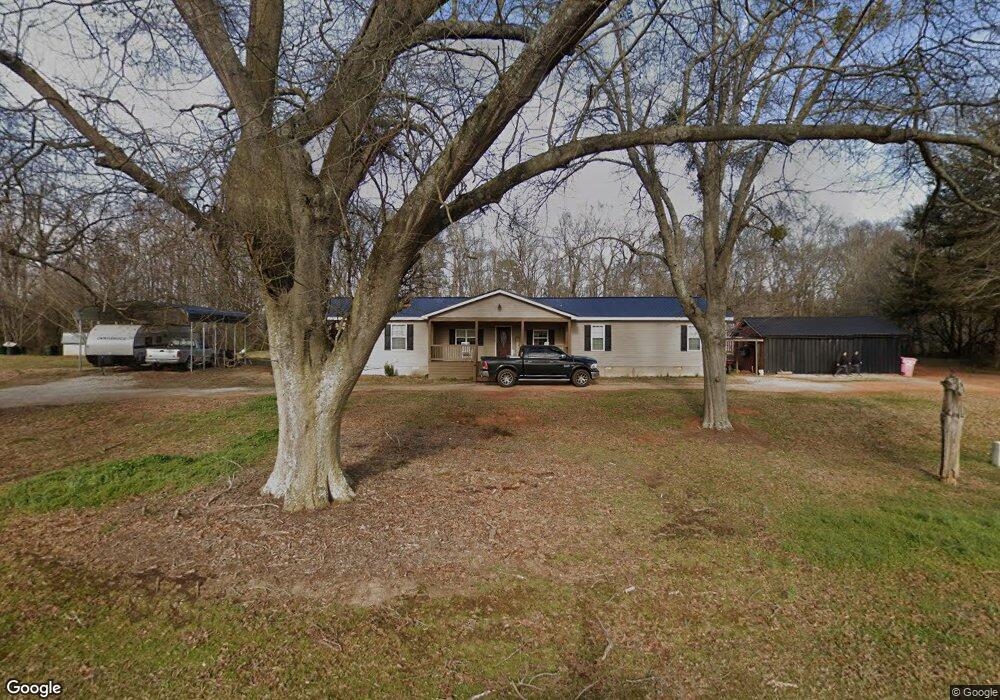
2753 Highway 191 Danielsville, GA 30633
Estimated Value: $190,220 - $679,000
--
Bed
1
Bath
2,372
Sq Ft
$153/Sq Ft
Est. Value
About This Home
This home is located at 2753 Highway 191, Danielsville, GA 30633 and is currently estimated at $363,555, approximately $153 per square foot. 2753 Highway 191 is a home located in Madison County with nearby schools including Madison County High School.
Ownership History
Date
Name
Owned For
Owner Type
Purchase Details
Closed on
Feb 19, 2020
Sold by
Manders Billy Jacob
Bought by
Manders Jack and Manders Virginia
Current Estimated Value
Purchase Details
Closed on
Feb 19, 2010
Sold by
Bell Linda Jean
Bought by
Manders Billy Jacob and Manders Christy
Purchase Details
Closed on
Jan 11, 2001
Sold by
Coile Charlie C & Ge
Bought by
Bell Linda Jean
Purchase Details
Closed on
Jan 1, 1971
Bought by
Coile Charlie C & Ge
Create a Home Valuation Report for This Property
The Home Valuation Report is an in-depth analysis detailing your home's value as well as a comparison with similar homes in the area
Home Values in the Area
Average Home Value in this Area
Purchase History
| Date | Buyer | Sale Price | Title Company |
|---|---|---|---|
| Manders Jack | -- | -- | |
| Manders Billy Jacob | -- | -- | |
| Bell Linda Jean | -- | -- | |
| Coile Charlie C & Ge | -- | -- |
Source: Public Records
Tax History Compared to Growth
Tax History
| Year | Tax Paid | Tax Assessment Tax Assessment Total Assessment is a certain percentage of the fair market value that is determined by local assessors to be the total taxable value of land and additions on the property. | Land | Improvement |
|---|---|---|---|---|
| 2024 | $1,033 | $39,706 | $7,813 | $31,893 |
| 2023 | $1,137 | $37,242 | $6,511 | $30,731 |
| 2022 | $925 | $33,520 | $4,478 | $29,042 |
| 2021 | $941 | $30,814 | $4,478 | $26,336 |
| 2020 | $597 | $19,433 | $3,827 | $15,606 |
| 2019 | $598 | $19,221 | $3,827 | $15,394 |
| 2018 | $577 | $18,486 | $3,501 | $14,985 |
| 2017 | $533 | $18,519 | $3,256 | $15,263 |
| 2016 | $482 | $16,776 | $2,715 | $14,061 |
| 2015 | $482 | $16,776 | $2,715 | $14,061 |
| 2014 | $485 | $16,778 | $2,691 | $14,086 |
| 2013 | -- | $16,778 | $2,691 | $14,086 |
Source: Public Records
Map
Nearby Homes
- 0 Georgia 191
- 0 Hwy 191 Unit CL339505
- 0 Hwy 29 N Unit 10574548
- 0 Hwy 29 N Unit CL335575
- 795 E Jones Chapel Rd
- 1885 Highway 29 N
- 0 Cedar Ln Unit 1026097
- 0 Cedar Ln Unit 10530523
- 107 Hill Lake Rd
- 450 Stagecoach Way
- 0 Irvin Kirk Rd
- 255 Hillwood Dr Unit 1
- 430 Sherwood Cir
- 417 Cheek Pulliam Rd
- 6356 Highway 191
- 6356 Georgia 191
- 2970 Davids Home Church Rd
- 0 Collins Brooks Rd Unit 10642235
- 0 Collins Brooks Rd Unit CL343375
- 75 Gunnell Rd
- 2701 Highway 191
- 2874 Highway 191
- 2909 Highway 191
- 2636 Highway 191
- 2874 Georgia 191
- 2670 Highway 191
- 2578 Highway 191
- 2540 Highway 191
- 127 Dalton Dr
- 9379 Wildcat Bridge Rd
- 9359 Wildcat Bridge Rd
- 233 Dalton Dr
- 9725 Wildcat Bridge Rd
- 9628 Wildcat Bridge Rd
- 9658 Wildcat Bridge Rd
- 9658 Wildcat Bridge Rd
- 9658 Wildcat Bridge Rd
- 88 Acres Georgia 281
- +/- 55 A Wildcat Bridge Rd
- 10019 Wildcat Bridge Rd