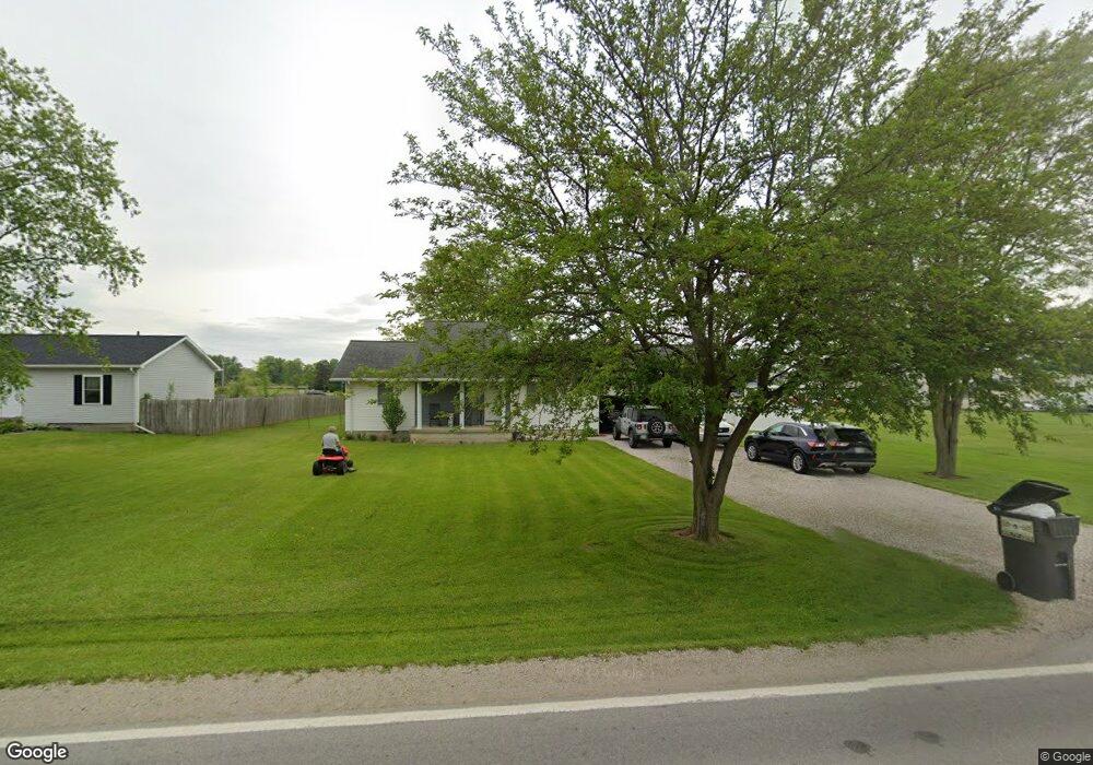
2755 Old State Rd N Norwalk, OH 44857
Estimated Value: $165,000 - $282,000
2
Beds
2
Baths
960
Sq Ft
$229/Sq Ft
Est. Value
About This Home
This home is located at 2755 Old State Rd N, Norwalk, OH 44857 and is currently estimated at $219,642, approximately $228 per square foot. 2755 Old State Rd N is a home located in Huron County with nearby schools including Maplehurst Elementary School, Pleasant Elementary School, and League Elementary School.
Ownership History
Date
Name
Owned For
Owner Type
Purchase Details
Closed on
Jun 18, 2021
Sold by
Brien Sr Michael O
Bought by
Long April M
Current Estimated Value
Home Financials for this Owner
Home Financials are based on the most recent Mortgage that was taken out on this home.
Original Mortgage
$109,283
Outstanding Balance
$98,942
Interest Rate
2.9%
Mortgage Type
FHA
Estimated Equity
$120,700
Purchase Details
Closed on
May 10, 2011
Bought by
Michael O'Brien
Purchase Details
Closed on
Jan 20, 2011
Bought by
Fannie Mae
Purchase Details
Closed on
Mar 2, 2000
Bought by
Baker Alma R
Purchase Details
Closed on
May 11, 1999
Bought by
Harpst Dawn J Custodian
Purchase Details
Closed on
Nov 23, 1998
Bought by
Baker Alma R
Purchase Details
Closed on
Oct 29, 1997
Bought by
Groneman Samual
Purchase Details
Closed on
Aug 2, 1990
Bought by
Baker Alma R
Create a Home Valuation Report for This Property
The Home Valuation Report is an in-depth analysis detailing your home's value as well as a comparison with similar homes in the area
Home Values in the Area
Average Home Value in this Area
Purchase History
| Date | Buyer | Sale Price | Title Company |
|---|---|---|---|
| Long April M | $25,000 | Tucker Escrow & Title Svcs | |
| Michael O'Brien | $26,000 | -- | |
| Fannie Mae | $33,300 | -- | |
| Baker Alma R | -- | -- | |
| Harpst Dawn J Custodian | -- | -- | |
| Baker Alma R | -- | -- | |
| Groneman Samual | -- | -- | |
| Baker Alma R | $35,000 | -- |
Source: Public Records
Mortgage History
| Date | Status | Borrower | Loan Amount |
|---|---|---|---|
| Open | Long April M | $109,283 |
Source: Public Records
Tax History Compared to Growth
Tax History
| Year | Tax Paid | Tax Assessment Tax Assessment Total Assessment is a certain percentage of the fair market value that is determined by local assessors to be the total taxable value of land and additions on the property. | Land | Improvement |
|---|---|---|---|---|
| 2024 | $1,813 | $48,210 | $8,110 | $40,100 |
| 2023 | $1,813 | $36,370 | $5,830 | $30,540 |
| 2022 | $1,338 | $36,370 | $5,830 | $30,540 |
| 2021 | $1,339 | $36,370 | $5,830 | $30,540 |
| 2020 | $1,286 | $32,540 | $5,830 | $26,710 |
| 2019 | $1,281 | $32,540 | $5,830 | $26,710 |
| 2018 | $1,257 | $32,540 | $5,830 | $26,710 |
| 2017 | $1,213 | $30,540 | $5,830 | $24,710 |
| 2016 | $1,190 | $30,540 | $5,830 | $24,710 |
| 2015 | $1,190 | $30,550 | $5,840 | $24,710 |
| 2014 | $1,180 | $30,530 | $5,850 | $24,680 |
| 2013 | $1,018 | $30,530 | $5,850 | $24,680 |
Source: Public Records
Map
Nearby Homes
- 431 Old State Rd S
- 9 Eagle Creek Dr
- 35 Eagle Creek Dr
- 191 Briarcrest Dr
- 40 Briarcrest Village
- 15 W Chestnut St
- 120 Woodlawn Ave
- 29 Harris Ave
- 85 Woodlawn Ave
- 58 E Elm St
- 40 Norwood Ave
- 21 Maple St
- 37 S Garden St
- 29 Corwin St
- 29 W Seminary St
- 14 Corwin St
- 0 Cleveland Rd
- 2163 Cole Creek Dr
- 14 Whitefield Blvd
- 27 Whitefield Blvd
- 2745 Old State Rd N
- 2739 Old State Rd
- 2762 U S 250
- 2708 Old State Rd N
- 42 Townline Road 151
- 70 Townline Road 151
- 42 Townline 151 Rd
- 2835 Old State Rd N
- 2822 Old State Rd N
- 2822 Old State Rd N
- 90 Townline Road 151
- 96 Townline Road 151
- 102 Town Line Road 151
- 114 Townline Road 151
- 126 Townline Road 151
- 138 Townline Road 151
- 150 Townline Road 151
- 166 Townline Road 151
- 166 Townline Road 151
- 166 Townline Road 151