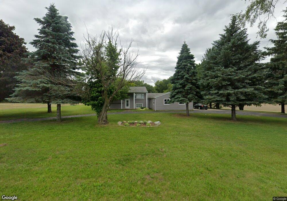
2755 W Garrison Rd Owosso, MI 48867
Estimated Value: $320,000 - $492,000
4
Beds
2
Baths
2,904
Sq Ft
$128/Sq Ft
Est. Value
About This Home
This home is located at 2755 W Garrison Rd, Owosso, MI 48867 and is currently estimated at $371,117, approximately $127 per square foot. 2755 W Garrison Rd is a home located in Shiawassee County with nearby schools including Owosso High School and Owosso Christian School.
Ownership History
Date
Name
Owned For
Owner Type
Purchase Details
Closed on
Aug 27, 2024
Sold by
Nash Dwight H
Bought by
Dwight H Nash Trust and Nash
Current Estimated Value
Purchase Details
Closed on
Aug 11, 2004
Sold by
Fannie Mae
Bought by
Malone Patrick Michael
Home Financials for this Owner
Home Financials are based on the most recent Mortgage that was taken out on this home.
Original Mortgage
$119,200
Interest Rate
7.6%
Mortgage Type
Purchase Money Mortgage
Purchase Details
Closed on
Oct 8, 2003
Sold by
Countrywide Home Loans Inc
Bought by
Federal National Mortgage Association
Create a Home Valuation Report for This Property
The Home Valuation Report is an in-depth analysis detailing your home's value as well as a comparison with similar homes in the area
Home Values in the Area
Average Home Value in this Area
Purchase History
| Date | Buyer | Sale Price | Title Company |
|---|---|---|---|
| Dwight H Nash Trust | -- | None Listed On Document | |
| Malone Patrick Michael | $149,000 | First American Title | |
| Federal National Mortgage Association | -- | -- | |
| Countrywide Home Loans Inc | $155,212 | -- |
Source: Public Records
Mortgage History
| Date | Status | Borrower | Loan Amount |
|---|---|---|---|
| Previous Owner | Malone Patrick Michael | $119,200 |
Source: Public Records
Tax History Compared to Growth
Tax History
| Year | Tax Paid | Tax Assessment Tax Assessment Total Assessment is a certain percentage of the fair market value that is determined by local assessors to be the total taxable value of land and additions on the property. | Land | Improvement |
|---|---|---|---|---|
| 2025 | $2,289 | $128,100 | $0 | $0 |
| 2024 | $2,277 | $115,400 | $0 | $0 |
| 2023 | $837 | $105,300 | $0 | $0 |
| 2022 | $797 | $95,100 | $0 | $0 |
| 2021 | $2,004 | $90,000 | $0 | $0 |
| 2020 | $1,985 | $88,400 | $0 | $0 |
| 2019 | $1,934 | $73,700 | $0 | $0 |
| 2018 | $1,960 | $71,600 | $0 | $0 |
| 2017 | $1,588 | $66,000 | $0 | $0 |
| 2016 | -- | $66,000 | $0 | $0 |
| 2015 | -- | $63,200 | $0 | $0 |
| 2014 | $8 | $60,200 | $0 | $0 |
Source: Public Records
Map
Nearby Homes
- 4458 S M 52
- 2628 W Brewer Rd
- 2973 W Brewer Rd
- 4650 Waugh Rd
- V/L Morrice Rd Rd
- 25 Bennington Greens Dr
- 26 Bennington Greens Dr Unit 26
- 20 Bennington Greens Dr
- 24 Bennington Greens Dr
- 38 Bennington Greens Dr
- 14 Bennington Greens Dr
- 54 Bennington Greens Dr
- 38 Bennington Greens
- 3110 Innsbrook Dr
- 7697 Riverview St
- 3062 Innsbrook Dr
- 3287 Oakview Dr
- 0 Gale Rd Unit 50124635
- 8 Bennington Greens Dr
- 2560 S Morrice Rd
- 2680 W Garrison Rd
- 2624 W Garrison Rd
- 2615 W Garrison Rd
- 2556 W Garrison Rd
- 2545 W Garrison Rd
- 4960 S M 52
- 4920 S M 52
- 5160 Old Colony Rd
- 9251 Old Colony Dr
- 5148 Old Colony Rd
- 5136 Old Colony Rd
- 2475 W Garrison Rd
- 5236 S M 52
- 5124 Old Colony Rd
- 2460 W Garrison Rd
- 5250 Michigan 52
- parcel "A" Old Colony Dr
- 5248 Michigan 52
- parcel A Old Colony Dr
- 5248 S M 52