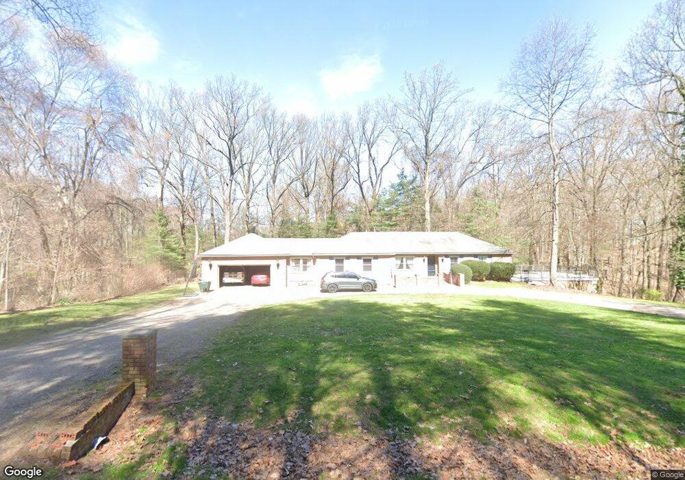
2756 Deer Path Duncan Falls, OH 43734
Estimated Value: $325,000 - $460,000
3
Beds
2
Baths
2,413
Sq Ft
$164/Sq Ft
Est. Value
About This Home
This home is located at 2756 Deer Path, Duncan Falls, OH 43734 and is currently estimated at $396,678, approximately $164 per square foot. 2756 Deer Path is a home located in Muskingum County with nearby schools including Philo High School.
Ownership History
Date
Name
Owned For
Owner Type
Purchase Details
Closed on
Mar 30, 2005
Sold by
Longstreth Mark R and Longstreth Kandice L
Bought by
Preston Robert B and Preston Keri A
Current Estimated Value
Home Financials for this Owner
Home Financials are based on the most recent Mortgage that was taken out on this home.
Original Mortgage
$142,000
Outstanding Balance
$72,611
Interest Rate
5.64%
Mortgage Type
Fannie Mae Freddie Mac
Estimated Equity
$324,067
Purchase Details
Closed on
Sep 15, 1995
Sold by
Dover James A
Bought by
Longstreth Mark R and Longstreth Kandice L
Home Financials for this Owner
Home Financials are based on the most recent Mortgage that was taken out on this home.
Original Mortgage
$65,000
Interest Rate
6%
Mortgage Type
New Conventional
Create a Home Valuation Report for This Property
The Home Valuation Report is an in-depth analysis detailing your home's value as well as a comparison with similar homes in the area
Purchase History
| Date | Buyer | Sale Price | Title Company |
|---|---|---|---|
| Preston Robert B | $149,900 | -- | |
| Longstreth Mark R | $95,000 | -- |
Source: Public Records
Mortgage History
| Date | Status | Borrower | Loan Amount |
|---|---|---|---|
| Open | Preston Robert B | $142,000 | |
| Closed | Longstreth Mark R | $65,000 |
Source: Public Records
Tax History
| Year | Tax Paid | Tax Assessment Tax Assessment Total Assessment is a certain percentage of the fair market value that is determined by local assessors to be the total taxable value of land and additions on the property. | Land | Improvement |
|---|---|---|---|---|
| 2024 | $3,359 | $104,370 | $7,980 | $96,390 |
| 2023 | $2,794 | $82,425 | $7,700 | $74,725 |
| 2022 | $2,677 | $82,425 | $7,700 | $74,725 |
| 2021 | $2,634 | $82,425 | $7,700 | $74,725 |
| 2020 | $2,445 | $74,935 | $7,000 | $67,935 |
| 2019 | $2,440 | $74,935 | $7,000 | $67,935 |
| 2018 | $2,495 | $74,935 | $7,000 | $67,935 |
| 2017 | $2,029 | $56,980 | $7,000 | $49,980 |
| 2016 | $1,949 | $56,980 | $7,000 | $49,980 |
| 2015 | $2,003 | $56,980 | $7,000 | $49,980 |
| 2013 | $2,151 | $56,980 | $7,000 | $49,980 |
Source: Public Records
Map
Nearby Homes
- 243 Mill St
- 512 North St
- 606 Main St
- 134 Main St
- 307 Harris St
- 524 Spring St
- 6965 Chandlersville Rd
- 3100 Durant Rd
- 3345 Durant Rd
- 0 Durant Rd Unit 5186947
- 0 Sealover Hollow Rd
- 4145 Old River Rd
- 3010 Corbin Dr
- 2519 Frick Dr
- 1685 Fattler Ridge Rd
- 2630 Glenn Cir
- 0 Okey Rd Unit 5130633
- 2125 Long Rd
- 5180 Pine Valley Dr
- 3620 Old Wheeling Rd
Your Personal Tour Guide
Ask me questions while you tour the home.