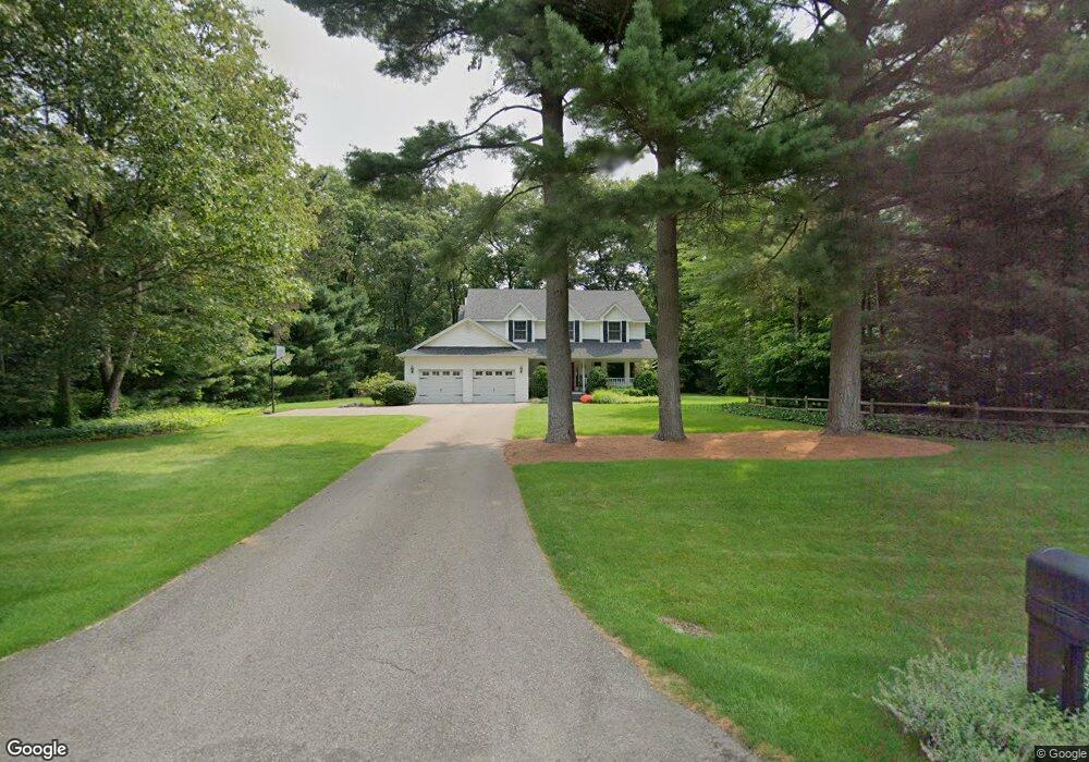
27574 Rolling Pines Ct Lawton, MI 49065
Estimated Value: $409,000 - $583,000
4
Beds
4
Baths
3,790
Sq Ft
$126/Sq Ft
Est. Value
About This Home
This home is located at 27574 Rolling Pines Ct, Lawton, MI 49065 and is currently estimated at $477,305, approximately $125 per square foot. 27574 Rolling Pines Ct is a home located in Van Buren County with nearby schools including Mattawan Early Elementary School, Mattawan Later Elementary School, and Mattawan Early Childhood Education Center.
Ownership History
Date
Name
Owned For
Owner Type
Purchase Details
Closed on
Nov 3, 2003
Bought by
Stair David and Stair Renee
Current Estimated Value
Purchase Details
Closed on
Jun 28, 2002
Sold by
Zaucha Robert and Zaucha Susan
Bought by
Dunn Ii Robert T
Purchase Details
Closed on
Jun 19, 1996
Sold by
Slevats Anthony
Bought by
Zaucha Robert and Zaucha Susan
Create a Home Valuation Report for This Property
The Home Valuation Report is an in-depth analysis detailing your home's value as well as a comparison with similar homes in the area
Home Values in the Area
Average Home Value in this Area
Purchase History
| Date | Buyer | Sale Price | Title Company |
|---|---|---|---|
| Stair David | $250,000 | -- | |
| Dunn Ii Robert T | $237,000 | -- | |
| Zaucha Robert | $220,000 | -- |
Source: Public Records
Tax History Compared to Growth
Tax History
| Year | Tax Paid | Tax Assessment Tax Assessment Total Assessment is a certain percentage of the fair market value that is determined by local assessors to be the total taxable value of land and additions on the property. | Land | Improvement |
|---|---|---|---|---|
| 2025 | $1,529 | $190,200 | $0 | $0 |
| 2024 | $1,529 | $176,200 | $0 | $0 |
| 2023 | $1,456 | $175,100 | $0 | $0 |
| 2022 | $4,659 | $172,600 | $0 | $0 |
| 2021 | $4,487 | $167,500 | $15,000 | $152,500 |
| 2020 | $4,425 | $171,400 | $15,000 | $156,400 |
| 2019 | $4,102 | $154,700 | $154,700 | $0 |
| 2018 | $4,011 | $129,200 | $129,200 | $0 |
| 2017 | $3,868 | $130,000 | $0 | $0 |
| 2016 | $3,901 | $121,300 | $0 | $0 |
| 2015 | $3,441 | $121,300 | $0 | $0 |
| 2014 | $3,418 | $124,700 | $0 | $0 |
| 2013 | -- | $112,900 | $112,900 | $0 |
Source: Public Records
Map
Nearby Homes
- 28302 Springbrook Dr
- 61121 Airpark Ln
- 59134 Whitewood Dr
- 28313 58th Ave
- 59103 Silvergrass Dr
- 58640 Swenson St
- 58367 Swenson St
- 58913 Swenson St
- 58664 Swenson St
- 59037 Norton St
- 59075 Norton St
- 58606 Interlaken St
- Elements 1870 Plan at Concord Farms
- Traditions 1600 V8.0b Plan at Concord Farms - Traditions
- Elements 2100 Plan at Concord Farms
- Integrity 2060 Plan at Concord Farms - Integrity
- Elements 2390 Plan at Concord Farms
- Integrity 1460 Plan at Concord Farms - Integrity
- Integrity 1880 Plan at Concord Farms - Integrity
- Elements 1800 Plan at Concord Farms
- 27562 Rolling Pines Ct
- 27588 Rolling Pines Ct
- 60844 Whitetail Run
- 27567 Rolling Pines Ct
- 60640 Whitetail Run
- 27579 Rolling Pines Ct
- 27550 Rolling Pines Ct
- 61022 Whitetail Run
- 14 Whitetail Run
- 27555 Rolling Pines Ct
- 60915 Whitetail Run
- 60727 Whitetail Run Unit 22
- 27624 Rolling Pines Ct
- 27538 Rolling Pines Ct
- 27467 Rolling Pines Ct
- 27459 Rolling Pines Ct
- 27676 Rolling Pines Ct
- 60444 Whitetail Run Unit 19
- 27475 Rolling Pines Ct
- 60523 Whitetail Run Unit 21