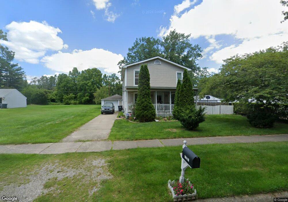
27582 Powers St Westland, MI 48186
Estimated Value: $198,000 - $266,000
3
Beds
2
Baths
2,344
Sq Ft
$98/Sq Ft
Est. Value
About This Home
This home is located at 27582 Powers St, Westland, MI 48186 and is currently estimated at $228,864, approximately $97 per square foot. 27582 Powers St is a home located in Wayne County with nearby schools including Taylor Parks Elementary School, Hoover Middle School, and Taylor High School.
Ownership History
Date
Name
Owned For
Owner Type
Purchase Details
Closed on
Oct 27, 2022
Sold by
Kaur Jasbir
Bought by
Kaur Jasbir and Kaur Taranbir
Current Estimated Value
Purchase Details
Closed on
Oct 14, 2011
Sold by
Kaur Hans Santokh Singh and Kaur Hans Surhdev
Bought by
Kaur Jasbir
Purchase Details
Closed on
Sep 13, 2011
Sold by
Hans Santokh Singh
Bought by
Kaur Hans Santokh Singh and Kaur Hans Surhdev
Purchase Details
Closed on
Jan 7, 2010
Sold by
Sonntag Andrew W
Bought by
Federal Home Loan Mortgage Corp
Create a Home Valuation Report for This Property
The Home Valuation Report is an in-depth analysis detailing your home's value as well as a comparison with similar homes in the area
Home Values in the Area
Average Home Value in this Area
Purchase History
| Date | Buyer | Sale Price | Title Company |
|---|---|---|---|
| Kaur Jasbir | -- | -- | |
| Kaur Jasbir | -- | None Available | |
| Kaur Hans Santokh Singh | -- | None Available | |
| Federal Home Loan Mortgage Corp | $141,444 | None Available |
Source: Public Records
Tax History Compared to Growth
Tax History
| Year | Tax Paid | Tax Assessment Tax Assessment Total Assessment is a certain percentage of the fair market value that is determined by local assessors to be the total taxable value of land and additions on the property. | Land | Improvement |
|---|---|---|---|---|
| 2025 | $1,236 | $95,000 | $0 | $0 |
| 2024 | $1,236 | $91,400 | $0 | $0 |
| 2023 | $1,271 | $73,900 | $0 | $0 |
| 2022 | $1,497 | $59,400 | $0 | $0 |
| 2021 | $1,414 | $49,600 | $0 | $0 |
| 2020 | $1,396 | $38,000 | $0 | $0 |
| 2019 | $1,338 | $32,500 | $0 | $0 |
| 2018 | $1,017 | $28,000 | $0 | $0 |
| 2017 | $570 | $26,900 | $0 | $0 |
| 2016 | $1,702 | $27,300 | $0 | $0 |
| 2015 | $2,641 | $26,410 | $0 | $0 |
| 2013 | $2,802 | $29,400 | $0 | $0 |
| 2012 | $1,080 | $28,530 | $0 | $0 |
Source: Public Records
Map
Nearby Homes
- 27523 Powers St
- POWERS Powers St
- 5526 Sylvia St
- 4133 Moore St
- 4130 Allen St
- 27285 Colgate St
- 4054 Moore St
- 4120 Ash St
- 6002 Frederick St Unit 81
- 6018 Frederick St Unit 83
- 4061 Wellington St
- 4863 Glenis St
- 6221 Inkster Rd
- 28654 N Maple St Unit 131
- 4315 Isabelle St
- 5926 Esther St
- 28919 Powers St
- 27022 Colgate St
- 3925 Spruce St
- 5898 W Maple St Unit 177
- 27568 Powers St
- 27608 Powers St
- 27608 Powers St
- 27554 Powers St
- 27581 Powers St
- 27567 Powers St
- 27595 Powers St
- 27620 Powers St
- 27547 Powers St
- 27540 Powers St
- 111 Powers St
- 27634 Powers St
- 27633 Powers St
- 27512 Powers St
- 27512 Powers St
- 27650 Powers St
- 27466 Powers St
- 27511 Powers St
- 27543 Eton St
- 27452 Powers St