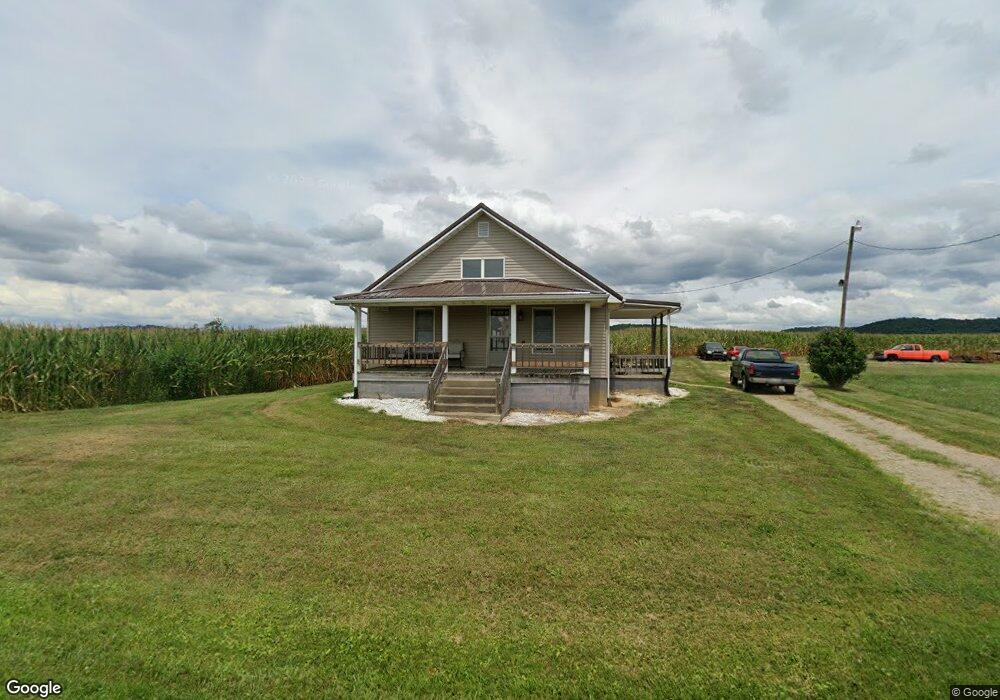
2759 Coal Dock Rd Waverly, OH 45690
Estimated Value: $108,000 - $201,506
--
Bed
1
Bath
896
Sq Ft
$166/Sq Ft
Est. Value
About This Home
This home is located at 2759 Coal Dock Rd, Waverly, OH 45690 and is currently estimated at $148,877, approximately $166 per square foot. 2759 Coal Dock Rd is a home located in Pike County.
Ownership History
Date
Name
Owned For
Owner Type
Purchase Details
Closed on
May 22, 2020
Sold by
Dixon Terry L and Dixon Charlotte S
Bought by
Fout Jonathan Wesley and Fout Erin
Current Estimated Value
Home Financials for this Owner
Home Financials are based on the most recent Mortgage that was taken out on this home.
Original Mortgage
$318,928
Interest Rate
3.3%
Mortgage Type
Commercial
Purchase Details
Closed on
May 6, 2019
Sold by
Fout Jonathan Wesley and Fout Erin
Bought by
Fout Jonathan Wesley and Fout Erin
Purchase Details
Closed on
Mar 26, 2019
Sold by
Estate Of Jonathan Ray Fout
Bought by
Fout Jonathan Wesley
Create a Home Valuation Report for This Property
The Home Valuation Report is an in-depth analysis detailing your home's value as well as a comparison with similar homes in the area
Home Values in the Area
Average Home Value in this Area
Purchase History
| Date | Buyer | Sale Price | Title Company |
|---|---|---|---|
| Fout Jonathan Wesley | $75,000 | None Available | |
| Fout Jonathan Wesley | -- | None Available | |
| Fout Jonathan Wesley | -- | None Available |
Source: Public Records
Mortgage History
| Date | Status | Borrower | Loan Amount |
|---|---|---|---|
| Previous Owner | Fout Jonathan Wesley | $318,928 |
Source: Public Records
Tax History Compared to Growth
Tax History
| Year | Tax Paid | Tax Assessment Tax Assessment Total Assessment is a certain percentage of the fair market value that is determined by local assessors to be the total taxable value of land and additions on the property. | Land | Improvement |
|---|---|---|---|---|
| 2024 | $755 | $22,760 | $6,810 | $15,950 |
| 2023 | $755 | $22,760 | $6,810 | $15,950 |
| 2022 | $642 | $18,870 | $6,760 | $12,110 |
| 2021 | $625 | $18,870 | $6,760 | $12,110 |
| 2020 | $630 | $18,870 | $6,760 | $12,110 |
| 2019 | $576 | $17,070 | $6,150 | $10,920 |
| 2018 | $568 | $17,070 | $6,150 | $10,920 |
| 2017 | $349 | $21,760 | $6,370 | $15,390 |
| 2016 | $352 | $10,380 | $2,530 | $7,850 |
| 2015 | $352 | $10,380 | $2,530 | $7,850 |
| 2014 | $358 | $10,380 | $2,530 | $7,850 |
| 2013 | $383 | $10,380 | $2,530 | $7,850 |
| 2012 | $394 | $10,380 | $2,530 | $7,850 |
Source: Public Records
Map
Nearby Homes
- 3115 Coal Dock Rd
- 2605 Adams Rd
- 1722 Beaver Pike
- 301 3rd St
- 6183 Ohio 335
- 001 Ervin Hill Rd
- 789 Moats Hollow Rd
- 01 Ervin Hill Rd
- 1112 Bailey Rd
- 874 Gravel Hill Rd
- 2765 Bobo Rd
- 0 Holbrook Rd
- 513 Posey Ridge Rd
- 1490 Millers Ln
- 300 Wadsworth Ave
- 2590 Zahns Corner Rd Unit 220562
- 967 Bobo Rd
- 215 Ohio 335
- 2351 Beaver Creek Rd
- 12893 Ohio 220
- 2874 Coal Dock Rd
- 2977 Coal Dock Rd
- 2519 Coal Dock Rd
- 2496 Coal Dock Rd
- 2391 Coal Dock Rd Unit 197403
- 6391 Red Hollow Rd
- 6326 Red Hollow Rd
- 6202 Red Hollow Rd
- 6340 Red Hollow Rd
- 5955 Red Hollow Rd
- 2272 Coal Dock Rd
- 5834 Red Hollow Rd
- 6199 Red Hollow Rd
- 6235 Red Hollow Rd
- 6303 Red Hollow Rd
- 2247 Coal Dock Rd
- 178 Cordle Rd
- 11 Cordle Rd
- 19 Cordle Rd
- 6416 Red Hollow Rd