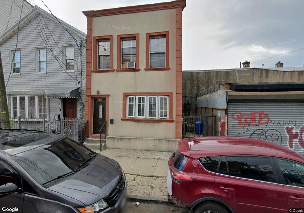
276 Ashford St Brooklyn, NY 11207
East New York NeighborhoodEstimated Value: $541,648 - $815,000
--
Bed
--
Bath
800
Sq Ft
$839/Sq Ft
Est. Value
About This Home
This home is located at 276 Ashford St, Brooklyn, NY 11207 and is currently estimated at $671,162, approximately $838 per square foot. 276 Ashford St is a home located in Kings County with nearby schools including P.S. 158 Warwick, Vista Academy, and Liberty Avenue Middle School.
Ownership History
Date
Name
Owned For
Owner Type
Purchase Details
Closed on
May 5, 2014
Sold by
Taurean Realty Llc
Bought by
Boddie Latisha
Current Estimated Value
Home Financials for this Owner
Home Financials are based on the most recent Mortgage that was taken out on this home.
Original Mortgage
$299,119
Outstanding Balance
$228,729
Interest Rate
4.42%
Mortgage Type
New Conventional
Estimated Equity
$442,433
Purchase Details
Closed on
Sep 26, 2013
Sold by
Mcneil Robin
Bought by
Taurean Realty Llc
Purchase Details
Closed on
Dec 12, 2003
Sold by
Treuhold Capital Group Llc
Bought by
Mcneil Robin
Home Financials for this Owner
Home Financials are based on the most recent Mortgage that was taken out on this home.
Original Mortgage
$204,750
Interest Rate
5.83%
Mortgage Type
Purchase Money Mortgage
Purchase Details
Closed on
Apr 10, 2003
Sold by
Greenpoint Mortgage Funding Inc
Bought by
Treuhold Capital Group Llc
Purchase Details
Closed on
Jan 30, 2003
Sold by
Mootze Michel Roache Esq
Bought by
Greenpoint Mortgage Funding Inc
Purchase Details
Closed on
Sep 15, 2000
Sold by
Sands Realty Corp
Bought by
Gay Anne
Home Financials for this Owner
Home Financials are based on the most recent Mortgage that was taken out on this home.
Original Mortgage
$120,000
Interest Rate
6.96%
Purchase Details
Closed on
Jan 13, 2000
Sold by
Federal Housing Commissioner
Bought by
Sand Realty Corp
Purchase Details
Closed on
Nov 15, 1993
Sold by
Gil Nir Properties Inc
Bought by
Saunders Gloria M
Home Financials for this Owner
Home Financials are based on the most recent Mortgage that was taken out on this home.
Original Mortgage
$71,450
Interest Rate
9.17%
Mortgage Type
FHA
Create a Home Valuation Report for This Property
The Home Valuation Report is an in-depth analysis detailing your home's value as well as a comparison with similar homes in the area
Home Values in the Area
Average Home Value in this Area
Purchase History
| Date | Buyer | Sale Price | Title Company |
|---|---|---|---|
| Boddie Latisha | $305,000 | -- | |
| Boddie Latisha | $305,000 | -- | |
| Taurean Realty Llc | $135,000 | -- | |
| Taurean Realty Llc | $135,000 | -- | |
| Mcneil Robin | $208,000 | -- | |
| Mcneil Robin | $208,000 | -- | |
| Treuhold Capital Group Llc | $107,000 | -- | |
| Treuhold Capital Group Llc | $107,000 | -- | |
| Greenpoint Mortgage Funding Inc | -- | -- | |
| Greenpoint Mortgage Funding Inc | -- | -- | |
| Gay Anne | $160,000 | Transworld Title | |
| Gay Anne | $160,000 | Transworld Title | |
| Sand Realty Corp | $40,384 | Fidelity National Title Ins | |
| Sand Realty Corp | $40,384 | Fidelity National Title Ins | |
| Saunders Gloria M | $71,000 | -- | |
| Saunders Gloria M | $71,000 | -- |
Source: Public Records
Mortgage History
| Date | Status | Borrower | Loan Amount |
|---|---|---|---|
| Open | Boddie Latisha | $299,119 | |
| Closed | Boddie Latisha | $299,119 | |
| Previous Owner | Mcneil Robin | $204,750 | |
| Previous Owner | Gay Anne | $120,000 | |
| Previous Owner | Saunders Gloria M | $71,450 | |
| Closed | Greenpoint Mortgage Funding Inc | $0 |
Source: Public Records
Tax History Compared to Growth
Tax History
| Year | Tax Paid | Tax Assessment Tax Assessment Total Assessment is a certain percentage of the fair market value that is determined by local assessors to be the total taxable value of land and additions on the property. | Land | Improvement |
|---|---|---|---|---|
| 2025 | $1,770 | $35,220 | $3,180 | $32,040 |
| 2024 | $1,770 | $27,840 | $3,180 | $24,660 |
| 2023 | $1,695 | $34,140 | $3,180 | $30,960 |
| 2022 | $1,573 | $37,380 | $3,180 | $34,200 |
| 2021 | $1,568 | $28,860 | $3,180 | $25,680 |
| 2020 | $778 | $24,120 | $3,180 | $20,940 |
| 2019 | $1,536 | $19,200 | $3,180 | $16,020 |
| 2018 | $1,418 | $6,956 | $1,237 | $5,719 |
| 2017 | $1,339 | $6,567 | $943 | $5,624 |
| 2016 | $1,241 | $6,208 | $1,089 | $5,119 |
| 2015 | $528 | $6,194 | $1,631 | $4,563 |
| 2014 | $528 | $6,120 | $1,931 | $4,189 |
Source: Public Records
Map
Nearby Homes
- 278 Ashford St
- 288 Ashford St
- 295 Ashford St
- 253 Ashford St
- 633 Glenmore Ave
- 389 Warwick St
- 599 Liberty Ave
- 597 Liberty Ave
- 590 Liberty Ave
- 323 Barbey St
- 400 Linwood St
- 339 Elton St Unit 341
- 349 Elton St
- 399 Linwood St
- 2321 Pitkin Ave
- 374 Ashford St
- 758 Glenmore Ave
- 341 Essex St
- 202 Schenck Ave
- 576 Glenmore Ave
- 274 Ashford St
- 282 Ashford St
- 646-648 Liberty Ave
- 652 Liberty Ave
- 652 Liberty Ave Unit 1
- 652 Liberty Ave Unit 2
- 652 Liberty Ave Ave
- 654 Liberty Ave Unit 1
- 654 Liberty Ave
- 284 Ashford St
- 640-642 Liberty Ave
- 286 Ashford St
- 279 Ashford St
- 656 Liberty Ave
- 281 Ashford St
- 341 Warwick St
- 341 Warwick St Unit Building
- 283 Ashford St
- 343 Warwick St
- 658 Liberty Ave