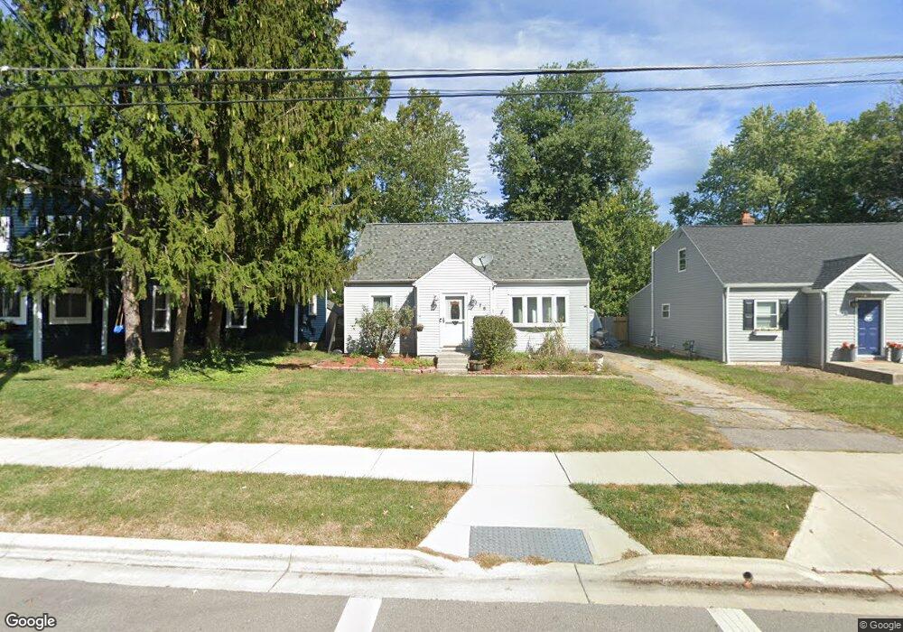
276 E Park St Westerville, OH 43081
Estimated Value: $270,062 - $305,000
4
Beds
1
Bath
1,093
Sq Ft
$267/Sq Ft
Est. Value
About This Home
This home is located at 276 E Park St, Westerville, OH 43081 and is currently estimated at $291,766, approximately $266 per square foot. 276 E Park St is a home located in Franklin County with nearby schools including Whittier Elementary School, Blendon Middle School, and Westerville South High School.
Ownership History
Date
Name
Owned For
Owner Type
Purchase Details
Closed on
Nov 18, 1997
Sold by
Hamilton Lewis R
Bought by
Palkiewicz Neil and Palkiewicz Sandra
Current Estimated Value
Home Financials for this Owner
Home Financials are based on the most recent Mortgage that was taken out on this home.
Original Mortgage
$78,990
Outstanding Balance
$11,199
Interest Rate
7.38%
Estimated Equity
$280,567
Purchase Details
Closed on
Mar 28, 1989
Create a Home Valuation Report for This Property
The Home Valuation Report is an in-depth analysis detailing your home's value as well as a comparison with similar homes in the area
Home Values in the Area
Average Home Value in this Area
Purchase History
| Date | Buyer | Sale Price | Title Company |
|---|---|---|---|
| Palkiewicz Neil | $76,000 | Express Title Services Of Oh | |
| -- | -- | -- |
Source: Public Records
Mortgage History
| Date | Status | Borrower | Loan Amount |
|---|---|---|---|
| Open | Palkiewicz Neil | $78,990 |
Source: Public Records
Tax History
| Year | Tax Paid | Tax Assessment Tax Assessment Total Assessment is a certain percentage of the fair market value that is determined by local assessors to be the total taxable value of land and additions on the property. | Land | Improvement |
|---|---|---|---|---|
| 2025 | $3,917 | $68,920 | $19,290 | $49,630 |
| 2024 | $3,917 | $68,920 | $19,290 | $49,630 |
| 2023 | $3,834 | $68,920 | $19,290 | $49,630 |
| 2022 | $3,264 | $44,800 | $13,720 | $31,080 |
| 2021 | $3,291 | $44,800 | $13,720 | $31,080 |
| 2020 | $3,282 | $44,800 | $13,720 | $31,080 |
| 2019 | $2,683 | $34,580 | $13,720 | $20,860 |
| 2018 | $2,770 | $34,580 | $13,720 | $20,860 |
| 2017 | $2,639 | $34,580 | $13,720 | $20,860 |
| 2016 | $3,005 | $35,840 | $11,480 | $24,360 |
| 2015 | $2,910 | $35,840 | $11,480 | $24,360 |
| 2014 | $2,912 | $35,840 | $11,480 | $24,360 |
| 2013 | $1,454 | $35,840 | $11,480 | $24,360 |
Source: Public Records
Map
Nearby Homes
- 328 Myrtle Dr Unit Lot 5
- 348 Myrtle Dr Unit Lot 10
- 337 Myrtle Dr Unit Lot 2
- 334 Myrtle Dr Unit Lot 7
- 342 Myrtle Dr Unit Lot 8
- 344 Myrtle Dr Unit Lot 9
- 133 Illinois Ave
- 291 Mohawk Ave
- 303 Pointe Place
- 291 Pointe Place
- 339 Aylesbury Dr S
- 629 Andrew Ave
- 687 E College Ave
- 480 S State St
- 355 Nature Trail Unit 355
- 559 Allview Ct
- 373 Wyndham Park S
- 448 Crossings Dr Unit 448
- 138 Wood St
- 487 Beachside Dr
Your Personal Tour Guide
Ask me questions while you tour the home.