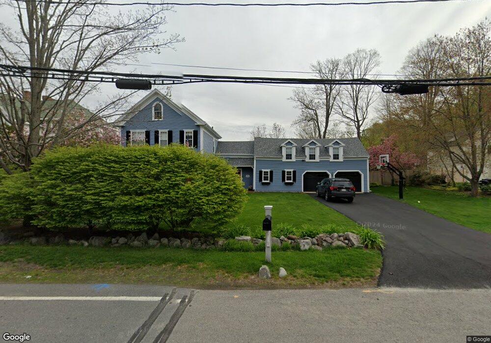
276 Old Sudbury Rd Sudbury, MA 01776
Estimated Value: $901,000 - $1,390,000
4
Beds
2
Baths
2,678
Sq Ft
$421/Sq Ft
Est. Value
About This Home
This home is located at 276 Old Sudbury Rd, Sudbury, MA 01776 and is currently estimated at $1,127,957, approximately $421 per square foot. 276 Old Sudbury Rd is a home located in Middlesex County with nearby schools including Peter Noyes Elementary School, Ephraim Curtis Middle School, and Lincoln-Sudbury Regional High School.
Ownership History
Date
Name
Owned For
Owner Type
Purchase Details
Closed on
Aug 26, 2005
Sold by
Shepard Dana Dewitt and Shepard Mark L
Bought by
Lahait Amy and Lahait Robert
Current Estimated Value
Purchase Details
Closed on
Mar 13, 1995
Sold by
Hayes Royal E and Hayes Barbara B
Bought by
Shepard Mark L and Shepard Dana D
Create a Home Valuation Report for This Property
The Home Valuation Report is an in-depth analysis detailing your home's value as well as a comparison with similar homes in the area
Home Values in the Area
Average Home Value in this Area
Purchase History
| Date | Buyer | Sale Price | Title Company |
|---|---|---|---|
| Lahait Amy | $540,000 | -- | |
| Shepard Mark L | $309,000 | -- |
Source: Public Records
Mortgage History
| Date | Status | Borrower | Loan Amount |
|---|---|---|---|
| Open | Shepard Mark L | $383,000 | |
| Closed | Shepard Mark L | $392,000 |
Source: Public Records
Tax History Compared to Growth
Tax History
| Year | Tax Paid | Tax Assessment Tax Assessment Total Assessment is a certain percentage of the fair market value that is determined by local assessors to be the total taxable value of land and additions on the property. | Land | Improvement |
|---|---|---|---|---|
| 2025 | $12,489 | $853,100 | $368,500 | $484,600 |
| 2024 | $12,042 | $824,200 | $357,800 | $466,400 |
| 2023 | $10,768 | $682,800 | $325,100 | $357,700 |
| 2022 | $9,904 | $548,700 | $298,400 | $250,300 |
| 2021 | $10,466 | $555,800 | $298,400 | $257,400 |
| 2020 | $10,255 | $555,800 | $298,400 | $257,400 |
| 2019 | $9,954 | $555,800 | $298,400 | $257,400 |
| 2018 | $9,602 | $535,500 | $301,900 | $233,600 |
| 2017 | $9,019 | $508,400 | $291,500 | $216,900 |
| 2016 | $8,809 | $494,900 | $280,400 | $214,500 |
| 2015 | $8,393 | $476,900 | $267,200 | $209,700 |
| 2014 | $8,342 | $462,700 | $257,800 | $204,900 |
Source: Public Records
Map
Nearby Homes
- 268 Old Sudbury Rd
- 377 Concord Rd
- 427 Concord Rd
- 210 Plympton Rd
- 7 Nashoba Rd
- 270 Old Lancaster Rd
- 4 Kato Summit
- 20 Kato Dr
- 447 Peakham Rd
- 24 Goodnow Rd
- 10 Bradley Place
- 23 Massasoit Ave
- 40 Tall Pine Dr Unit 12
- 89 Bridle Path
- 271 Landham Rd
- 16 Meadowbrook Cir
- 1011 Boston Post Rd
- 12 Camperdown Ln
- 14 Frost Ln
- 45 Widow Rites Ln
- 262 Old Sudbury Rd
- 254 Old Sudbury Rd
- 254 Old Sudbury Rd - Cart Path
- 250 Old Sudbury Rd
- 277 Old Sudbury Rd
- 249 Old Sudbury Rd
- 308 Concord Rd
- 298 Concord Rd
- 284 Concord Rd
- 241 Old Sudbury Rd
- 301 Concord Rd
- 230 Old Sudbury Rd
- 295 Concord Rd
- 332 Goodmans Hill Rd
- 293 Concord Rd
- 328 Goodmans Hill Rd
- 289 Concord Rd
- 10 Hudson Rd
- 316 Goodmans Hill Rd
- 22 Brewster Rd