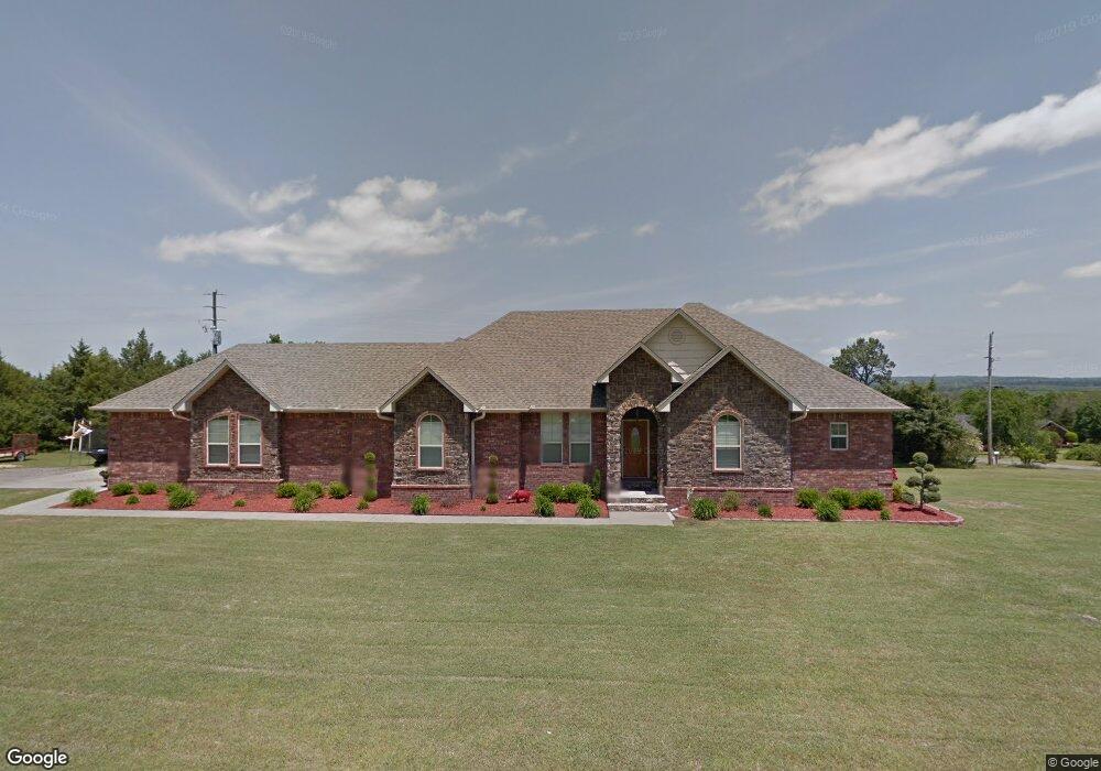
276 Phillips Rd Pottsville, AR 72858
Estimated Value: $425,856 - $483,000
4
Beds
3
Baths
2,813
Sq Ft
$161/Sq Ft
Est. Value
About This Home
This home is located at 276 Phillips Rd, Pottsville, AR 72858 and is currently estimated at $451,714, approximately $160 per square foot. 276 Phillips Rd is a home located in Pope County with nearby schools including Pottsville Elementary School, Pottsville Middle Grade, and Pottsville Junior High School.
Ownership History
Date
Name
Owned For
Owner Type
Purchase Details
Closed on
Sep 28, 2018
Sold by
Rowland Erick W and Rowland Jennifer W
Bought by
Wells Jeremy and Wells Jamie
Current Estimated Value
Home Financials for this Owner
Home Financials are based on the most recent Mortgage that was taken out on this home.
Original Mortgage
$287,850
Outstanding Balance
$250,505
Interest Rate
4.5%
Mortgage Type
New Conventional
Estimated Equity
$201,209
Create a Home Valuation Report for This Property
The Home Valuation Report is an in-depth analysis detailing your home's value as well as a comparison with similar homes in the area
Home Values in the Area
Average Home Value in this Area
Purchase History
| Date | Buyer | Sale Price | Title Company |
|---|---|---|---|
| Wells Jeremy | $303,000 | -- |
Source: Public Records
Mortgage History
| Date | Status | Borrower | Loan Amount |
|---|---|---|---|
| Open | Wells Jeremy | $287,850 |
Source: Public Records
Tax History
| Year | Tax Paid | Tax Assessment Tax Assessment Total Assessment is a certain percentage of the fair market value that is determined by local assessors to be the total taxable value of land and additions on the property. | Land | Improvement |
|---|---|---|---|---|
| 2025 | $3,042 | $61,360 | $7,880 | $53,480 |
| 2024 | $3,042 | $61,360 | $7,880 | $53,480 |
| 2023 | $2,915 | $61,360 | $7,880 | $53,480 |
| 2022 | $2,414 | $61,360 | $7,880 | $53,480 |
| 2021 | $2,287 | $61,360 | $7,880 | $53,480 |
| 2020 | $2,160 | $51,010 | $4,160 | $46,850 |
| 2019 | $2,160 | $51,010 | $4,160 | $46,850 |
| 2018 | $2,186 | $48,980 | $1,570 | $47,410 |
| 2017 | $2,434 | $48,980 | $1,570 | $47,410 |
| 2016 | $2,084 | $48,980 | $1,570 | $47,410 |
| 2015 | $2,457 | $49,430 | $1,320 | $48,110 |
| 2014 | $2,107 | $49,430 | $1,320 | $48,110 |
Source: Public Records
Map
Nearby Homes
- 1224 Sr 363
- 0 Rattlesnake Ln
- 561 Butterfield Stagecoach Bypass
- 0 Apache Dr Unit 25021438
- 170 Piney Point Ct
- 000 Pine Ridge Rd
- 428 Welcome Hill Rd
- 70 S C St
- 9341 U S 64
- 9341 US Highway 64 E
- 20 Acres
- 814 Stoneridge Cir
- LOTS 80,81,234 Cliff Rd
- LOTS 80, 81 and 234 Cliff Rd
- 340 Stonegate Dr
- 80 Sagebrush Cir
- 88 Quail Meadow Dr
- 155 Quail Meadow Dr
- 282/280 Rush Rd
- 297 Cliff Rd
- 223 Home Place Ln
- 279 Phillips Rd
- 350 Home Place Ln
- 245 Phillips Rd
- 315 Phillips Rd
- 225 Home Place Ln
- 302 Phillips Rd
- 231 Phillips Rd
- 212 Phillips Rd
- 175 Phillips Rd
- 263 Trailer Place
- 150 Estep Ln
- 0 Estep Ln
- 282 Home Place Ln
- 282 Home Place Ln
- 351 Home Place Ln
- 285 Home Place Ln
- 00 Home Place Ln
- 203 Home Place Ln
- 324 Phillips Rd
Your Personal Tour Guide
Ask me questions while you tour the home.