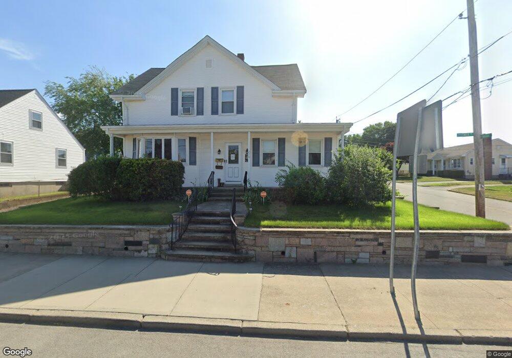
276 Power Rd Pawtucket, RI 02860
Fairlawn NeighborhoodEstimated Value: $414,000 - $441,000
3
Beds
2
Baths
1,743
Sq Ft
$246/Sq Ft
Est. Value
About This Home
This home is located at 276 Power Rd, Pawtucket, RI 02860 and is currently estimated at $428,471, approximately $245 per square foot. 276 Power Rd is a home located in Providence County with nearby schools including Blackstone Valley Prep Upper Elementary School, The San Miguel School, and Bishop Keough Regional High School.
Ownership History
Date
Name
Owned For
Owner Type
Purchase Details
Closed on
Aug 11, 2009
Sold by
Frattarelli Frank and Lacy Irene
Bought by
Rotondo Scott M and Rotondo Diane M
Current Estimated Value
Home Financials for this Owner
Home Financials are based on the most recent Mortgage that was taken out on this home.
Original Mortgage
$181,649
Outstanding Balance
$119,033
Interest Rate
5.47%
Mortgage Type
Purchase Money Mortgage
Estimated Equity
$309,438
Create a Home Valuation Report for This Property
The Home Valuation Report is an in-depth analysis detailing your home's value as well as a comparison with similar homes in the area
Home Values in the Area
Average Home Value in this Area
Purchase History
| Date | Buyer | Sale Price | Title Company |
|---|---|---|---|
| Rotondo Scott M | $185,000 | -- |
Source: Public Records
Mortgage History
| Date | Status | Borrower | Loan Amount |
|---|---|---|---|
| Open | Rotondo Scott M | $181,649 |
Source: Public Records
Tax History
| Year | Tax Paid | Tax Assessment Tax Assessment Total Assessment is a certain percentage of the fair market value that is determined by local assessors to be the total taxable value of land and additions on the property. | Land | Improvement |
|---|---|---|---|---|
| 2025 | $4,958 | $377,000 | $155,900 | $221,100 |
| 2024 | $4,652 | $377,000 | $155,900 | $221,100 |
| 2023 | $4,230 | $249,700 | $74,900 | $174,800 |
| 2022 | $4,140 | $249,700 | $74,900 | $174,800 |
| 2021 | $4,140 | $249,700 | $74,900 | $174,800 |
| 2020 | $3,835 | $183,600 | $59,500 | $124,100 |
| 2019 | $3,835 | $183,600 | $59,500 | $124,100 |
| 2018 | $3,696 | $183,600 | $59,500 | $124,100 |
| 2017 | $3,612 | $159,000 | $55,700 | $103,300 |
| 2016 | $3,481 | $159,000 | $55,700 | $103,300 |
| 2015 | $3,481 | $159,000 | $55,700 | $103,300 |
| 2014 | $3,521 | $152,700 | $61,800 | $90,900 |
Source: Public Records
Map
Nearby Homes
- 18 Fairmont Ave
- 82 Hillcrest Ave
- 957 Mineral Spring Ave
- 60 Dorman Ave
- 53 Oriole Ave
- 458 Smithfield Ave
- 0 Piave St
- 2 Ward Ave
- 53 Francis Ave
- 1002 Charles St
- 136 Windmill St
- 11 Franklin St
- 63 Chandler Ave
- 19 Benedict St
- 5 Morrill Ln Unit C
- 20 Hurdis St Unit 1
- 220 Francis Ave
- 116 Toledo Ave
- 209 Windmill St
- 862 Charles St
Your Personal Tour Guide
Ask me questions while you tour the home.