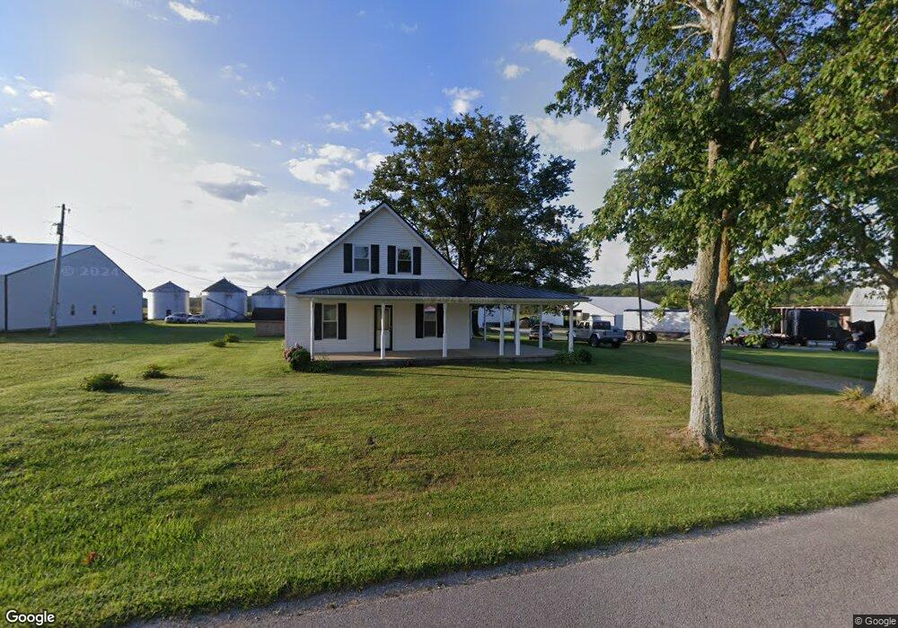
276 Unity Rd West Union, OH 45693
Estimated Value: $414,000 - $559,519
4
Beds
1
Bath
1,930
Sq Ft
$252/Sq Ft
Est. Value
About This Home
This home is located at 276 Unity Rd, West Union, OH 45693 and is currently estimated at $486,760, approximately $252 per square foot. 276 Unity Rd is a home located in Adams County with nearby schools including West Union Elementary School, West Union High School, and Adams County Christian School.
Ownership History
Date
Name
Owned For
Owner Type
Purchase Details
Closed on
Apr 26, 2001
Sold by
Louiso Randy E
Bought by
Louiso Randy E
Current Estimated Value
Purchase Details
Closed on
Jan 1, 1990
Bought by
Louiso Randy E
Create a Home Valuation Report for This Property
The Home Valuation Report is an in-depth analysis detailing your home's value as well as a comparison with similar homes in the area
Purchase History
| Date | Buyer | Sale Price | Title Company |
|---|---|---|---|
| Louiso Randy E | -- | -- | |
| Louiso Randy E | -- | -- |
Source: Public Records
Tax History
| Year | Tax Paid | Tax Assessment Tax Assessment Total Assessment is a certain percentage of the fair market value that is determined by local assessors to be the total taxable value of land and additions on the property. | Land | Improvement |
|---|---|---|---|---|
| 2025 | $2,682 | $145,250 | $88,690 | $56,560 |
| 2024 | $1,341 | $145,250 | $88,690 | $56,560 |
| 2023 | $1,350 | $145,250 | $88,690 | $56,560 |
| 2022 | $2,680 | $132,480 | $69,930 | $62,550 |
| 2021 | $3,029 | $132,480 | $69,930 | $62,550 |
| 2020 | $3,098 | $132,480 | $69,930 | $62,550 |
| 2019 | $3,099 | $132,480 | $69,930 | $62,550 |
| 2018 | $3,040 | $115,190 | $60,800 | $54,390 |
| 2017 | $2,990 | $115,190 | $60,800 | $54,390 |
| 2016 | $2,985 | $115,190 | $60,800 | $54,390 |
| 2015 | $2,688 | $104,440 | $54,670 | $49,770 |
| 2014 | $2,029 | $85,580 | $54,670 | $30,910 |
Source: Public Records
Map
Nearby Homes
- 435 Rolling Woods Dr
- 3287 Chapparal Rd
- 3315 Chapparal Rd
- 166 Rigdon Rd
- 4400 Chapparal Rd
- 1148 Robinette Rd
- 917 Logans Ln
- 831 Tom Brown Rd
- 292 Larry Baynum Rd
- 247 Madonna Dr
- 80 Madonna Dr
- 175 Paula Dr
- 215 Chesley St
- 70 Logans Ln
- 1478 Robinson Hollow Rd
- 315 E North St
- 5768 Ohio 125
- 0.8ac State Route 41
- 12196 State Route 41
- 9727 Ohio 125
- 476 Unity Rd
- 10170 Ohio 247
- 0 Unity Rd
- 0 Unity Rd Unit 1830780
- 0 Unity Rd Unit 689282
- 0 Unity Rd Unit 686918
- 0 Unity Rd Unit 686908
- 10166 State Route 247
- 10166 State Route 247
- 10373 State Route 247
- 10320 State Route 247
- 10550 State Route 247
- 650 Unity Rd
- 10173 State Route 247
- 10166 Sr 247
- 10825 State Route 247
- 736 Unity Rd
- 760 Unity Rd
- 1170 Unity Rd
- 1170 Unity Rd
Your Personal Tour Guide
Ask me questions while you tour the home.