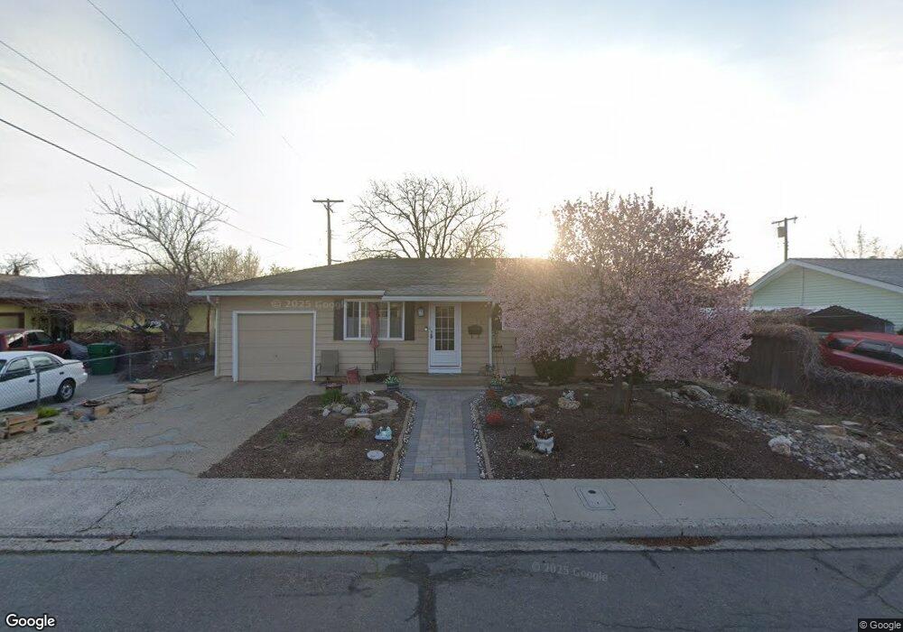
2760 Lennox Ln Sparks, NV 89431
McCarran Boulevard-Probasco NeighborhoodEstimated Value: $419,953 - $447,000
3
Beds
2
Baths
1,296
Sq Ft
$333/Sq Ft
Est. Value
About This Home
This home is located at 2760 Lennox Ln, Sparks, NV 89431 and is currently estimated at $431,738, approximately $333 per square foot. 2760 Lennox Ln is a home located in Washoe County with nearby schools including Florence Drake Elementary School, George L Dilworth Middle School, and Sparks High School.
Ownership History
Date
Name
Owned For
Owner Type
Purchase Details
Closed on
Oct 23, 1995
Sold by
Skaug Barbara J and Ryan Patrice A
Bought by
More Patricia
Current Estimated Value
Home Financials for this Owner
Home Financials are based on the most recent Mortgage that was taken out on this home.
Original Mortgage
$100,767
Outstanding Balance
$706
Interest Rate
7.59%
Mortgage Type
FHA
Estimated Equity
$431,032
Create a Home Valuation Report for This Property
The Home Valuation Report is an in-depth analysis detailing your home's value as well as a comparison with similar homes in the area
Home Values in the Area
Average Home Value in this Area
Purchase History
| Date | Buyer | Sale Price | Title Company |
|---|---|---|---|
| More Patricia | $101,500 | First Centennial Title Co |
Source: Public Records
Mortgage History
| Date | Status | Borrower | Loan Amount |
|---|---|---|---|
| Open | More Patricia | $100,767 |
Source: Public Records
Tax History Compared to Growth
Tax History
| Year | Tax Paid | Tax Assessment Tax Assessment Total Assessment is a certain percentage of the fair market value that is determined by local assessors to be the total taxable value of land and additions on the property. | Land | Improvement |
|---|---|---|---|---|
| 2025 | $747 | $51,908 | $33,565 | $18,344 |
| 2024 | $714 | $48,128 | $30,065 | $18,063 |
| 2023 | $714 | $47,705 | $31,325 | $16,380 |
| 2022 | $695 | $39,564 | $26,180 | $13,384 |
| 2021 | $656 | $30,491 | $17,955 | $12,536 |
| 2020 | $597 | $28,234 | $16,940 | $11,294 |
| 2019 | $580 | $26,747 | $15,890 | $10,857 |
| 2018 | $564 | $22,136 | $11,725 | $10,411 |
| 2017 | $546 | $20,649 | $10,395 | $10,254 |
| 2016 | $534 | $19,570 | $9,345 | $10,225 |
| 2015 | $533 | $17,857 | $7,700 | $10,157 |
| 2014 | $518 | $16,071 | $6,440 | $9,631 |
| 2013 | -- | $13,728 | $4,270 | $9,458 |
Source: Public Records
Map
Nearby Homes
- 10 Sheridan Way
- 120 E Lenwood Dr
- 119 Devere Way
- 3071 Meadowlands Dr
- 3245 Elaine Way
- 3104 Sandy St
- 465 Lenwood Dr
- 8 E O St
- 745 Glen Vista Dr
- 3167 Bristle Branch Dr
- 1703 1st St
- 1940 4th St Unit 20
- 1940 4th St Unit 51
- 3188 Bristle Branch Dr
- 3198 Bristle Branch Dr
- 3200 Bristle Branch Dr
- 1945 4th St Unit 32
- 1945 4th St Unit 33
- 3595 Rocky Ridge Ct
- 780 Emerson Way
- 2730 Lennox Ln
- 2790 Lennox Ln
- 2759 Probasco Way
- 2789 Probasco Way
- 2700 Lennox Ln
- 2729 Probasco Way
- 30 Amberley Way
- 2701 Probasco Way Unit 1A
- 35 E Devere Way
- 2670 Lennox Ln
- 50 E Devere Way
- 20 Amberley Way
- 39 Amberley Way
- 2669 Probasco Way
- 40 E Devere Way
- 60 E Devere Way
- 2630 Lennox Ln
- 36 E Devere Way
- 2790 Probasco Way
- 2760 Probasco Way