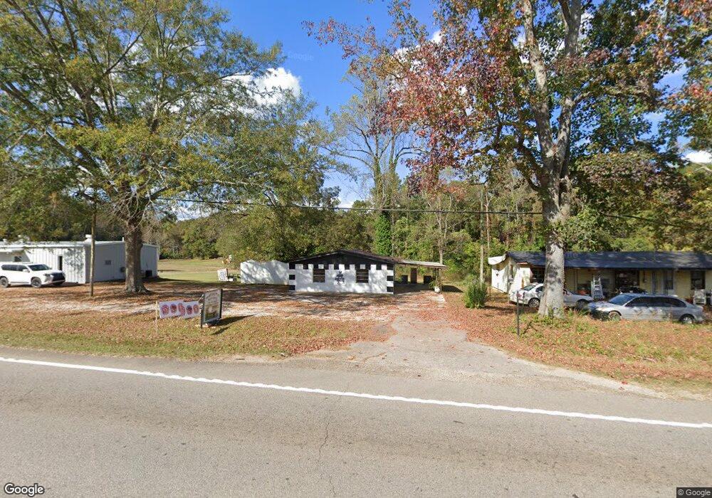
2760 West Point Rd Lagrange, GA 30240
Estimated Value: $166,670
Studio
2
Baths
1,530
Sq Ft
$109/Sq Ft
Est. Value
About This Home
This home is located at 2760 West Point Rd, Lagrange, GA 30240 and is currently estimated at $166,670, approximately $108 per square foot. 2760 West Point Rd is a home located in Troup County with nearby schools including Berta Weathersbee Elementary School, Long Cane Elementary School, and Whitesville Road Elementary School.
Ownership History
Date
Name
Owned For
Owner Type
Purchase Details
Closed on
Apr 9, 2021
Sold by
Hansen Lisa Renee
Bought by
Abel Edward E and Abel Connie D
Current Estimated Value
Home Financials for this Owner
Home Financials are based on the most recent Mortgage that was taken out on this home.
Original Mortgage
$98,215
Outstanding Balance
$71,816
Interest Rate
3.05%
Mortgage Type
Commercial
Estimated Equity
$94,854
Purchase Details
Closed on
Jan 20, 1994
Sold by
Walt Sims
Bought by
Walter T Sims
Purchase Details
Closed on
Aug 11, 1978
Sold by
Birdsell Corless and Birdsell Helen C
Bought by
Walt Sims
Purchase Details
Closed on
Aug 1, 1970
Sold by
Raymond Wadell
Bought by
Birdsell Corless and Birdsell Helen C
Purchase Details
Closed on
Aug 17, 1966
Sold by
Linward Hill
Bought by
Raymond Wadell
Create a Home Valuation Report for This Property
The Home Valuation Report is an in-depth analysis detailing your home's value as well as a comparison with similar homes in the area
Purchase History
| Date | Buyer | Sale Price | Title Company |
|---|---|---|---|
| Abel Edward E | $118,000 | -- | |
| Walter T Sims | -- | -- | |
| Walt Sims | -- | -- | |
| Birdsell Corless | $8,000 | -- | |
| Raymond Wadell | -- | -- |
Source: Public Records
Mortgage History
| Date | Status | Borrower | Loan Amount |
|---|---|---|---|
| Open | Abel Edward E | $98,215 |
Source: Public Records
Tax History
| Year | Tax Paid | Tax Assessment Tax Assessment Total Assessment is a certain percentage of the fair market value that is determined by local assessors to be the total taxable value of land and additions on the property. | Land | Improvement |
|---|---|---|---|---|
| 2025 | $1,379 | $50,560 | $14,000 | $36,560 |
| 2024 | $1,379 | $50,560 | $14,000 | $36,560 |
| 2023 | $1,372 | $50,320 | $14,000 | $36,320 |
| 2022 | $1,317 | $50,320 | $14,000 | $36,320 |
| 2021 | $933 | $30,920 | $14,000 | $16,920 |
| 2020 | $933 | $30,920 | $14,000 | $16,920 |
| 2019 | $901 | $29,880 | $7,680 | $22,200 |
| 2018 | $901 | $29,880 | $7,680 | $22,200 |
| 2017 | $901 | $29,880 | $7,680 | $22,200 |
| 2016 | $960 | $31,815 | $7,680 | $24,135 |
| 2015 | $961 | $31,815 | $7,680 | $24,135 |
| 2014 | $963 | $31,815 | $7,680 | $24,135 |
| 2013 | -- | $31,815 | $7,680 | $24,135 |
Source: Public Records
Map
Nearby Homes
- 0 Bradfield Dr Unit 10568803
- 8 Horace Carter Rd
- 808 S Fling Rd
- 427 Fling Rd
- 509 Connie Dr
- 0 Glass Bridge Rd Unit 10679358
- 275 Hanson Dr
- 0 Hanson Dr Unit 10641272
- 22 Freeman Rd
- 103 Hawthorne Cir
- 124 Foxdale Dr
- 3 Reed Dr
- 105 Redwood Dr
- 266 Glass Bridge Rd
- 0 Unit 10514554
- 229 W Lakeview Dr
- 336 Whitaker Rd
- 104 Bridlewood Dr
- 223 Pinehaven Dr
- 640 Hudson Rd
- 2714 W Point Rd
- 2785 West Point Rd
- 2800 West Point Rd
- 24 Oakridge Dr
- 2726 W Point Rd
- 87 Horace Carter Rd
- 17 Oakridge Dr
- 2809 West Point Rd
- 2726 West Point Rd
- 25 Oakridge Dr
- 75 Horace Carter Rd
- 44 Oakridge Dr
- 2725 West Point Rd
- 2829 W Point Rd
- 56 Oakridge Dr
- 2700 W Point Rd
- 2700 West Point Rd
- 2842 W Point Rd
- 567 Fling Rd Unit B
- 567 Fling Rd
Your Personal Tour Guide
Ask me questions while you tour the home.