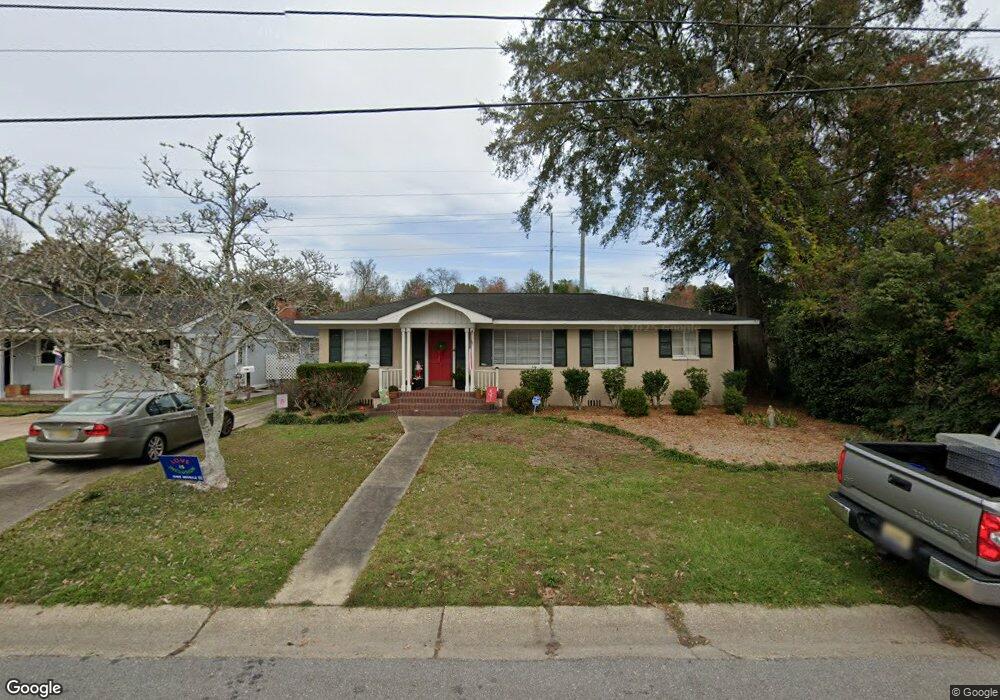
2762 N Barksdale Dr Mobile, AL 36606
Brookwood NeighborhoodEstimated Value: $212,000 - $246,000
3
Beds
2
Baths
1,954
Sq Ft
$116/Sq Ft
Est. Value
About This Home
This home is located at 2762 N Barksdale Dr, Mobile, AL 36606 and is currently estimated at $226,794, approximately $116 per square foot. 2762 N Barksdale Dr is a home located in Mobile County with nearby schools including Morningside Elementary School, Williamson High School, and St. Pius Catholic School.
Ownership History
Date
Name
Owned For
Owner Type
Purchase Details
Closed on
Dec 19, 2007
Sold by
Jrm Investments Llc
Bought by
Inge Richard D and Inge Ann W
Current Estimated Value
Purchase Details
Closed on
Mar 15, 2004
Sold by
Inge Richard D and Inge Ann W
Bought by
Curry Marie B
Home Financials for this Owner
Home Financials are based on the most recent Mortgage that was taken out on this home.
Original Mortgage
$133,000
Outstanding Balance
$62,376
Interest Rate
5.72%
Mortgage Type
Unknown
Estimated Equity
$164,418
Purchase Details
Closed on
Jun 30, 2000
Sold by
Gleason Geil Geil Roger Joseph
Bought by
Bork Jon Patrick
Home Financials for this Owner
Home Financials are based on the most recent Mortgage that was taken out on this home.
Original Mortgage
$109,000
Interest Rate
8.63%
Create a Home Valuation Report for This Property
The Home Valuation Report is an in-depth analysis detailing your home's value as well as a comparison with similar homes in the area
Home Values in the Area
Average Home Value in this Area
Purchase History
| Date | Buyer | Sale Price | Title Company |
|---|---|---|---|
| Inge Richard D | $325,000 | None Available | |
| Curry Marie B | -- | -- | |
| Bork Jon Patrick | -- | -- |
Source: Public Records
Mortgage History
| Date | Status | Borrower | Loan Amount |
|---|---|---|---|
| Open | Curry Marie B | $133,000 | |
| Previous Owner | Bork Jon Patrick | $109,000 |
Source: Public Records
Tax History Compared to Growth
Tax History
| Year | Tax Paid | Tax Assessment Tax Assessment Total Assessment is a certain percentage of the fair market value that is determined by local assessors to be the total taxable value of land and additions on the property. | Land | Improvement |
|---|---|---|---|---|
| 2024 | $1,053 | $17,640 | $2,800 | $14,840 |
| 2023 | $1,063 | $15,890 | $2,800 | $13,090 |
| 2022 | $905 | $15,290 | $2,800 | $12,490 |
| 2021 | $905 | $15,290 | $2,800 | $12,490 |
| 2020 | $905 | $15,290 | $2,800 | $12,490 |
| 2019 | $912 | $15,420 | $0 | $0 |
| 2018 | $908 | $15,360 | $0 | $0 |
| 2017 | $908 | $15,360 | $0 | $0 |
| 2016 | $774 | $13,240 | $0 | $0 |
| 2013 | $967 | $15,940 | $0 | $0 |
Source: Public Records
Map
Nearby Homes
- 2758 Brookwood Dr
- 509 W Barksdale Dr
- 2755 Kreitner St
- 421 Pennington Cir
- 2762 Marcelus Dr
- 919 Grant Park Dr
- 892 Grant Park Dr
- 361 Coventry Way
- 2901 Grant St Unit 903
- 2901 Grant St Unit 304
- 2901 Grant St Unit 601
- 255 Berkley Ct
- 254 Berkley Ct
- 324 Hadrian St
- 420 S Sage Ave Unit 1
- 2553 S Durham Dr
- 1833 Woodcock Place
- 1841 Woodcock Place
- 1837 Woodcock Place
- 1829 Woodcock Place
- 2764 N Barksdale Dr
- 2760 N Barksdale Dr
- 2766 N Barksdale Dr
- 2763 N Barksdale Dr
- 2763 N Barksdale Dr
- 2759 N Barksdale Dr
- 2756 N Barksdale Dr
- 2765 N Barksdale Dr
- 2768 N Barksdale Dr
- 2757 N Barksdale Dr
- 2767 N Barksdale Dr
- 2754 N Barksdale Dr
- 2762 Brookwood Dr
- 2760 Brookwood Dr
- 2755 N Barksdale Dr
- 2770 N Barksdale Dr
- 2764 Brookwood Dr
- 2756 Brookwood Dr
- 2752 N Barksdale Dr
- 2768 Brookwood Dr