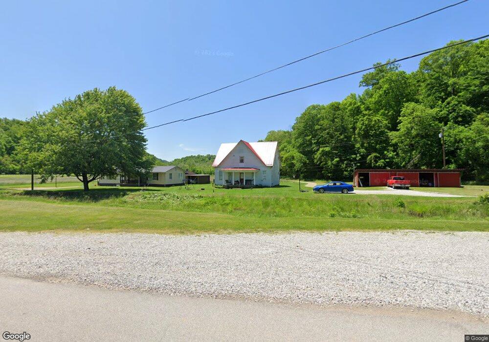
2762 Paden Fork Rd New Martinsville, WV 26155
Estimated Value: $96,000 - $159,000
3
Beds
1
Bath
1,800
Sq Ft
$74/Sq Ft
Est. Value
About This Home
This home is located at 2762 Paden Fork Rd, New Martinsville, WV 26155 and is currently estimated at $133,402, approximately $74 per square foot. 2762 Paden Fork Rd is a home located in Wetzel County with nearby schools including New Martinsville School and Magnolia High School.
Ownership History
Date
Name
Owned For
Owner Type
Purchase Details
Closed on
Aug 6, 2025
Sold by
Workman Sherry Sue
Bought by
Antero Minerals Llc
Current Estimated Value
Purchase Details
Closed on
Jul 29, 2025
Sold by
Gardner Pamela Lynn
Bought by
Antero Minerals Llc
Purchase Details
Closed on
Oct 27, 2011
Sold by
Batson Deloris June and Davis Carolyn Jean
Bought by
Moore Charles M and Moore Ashley L
Purchase Details
Closed on
Dec 30, 2009
Sold by
Cotter Marilyn Kay
Bought by
Virden Ronald Lee and Virden Charles E
Create a Home Valuation Report for This Property
The Home Valuation Report is an in-depth analysis detailing your home's value as well as a comparison with similar homes in the area
Home Values in the Area
Average Home Value in this Area
Purchase History
| Date | Buyer | Sale Price | Title Company |
|---|---|---|---|
| Antero Minerals Llc | $3,788 | None Listed On Document | |
| Antero Minerals Llc | $3,788 | None Listed On Document | |
| Antero Minerals Llc | $3,788 | None Listed On Document | |
| Antero Minerals Llc | $3,788 | None Listed On Document | |
| Moore Charles M | $57,000 | -- | |
| Virden Ronald Lee | -- | -- |
Source: Public Records
Tax History Compared to Growth
Tax History
| Year | Tax Paid | Tax Assessment Tax Assessment Total Assessment is a certain percentage of the fair market value that is determined by local assessors to be the total taxable value of land and additions on the property. | Land | Improvement |
|---|---|---|---|---|
| 2024 | $545 | $49,200 | $7,200 | $42,000 |
| 2023 | $552 | $48,300 | $6,720 | $41,580 |
| 2022 | $512 | $44,460 | $6,420 | $38,040 |
| 2021 | $499 | $43,320 | $6,360 | $36,960 |
| 2020 | $479 | $41,640 | $6,360 | $35,280 |
| 2019 | $462 | $40,200 | $5,880 | $34,320 |
| 2018 | $449 | $39,000 | $5,580 | $33,420 |
| 2017 | $426 | $37,020 | $5,460 | $31,560 |
| 2016 | $412 | $36,060 | $5,040 | $31,020 |
| 2015 | $376 | $32,940 | $4,560 | $28,380 |
| 2014 | $350 | $30,180 | $4,200 | $25,980 |
Source: Public Records
Map
Nearby Homes
- 290 Pleasants Valley Rd
- 1762 Buck Run Rd
- 914 Meadow Heights
- 713 N 8th Ave
- 2297 Buck Run Rd
- 604 N 7th Ave
- 617 N 7th Ave
- 0 Above Rt 2 at Forbes & Energy Hwy Unit 138670
- 731 N 4th Ave
- 126 N 7th Ave
- 123 Boston St
- 37020 Monroe St
- 321 N 1st Ave
- 130 N 1st Ave
- 104 E Pollock St
- 37370 5th Ave
- 111 E Adams St
- 109 S 1st Ave
- 37311 Willow St
- 2 lots Main St
- 2762 Paden Fork Rd
- 2800 Paden Fork Rd
- 2754 Paden Fork Rd
- 2645 Paden Fork Rd
- 4100 Veterans Hwy
- 201 Spruce Ln
- 185 Spruce Ln
- 3893 Veterans Hwy
- 200 Spruce Ln
- 175 Spruce Ln
- 163 Spruce Ln
- 170 Spruce Ln
- 146 Spruce Ln
- 146 Spruce Ln
- 135 Spruce Ln
- 104 Spruce Ln
- 2160 Paden Fork Rd
- 106 Spruce Ln
- 74 Spruce Ln
- 2093 Paden Fork Rd