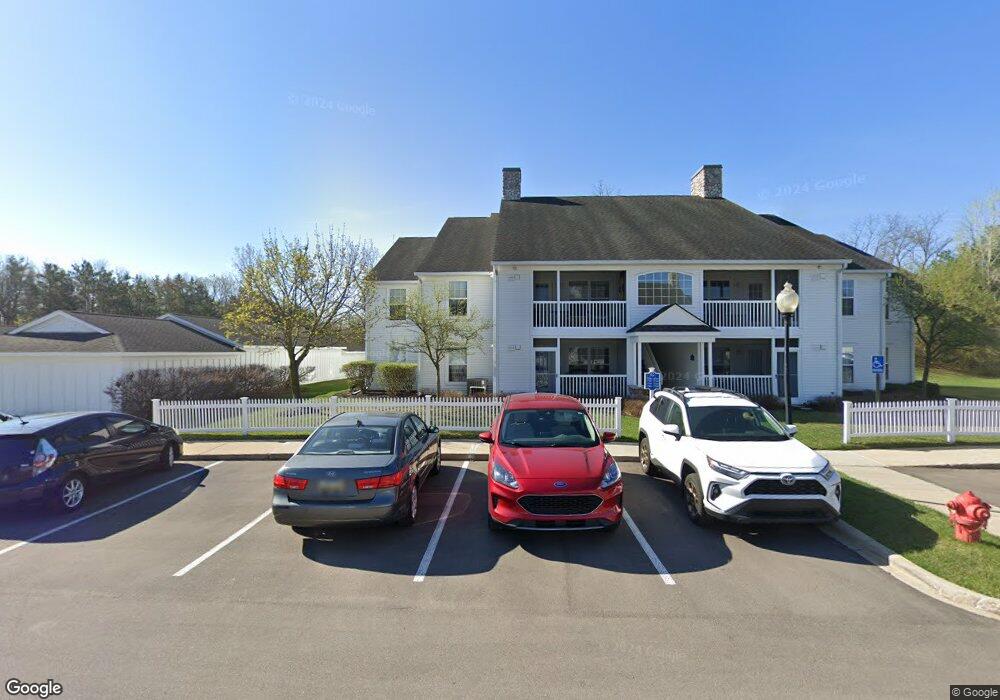
2762 S Knightsbridge Cir Unit 77 Ann Arbor, MI 48105
Northern Ann Arbor NeighborhoodEstimated Value: $292,000 - $322,000
2
Beds
2
Baths
1,100
Sq Ft
$281/Sq Ft
Est. Value
About This Home
This home is located at 2762 S Knightsbridge Cir Unit 77, Ann Arbor, MI 48105 and is currently estimated at $308,854, approximately $280 per square foot. 2762 S Knightsbridge Cir Unit 77 is a home located in Washtenaw County with nearby schools including Ann Arbor STEAM at Northside, Clague Middle School, and Skyline High School.
Ownership History
Date
Name
Owned For
Owner Type
Purchase Details
Closed on
Oct 1, 2015
Sold by
Sriram Hari and Sriram Venkat
Bought by
Sriram Venkatachalam and Sriram Uma
Current Estimated Value
Purchase Details
Closed on
Jun 21, 2011
Sold by
Noll Nancy
Bought by
Siriram Hari and Sriram Uma
Purchase Details
Closed on
Sep 16, 2003
Sold by
Ndc Of Northside Commons Ltd
Bought by
Noll Nancy
Create a Home Valuation Report for This Property
The Home Valuation Report is an in-depth analysis detailing your home's value as well as a comparison with similar homes in the area
Home Values in the Area
Average Home Value in this Area
Purchase History
| Date | Buyer | Sale Price | Title Company |
|---|---|---|---|
| Sriram Venkatachalam | -- | None Available | |
| Siriram Hari | $134,000 | Liberty Title | |
| Noll Nancy | $164,375 | Liberty Title Agency |
Source: Public Records
Tax History Compared to Growth
Tax History
| Year | Tax Paid | Tax Assessment Tax Assessment Total Assessment is a certain percentage of the fair market value that is determined by local assessors to be the total taxable value of land and additions on the property. | Land | Improvement |
|---|---|---|---|---|
| 2025 | $5,641 | $123,000 | $0 | $0 |
| 2024 | $5,486 | $111,000 | $0 | $0 |
| 2023 | $5,066 | $107,500 | $0 | $0 |
| 2022 | $6,131 | $117,900 | $0 | $0 |
| 2021 | $5,958 | $118,300 | $0 | $0 |
| 2020 | $5,771 | $110,600 | $0 | $0 |
| 2019 | $5,504 | $106,000 | $106,000 | $0 |
| 2018 | $5,400 | $95,700 | $0 | $0 |
| 2017 | $5,210 | $94,800 | $0 | $0 |
| 2016 | $5,076 | $82,045 | $0 | $0 |
| 2015 | $3,639 | $78,958 | $0 | $0 |
| 2014 | $3,639 | $76,492 | $0 | $0 |
| 2013 | -- | $76,492 | $0 | $0 |
Source: Public Records
Map
Nearby Homes
- 2768 S Knightsbridge Cir
- 2678 S Knightsbridge Cir Unit 24
- 2768 Bristol Ridge Dr Unit 33
- 2776 Bristol Ridge Dr Unit 37
- 2772 Bristol Ridge Dr Unit 35
- 2774 Bristol Ridge Dr Unit 36
- 2778 Bristol Ridge Dr Unit 38
- 2994 Montana Way
- 2757 Polson St
- 2865 Dillon Dr
- 3500 Pontiac Trail
- Morenci Plan at Barton Ridge
- Brant Plan at Barton Ridge
- Haslett Plan at Barton Ridge
- Alma Plan at Barton Ridge
- Decker Plan at Barton Ridge
- 3415 Maple Ridge Dr
- 822 Starwick Dr
- 244 Barton Shore Dr
- 3440 Maple Ridge Dr
- 2754 S Knightsbridge Cir Unit 73
- 2758 S Knightsbridge Cir Unit 75
- 2766 S Knightsbridge Cir Cir
- 2764 S Knightsbridge Cir Unit 78
- 2756 S Knightsbridge Cir Unit 74
- 2766 S Knightsbridge Cir Unit 79
- 2768 S Knightsbridge Cir Unit 80
- 2760 S Knightsbridge Cir
- 2782 S Knightsbridge Cir Unit 86
- 2774 S Knightsbridge Cir Unit 82
- 2772 S Knightsbridge Cir Unit 81
- 2778 S Knightsbridge Cir
- 2786 S Knightsbridge Cir Unit 88
- 2776 S Knightsbridge Cir Unit 83
- 2780 S Knightsbridge Cir Unit 85
- 2784 S Knightsbridge Cir Unit 87
- 2795 S Knightsbridge Cir Unit 66
- 2793 S Knightsbridge Cir Unit 65
- 2777 S Knightsbridge Cir Unit 70
- 2787 S Knightsbridge Cir Unit 58