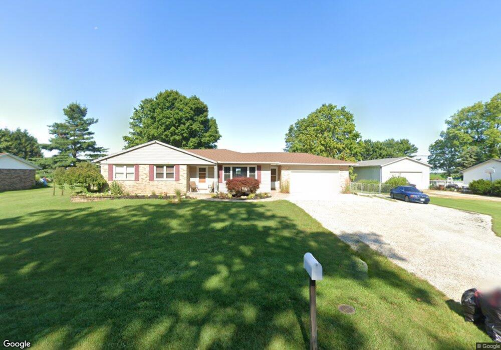
2763 Spence Rd New Carlisle, OH 45344
Estimated Value: $251,495 - $332,000
3
Beds
2
Baths
1,531
Sq Ft
$194/Sq Ft
Est. Value
About This Home
This home is located at 2763 Spence Rd, New Carlisle, OH 45344 and is currently estimated at $297,374, approximately $194 per square foot. 2763 Spence Rd is a home located in Clark County with nearby schools including Northwestern Elementary School and Northwestern Junior/Senior High School.
Ownership History
Date
Name
Owned For
Owner Type
Purchase Details
Closed on
May 19, 2021
Sold by
Griffith Michelle L and Griffith Brad L
Bought by
Griffith Brad L
Current Estimated Value
Purchase Details
Closed on
Nov 3, 2009
Sold by
Rodman James H and Rodman Carol
Bought by
Griffith Brad L and Griffith Michelle L
Home Financials for this Owner
Home Financials are based on the most recent Mortgage that was taken out on this home.
Original Mortgage
$120,000
Interest Rate
5.11%
Mortgage Type
New Conventional
Purchase Details
Closed on
Mar 31, 1992
Create a Home Valuation Report for This Property
The Home Valuation Report is an in-depth analysis detailing your home's value as well as a comparison with similar homes in the area
Home Values in the Area
Average Home Value in this Area
Purchase History
| Date | Buyer | Sale Price | Title Company |
|---|---|---|---|
| Griffith Brad L | -- | None Available | |
| Griffith Brad L | $150,000 | Team Title & Closing Service | |
| -- | $83,000 | -- |
Source: Public Records
Mortgage History
| Date | Status | Borrower | Loan Amount |
|---|---|---|---|
| Closed | Griffith Brad L | $120,000 |
Source: Public Records
Tax History Compared to Growth
Tax History
| Year | Tax Paid | Tax Assessment Tax Assessment Total Assessment is a certain percentage of the fair market value that is determined by local assessors to be the total taxable value of land and additions on the property. | Land | Improvement |
|---|---|---|---|---|
| 2024 | $2,910 | $62,200 | $11,840 | $50,360 |
| 2023 | $2,910 | $62,200 | $11,840 | $50,360 |
| 2022 | $2,988 | $62,200 | $11,840 | $50,360 |
| 2021 | $2,466 | $45,400 | $8,640 | $36,760 |
| 2020 | $2,444 | $45,400 | $8,640 | $36,760 |
| 2019 | $2,467 | $45,400 | $8,640 | $36,760 |
| 2018 | $2,483 | $45,410 | $7,850 | $37,560 |
| 2017 | $2,484 | $45,409 | $7,854 | $37,555 |
| 2016 | $2,435 | $45,409 | $7,854 | $37,555 |
| 2015 | $2,252 | $42,889 | $7,854 | $35,035 |
| 2014 | $2,251 | $42,889 | $7,854 | $35,035 |
| 2013 | $2,236 | $42,889 | $7,854 | $35,035 |
Source: Public Records
Map
Nearby Homes
- 7585 Wrenview Dr
- 7475 Detrick Jordan Pike
- 3390 Spence Rd
- 2430 Myers Rd
- 3771 Spence Rd
- 286 Hampton Trail
- 268 Hampton Trail
- 00 Folk Ream Rd
- 1 Folk Ream Rd
- 3172 Folk Ream Rd
- 81 W Clark St
- 6580 Shaler Dr
- 1559 Folk Ream Rd
- 1650 Cranbrook Dr
- 3961 Shrine Rd
- 6258 Zachary Ave
- 3410 Michael Dr
- 3430 Michael Dr
- 5889 Troy Rd
- 3000-3002 Shrine Rd
- 2775 Spence Rd
- 2751 Spence Rd
- 2780 Spence Rd
- 2721 Spence Rd
- 2738 Spence Rd
- 2806 Spence Rd
- 2701 Spence Rd
- 2692 Spence Rd
- 2683 Spence Rd
- 2836 Spence Rd
- 2669 Spence Rd
- 2874 Spence Rd
- 2662 Spence Rd
- 2651 Spence Rd
- 2648 Spence Rd
- 2911 Spence Rd
- 2888 Spence Rd
- 2932 Spence Rd
- 2615 Spence Rd
- 8222 Detrick Jordan Pike