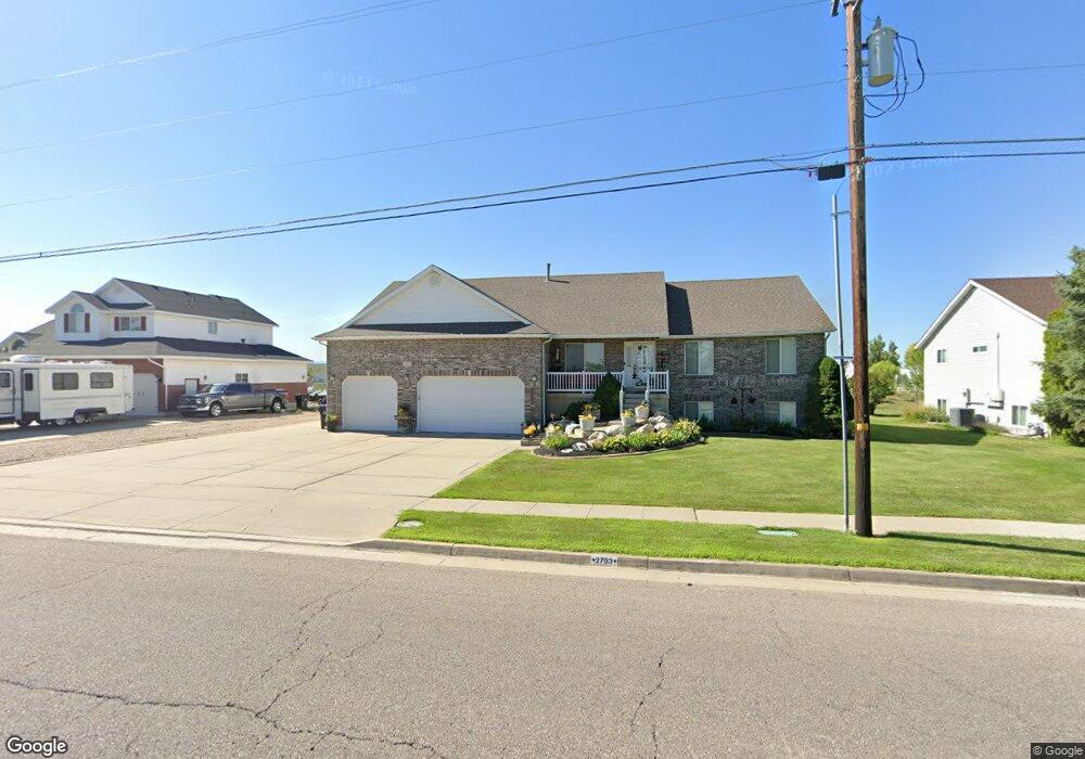
2763 W 2700 S Syracuse, UT 84075
Estimated Value: $582,000 - $675,426
3
Beds
3
Baths
1,914
Sq Ft
$332/Sq Ft
Est. Value
About This Home
This home is located at 2763 W 2700 S, Syracuse, UT 84075 and is currently estimated at $635,357, approximately $331 per square foot. 2763 W 2700 S is a home located in Davis County with nearby schools including Cook School, Legacy Junior High School, and Clearfield High School.
Ownership History
Date
Name
Owned For
Owner Type
Purchase Details
Closed on
Apr 19, 2017
Sold by
Newbold Janet I
Bought by
Janet Newbold Trust
Current Estimated Value
Purchase Details
Closed on
Dec 22, 1998
Sold by
Sherman Clinton B and Sherman Suzanne L
Bought by
Newbold Norman Earl and Newbold Janet I
Home Financials for this Owner
Home Financials are based on the most recent Mortgage that was taken out on this home.
Original Mortgage
$202,500
Interest Rate
6.91%
Purchase Details
Closed on
Aug 8, 1997
Sold by
Equivest Development Co Lc
Bought by
Sherman Clinton B and Sherman Suzanne L
Create a Home Valuation Report for This Property
The Home Valuation Report is an in-depth analysis detailing your home's value as well as a comparison with similar homes in the area
Home Values in the Area
Average Home Value in this Area
Purchase History
| Date | Buyer | Sale Price | Title Company |
|---|---|---|---|
| Janet Newbold Trust | -- | -- | |
| Newbold Janet Irene | -- | -- | |
| Newbold Norman Earl | -- | Associated Title Company | |
| Sherman Clinton B | -- | Bonneville Title Company Inc |
Source: Public Records
Mortgage History
| Date | Status | Borrower | Loan Amount |
|---|---|---|---|
| Previous Owner | Newbold Norman Earl | $202,500 |
Source: Public Records
Tax History Compared to Growth
Tax History
| Year | Tax Paid | Tax Assessment Tax Assessment Total Assessment is a certain percentage of the fair market value that is determined by local assessors to be the total taxable value of land and additions on the property. | Land | Improvement |
|---|---|---|---|---|
| 2025 | $3,472 | $334,950 | $108,792 | $226,158 |
| 2024 | $3,290 | $319,550 | $106,965 | $212,585 |
| 2023 | $3,198 | $566,000 | $173,565 | $392,435 |
| 2022 | $3,418 | $331,651 | $101,668 | $229,983 |
| 2021 | $2,883 | $433,000 | $146,260 | $286,740 |
| 2020 | $2,558 | $372,000 | $136,369 | $235,631 |
| 2019 | $2,410 | $346,000 | $129,625 | $216,375 |
| 2018 | $2,225 | $317,000 | $120,387 | $196,613 |
| 2016 | $2,170 | $162,195 | $42,870 | $119,325 |
| 2015 | $2,056 | $146,300 | $42,870 | $103,430 |
| 2014 | $1,949 | $141,335 | $42,870 | $98,465 |
| 2013 | -- | $150,127 | $43,457 | $106,670 |
Source: Public Records
Map
Nearby Homes
- 2735 S Shoreline Dr
- 2635 S 2430 W Unit 114
- 2971 S 2425 W Unit 1124
- 2625 S 2430 W Unit 112
- 2686 S 2440 W Unit 101
- 3062 W Solace St
- 2726 2495 S Unit 205
- 3006 S 2725 W
- Bridgeport Plan at Sadie's Glenn
- Sullivan Plan at Sadie's Glenn
- Ashmore Plan at Sadie's Glenn
- Havenwood Plan at Sadie's Glenn
- Bradford Plan at Sadie's Glenn
- Sadie's Glen Plan at Sadie's Glenn
- Hamilton Plan at Sadie's Glenn
- Avery Plan at Sadie's Glenn
- Havenwood with Loft Plan at Sadie's Glenn
- Malan Plan at Sadie's Glenn
- 2996 S 2550 W
- 2983 W North Shore Dr
- 2781 W 2700 S
- 2747 W 2700 S
- 2809 W 2700 S
- 2735 W 2700 S
- 2713 W 2700 S
- 2831 W 2700 S
- 2750 S 2675 W
- 2715 S Shoreline Dr Unit 501
- 2715 S Shoreline Dr
- 2755 S Shoreline Dr
- 2764 S 2675 W
- 2786 S 2675 W
- 2751 S 2675 W
- 2790 W 2850 S
- 2772 W 2850 S
- 2659 W 2700 S
- 2804 S 2675 W
- 2810 W 2850 S
- 2810 W 2850 S Unit 35
- 2752 W 2850 S