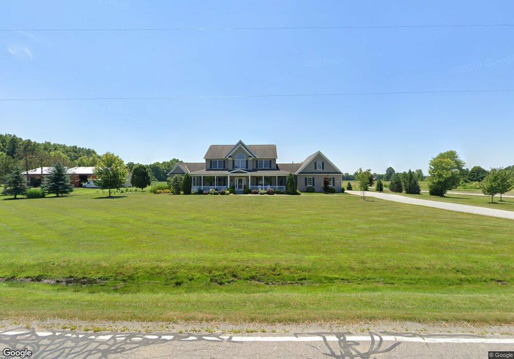
27643 Osborne Rd Columbia Station, OH 44028
Estimated Value: $668,460 - $791,000
4
Beds
4
Baths
4,057
Sq Ft
$179/Sq Ft
Est. Value
About This Home
This home is located at 27643 Osborne Rd, Columbia Station, OH 44028 and is currently estimated at $724,615, approximately $178 per square foot. 27643 Osborne Rd is a home located in Lorain County with nearby schools including Copopa Elementary School, Columbia Middle School, and Columbia High School.
Ownership History
Date
Name
Owned For
Owner Type
Purchase Details
Closed on
Apr 21, 2010
Sold by
Maddock Nancy L
Bought by
Maddock Nancy L and Nancy L Maddock Revocable Living Trust
Current Estimated Value
Purchase Details
Closed on
May 20, 2005
Sold by
Schafer Development Co Inc
Bought by
Skor Mark and Skor Jennifer
Home Financials for this Owner
Home Financials are based on the most recent Mortgage that was taken out on this home.
Original Mortgage
$359,600
Outstanding Balance
$190,021
Interest Rate
6.05%
Mortgage Type
Fannie Mae Freddie Mac
Estimated Equity
$534,594
Purchase Details
Closed on
Jul 28, 2004
Sold by
Skor Mark A and Skor Jennifer L
Bought by
Schafer Development Co Inc
Create a Home Valuation Report for This Property
The Home Valuation Report is an in-depth analysis detailing your home's value as well as a comparison with similar homes in the area
Home Values in the Area
Average Home Value in this Area
Purchase History
| Date | Buyer | Sale Price | Title Company |
|---|---|---|---|
| Maddock Nancy L | -- | Attorney | |
| Skor Mark | -- | Multiple | |
| Schafer Development Co Inc | -- | Lorain County Title Company | |
| Skor Mark A | -- | Lorain County Title Company |
Source: Public Records
Mortgage History
| Date | Status | Borrower | Loan Amount |
|---|---|---|---|
| Open | Skor Mark | $359,600 | |
| Closed | Skor Mark | $20,000 |
Source: Public Records
Tax History Compared to Growth
Tax History
| Year | Tax Paid | Tax Assessment Tax Assessment Total Assessment is a certain percentage of the fair market value that is determined by local assessors to be the total taxable value of land and additions on the property. | Land | Improvement |
|---|---|---|---|---|
| 2024 | $8,600 | $198,618 | $30,069 | $168,550 |
| 2023 | $8,356 | $168,543 | $26,947 | $141,596 |
| 2022 | $8,151 | $168,543 | $26,947 | $141,596 |
| 2021 | $8,233 | $168,543 | $26,947 | $141,596 |
| 2020 | $7,957 | $146,180 | $23,370 | $122,810 |
| 2019 | $7,911 | $146,180 | $23,370 | $122,810 |
| 2018 | $8,096 | $146,180 | $23,370 | $122,810 |
| 2017 | $8,213 | $139,680 | $25,070 | $114,610 |
| 2016 | $8,272 | $139,680 | $25,070 | $114,610 |
| 2015 | $8,276 | $139,680 | $25,070 | $114,610 |
| 2014 | $7,323 | $122,470 | $21,800 | $100,670 |
| 2013 | $7,350 | $122,470 | $21,800 | $100,670 |
Source: Public Records
Map
Nearby Homes
- 33621 Henwell Rd
- 33700 Henwell Rd
- 33743 Henwell Rd
- 33932 Abercorn Place
- 33964 Abercorn Place
- 10990 Reed Rd
- 26271 Royalton Rd
- 26571 Sprague Rd
- 34645 Dye Rd
- 23663 Victory Ln
- 9628 Kingston Trail
- 34691 N Legends Way
- 9954 Ethan Dr
- 27167 Watkin Rd
- 33110 Wren Haven Cir
- 25931 Royalton Rd
- 0 Cowley Rd Unit 5171639
- 9032 Riverwood Dr
- 9129 Riverwood Dr
- 8860 Sharp Rd
- 27609 Osborne Rd
- 27767 Osborne Rd
- 27744 Osborne Rd
- 11678 Root Rd
- 27794 Osborne Rd
- 27831 Osborne Rd
- 11532 Root Rd
- 11768 Root Rd
- 11547 Root Rd
- 11418 Root Rd
- 27851 Osborne Rd
- 27850 Osborne Rd
- 11920 Root Rd
- 27868 Osborne Rd
- 27871 Osborne Rd
- 27440 Osborne Rd
- 11960 Root Rd
- 11857 Root Rd
- 11972 Root Rd
- 27900 Osborne Rd