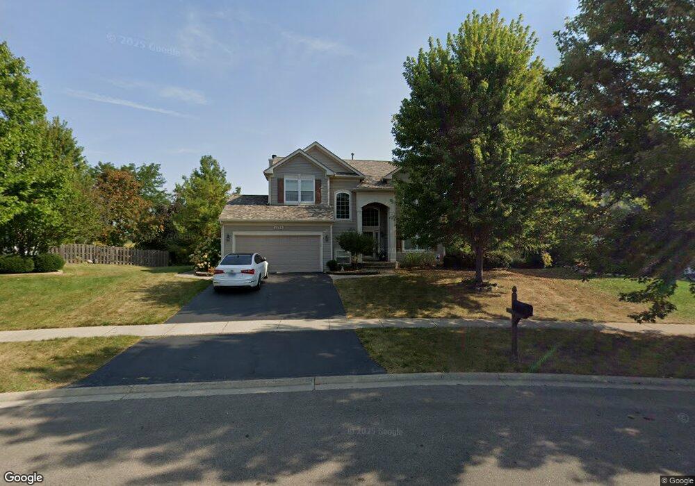
2768 Constitution Dr Lindenhurst, IL 60046
Estimated Value: $445,147 - $489,000
3
Beds
3
Baths
2,528
Sq Ft
$186/Sq Ft
Est. Value
About This Home
This home is located at 2768 Constitution Dr, Lindenhurst, IL 60046 and is currently estimated at $470,287, approximately $186 per square foot. 2768 Constitution Dr is a home located in Lake County with nearby schools including Millburn Elementary School, Millburn Middle School, and Lakes Community High School.
Ownership History
Date
Name
Owned For
Owner Type
Purchase Details
Closed on
May 17, 2012
Sold by
Bies Maureen J and Bies Maureen J
Bought by
Bies Maureen J
Current Estimated Value
Purchase Details
Closed on
Aug 1, 1999
Sold by
The Ryland Group Inc
Bought by
Bies Scott and Bies Maureen J
Home Financials for this Owner
Home Financials are based on the most recent Mortgage that was taken out on this home.
Original Mortgage
$194,000
Interest Rate
7.9%
Mortgage Type
Balloon
Create a Home Valuation Report for This Property
The Home Valuation Report is an in-depth analysis detailing your home's value as well as a comparison with similar homes in the area
Home Values in the Area
Average Home Value in this Area
Purchase History
| Date | Buyer | Sale Price | Title Company |
|---|---|---|---|
| Bies Maureen J | -- | None Available | |
| Bies Scott | $243,000 | -- |
Source: Public Records
Mortgage History
| Date | Status | Borrower | Loan Amount |
|---|---|---|---|
| Previous Owner | Bies Scott | $194,000 |
Source: Public Records
Tax History
| Year | Tax Paid | Tax Assessment Tax Assessment Total Assessment is a certain percentage of the fair market value that is determined by local assessors to be the total taxable value of land and additions on the property. | Land | Improvement |
|---|---|---|---|---|
| 2024 | $11,649 | $126,282 | $22,892 | $103,390 |
| 2023 | $12,915 | $111,576 | $20,226 | $91,350 |
| 2022 | $12,915 | $101,649 | $15,521 | $86,128 |
| 2021 | $12,448 | $94,425 | $14,418 | $80,007 |
| 2020 | $12,006 | $91,400 | $13,956 | $77,444 |
| 2019 | $12,860 | $93,417 | $14,264 | $79,153 |
| 2018 | $11,570 | $90,117 | $17,985 | $72,132 |
| 2017 | $11,227 | $87,713 | $17,505 | $70,208 |
| 2016 | $12,503 | $93,511 | $18,662 | $74,849 |
| 2015 | $11,935 | $87,337 | $17,430 | $69,907 |
| 2014 | $11,727 | $79,576 | $17,511 | $62,065 |
| 2012 | $10,499 | $92,868 | $19,499 | $73,369 |
Source: Public Records
Map
Nearby Homes
- 697 Providence Ln
- 19135 W Millburn Rd
- 2312 High Point Dr
- 533 N Beck Rd Unit 28
- 527 Northgate Rd Unit 28
- 1896 E Vista Terrace
- 20215 W Miller Rd
- 1288 Prairie Ridge Trail
- 1245 Prairie Ridge Trail
- 1249 Prairie Ridge Trail
- 1253 Prairie Ridge Trail
- 1261 Prairie Ridge Trail
- 1903 S Shore Cove
- 2208 Sprucewood Ln
- 1650 Natures Way
- 1772 S Port Dr
- 1768 S Port Dr
- 1764 S Port Dr
- 1834 Tall Oaks Dr
- 1873 White Lake Dr
- 2758 Constitution Dr
- 2778 Constitution Dr
- 2748 Constitution Dr
- 2788 Constitution Dr
- 2779 Constitution Dr
- 2798 Constitution Dr
- 2738 Constitution Dr
- 2728 Constitution Dr
- 2729 Constitution Dr
- 2718 Constitution Dr
- 2799 Constitution Dr
- 2719 Constitution Dr
- 773 Independence Blvd
- 2739 Gettysburg Ct
- 2749 Gettysburg Ct
- 765 Independence Blvd
- 2690 Constitution Dr
- 2729 Gettysburg Ct
- 2691 Constitution Dr
- 2759 Gettysburg Ct
Your Personal Tour Guide
Ask me questions while you tour the home.