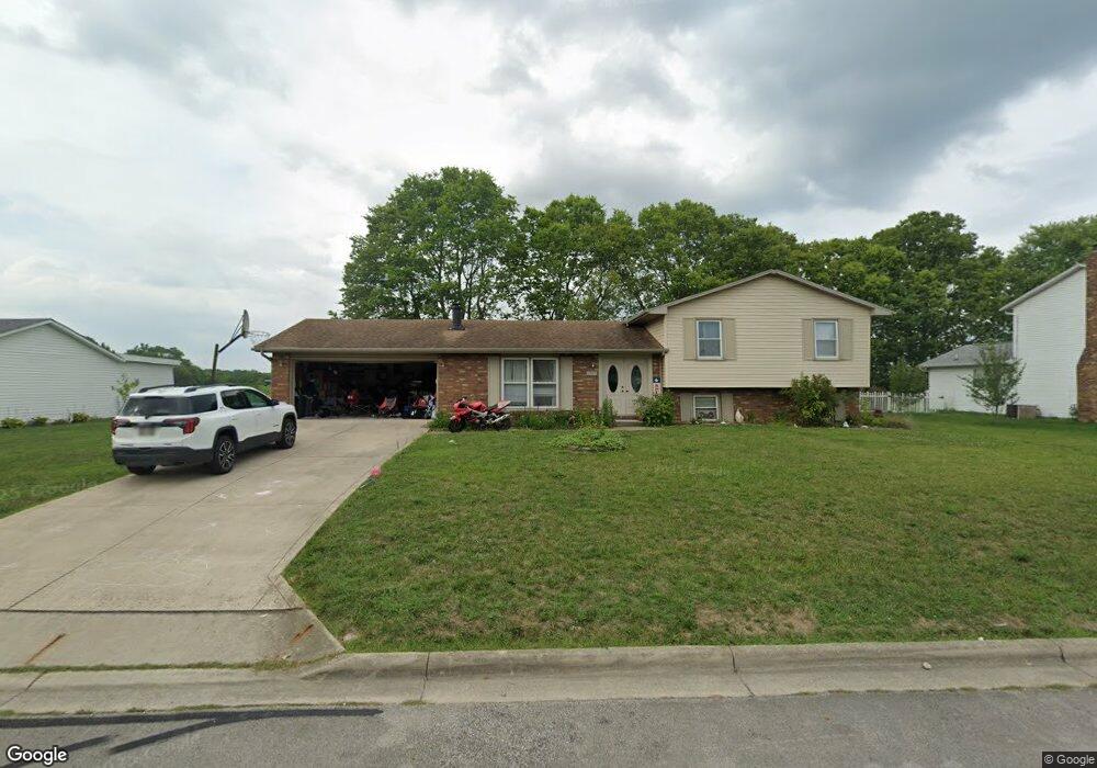
2768 Cornstalk Ave Ashville, OH 43103
Estimated Value: $251,408 - $324,000
3
Beds
2
Baths
1,152
Sq Ft
$240/Sq Ft
Est. Value
About This Home
This home is located at 2768 Cornstalk Ave, Ashville, OH 43103 and is currently estimated at $276,352, approximately $239 per square foot. 2768 Cornstalk Ave is a home located in Pickaway County.
Ownership History
Date
Name
Owned For
Owner Type
Purchase Details
Closed on
Apr 5, 2024
Sold by
Maynard Sherry L
Bought by
Burggraf Brenda L
Current Estimated Value
Purchase Details
Closed on
May 28, 1999
Sold by
Spradling Michael J
Bought by
Maynard Palmer L and Maynard Dolinda R
Home Financials for this Owner
Home Financials are based on the most recent Mortgage that was taken out on this home.
Original Mortgage
$81,000
Interest Rate
6.92%
Mortgage Type
New Conventional
Purchase Details
Closed on
Sep 1, 1995
Sold by
Cotton Kenneth
Bought by
Spadling Michael J and Spadling Amy J
Home Financials for this Owner
Home Financials are based on the most recent Mortgage that was taken out on this home.
Original Mortgage
$103,016
Interest Rate
7.55%
Mortgage Type
FHA
Purchase Details
Closed on
Aug 22, 1994
Sold by
Park Charles N
Bought by
Cotton Kenneth and Cotton Evelyn A
Purchase Details
Closed on
May 5, 1993
Sold by
Howard John J
Bought by
Park Charles N
Purchase Details
Closed on
Aug 1, 1985
Purchase Details
Closed on
Jul 1, 1985
Create a Home Valuation Report for This Property
The Home Valuation Report is an in-depth analysis detailing your home's value as well as a comparison with similar homes in the area
Home Values in the Area
Average Home Value in this Area
Purchase History
| Date | Buyer | Sale Price | Title Company |
|---|---|---|---|
| Burggraf Brenda L | -- | None Listed On Document | |
| Maynard Palmer L | $121,000 | -- | |
| Spadling Michael J | $103,800 | -- | |
| Cotton Kenneth | $92,500 | -- | |
| Park Charles N | $85,000 | -- | |
| -- | $64,700 | -- | |
| -- | $50,000 | -- |
Source: Public Records
Mortgage History
| Date | Status | Borrower | Loan Amount |
|---|---|---|---|
| Previous Owner | Maynard Palmer L | $81,000 | |
| Previous Owner | Spadling Michael J | $103,016 |
Source: Public Records
Tax History Compared to Growth
Tax History
| Year | Tax Paid | Tax Assessment Tax Assessment Total Assessment is a certain percentage of the fair market value that is determined by local assessors to be the total taxable value of land and additions on the property. | Land | Improvement |
|---|---|---|---|---|
| 2024 | -- | $69,290 | $10,540 | $58,750 |
| 2023 | $2,141 | $69,290 | $10,540 | $58,750 |
| 2022 | $1,612 | $50,980 | $8,620 | $42,360 |
| 2021 | $1,614 | $50,980 | $8,620 | $42,360 |
| 2020 | $1,615 | $50,980 | $8,620 | $42,360 |
| 2019 | $1,362 | $41,880 | $8,620 | $33,260 |
| 2018 | $1,307 | $41,880 | $8,620 | $33,260 |
| 2017 | $1,341 | $41,880 | $8,620 | $33,260 |
| 2016 | $1,474 | $45,450 | $8,620 | $36,830 |
| 2015 | $1,438 | $45,450 | $8,620 | $36,830 |
| 2014 | $1,439 | $45,450 | $8,620 | $36,830 |
| 2013 | $1,502 | $45,450 | $8,620 | $36,830 |
Source: Public Records
Map
Nearby Homes
- 16715 Pontiac Place
- 0 Little Walnut Rd
- 3055 Clifford Ave
- 5009 Roese Ave
- 30 Bazler Ln
- 94 Richard Ave
- 5069 Ashville Rd
- 77 Cromley St
- 61 Bortz St
- 170 Jefferson Ave
- 307 Honeysuckle St
- 302 Honeysuckle St
- 234 Dowler Dr
- 5050 S Walnut St
- 5049 Lee Rd
- 18825 Island Rd
- 5441 Morning Glory St Unit Lot 338
- 5439 Morning Glory St Unit Lot 337
- 5445 Morning Glory St Unit Lot 340
- 5435 Morning Glory St Unit Lot 335
- 2740 Cornstalk Ave
- 2780 Cornstalk Ave
- 2751 Cornstalk Ave
- 2771 Cornstalk Ave
- 2724 Cornstalk Ave
- 2800 Cornstalk Ave
- 2791 Cornstalk Ave
- 2820 Cornstalk Ave
- 2700 Cornstalk Ave
- 2815 Cornstalk Ave
- 16725 Hiawatha Ave
- 2840 Cornstalk Ave
- 2665 Cornstalk Ave
- 2686 Cornstalk Ave
- 2835 Cornstalk Ave
- 2860 Cornstalk Ave
- 2855 Cornstalk Ave
- 16705 Nokomis Cir
- 2652 Cornstalk Ave
- 2875 Cornstalk Ave