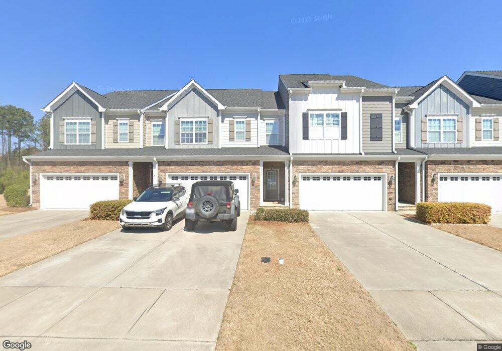
2768 Masonboro Ferry Dr Apex, NC 27502
Friendship NeighborhoodEstimated Value: $516,302 - $550,000
--
Bed
1
Bath
2,681
Sq Ft
$200/Sq Ft
Est. Value
About This Home
This home is located at 2768 Masonboro Ferry Dr, Apex, NC 27502 and is currently estimated at $535,826, approximately $199 per square foot. 2768 Masonboro Ferry Dr is a home with nearby schools including Apex Friendship Elementary, Apex Friendship Middle School, and Apex Friendship High School.
Ownership History
Date
Name
Owned For
Owner Type
Purchase Details
Closed on
Feb 14, 2017
Sold by
Royal Oaks Blvd Groyp Llc
Bought by
Burket Erik
Current Estimated Value
Home Financials for this Owner
Home Financials are based on the most recent Mortgage that was taken out on this home.
Original Mortgage
$299,812
Interest Rate
4.16%
Mortgage Type
New Conventional
Purchase Details
Closed on
Aug 29, 2016
Sold by
Parkside Development Group Llc
Bought by
Royal Oaks Bullding Group Llc
Create a Home Valuation Report for This Property
The Home Valuation Report is an in-depth analysis detailing your home's value as well as a comparison with similar homes in the area
Home Values in the Area
Average Home Value in this Area
Purchase History
| Date | Buyer | Sale Price | Title Company |
|---|---|---|---|
| Burket Erik | $333,500 | None Available | |
| Royal Oaks Bullding Group Llc | $640,000 | None Available |
Source: Public Records
Mortgage History
| Date | Status | Borrower | Loan Amount |
|---|---|---|---|
| Previous Owner | Burket Erik | $299,812 |
Source: Public Records
Tax History Compared to Growth
Tax History
| Year | Tax Paid | Tax Assessment Tax Assessment Total Assessment is a certain percentage of the fair market value that is determined by local assessors to be the total taxable value of land and additions on the property. | Land | Improvement |
|---|---|---|---|---|
| 2025 | $4,225 | $481,615 | $100,000 | $381,615 |
| 2024 | $4,131 | $481,615 | $100,000 | $381,615 |
| 2023 | $4,062 | $368,483 | $72,000 | $296,483 |
| 2022 | $3,814 | $368,483 | $72,000 | $296,483 |
| 2021 | $3,668 | $368,483 | $72,000 | $296,483 |
| 2020 | $3,631 | $368,483 | $72,000 | $296,483 |
| 2019 | $3,489 | $305,450 | $72,000 | $233,450 |
| 2018 | $3,286 | $305,450 | $72,000 | $233,450 |
| 2017 | $1,688 | $169,638 | $72,000 | $97,638 |
Source: Public Records
Map
Nearby Homes
- 2849 Dallas Valley Ln
- 2751 Lake Waccamaw Trail
- 2876 MacIntosh Woods Dr
- 2928 Murray Ridge Trail
- 2809 Carbondale Ct Unit 640
- 2805 Carbondale Ct Unit 638
- 2801 Carbondale Ct Unit 636
- 2712 Hunter Woods Dr Unit 633
- 2710 Hunter Woods Dr Unit 634
- 2708 Hunter Woods Dr Unit 635
- 2716 Hunter Woods Dr Unit 631
- 2726 Hunter Woods Dr Unit 627
- 2728 Hunter Woods Dr Unit 626
- Buckingham - A Plan at Friendship Station
- Buckingham - B Plan at Friendship Station
- Kensington - B Plan at Friendship Station
- Hyde Park - A Plan at Friendship Station
- Buckingham - C Plan at Friendship Station
- 2804 Austin Falls Station
- 2701 Sugar Mountain Way
- 2766 Masonboro Ferry Dr
- 2770 Masonboro Ferry Dr
- 2764 Masonboro Ferry Dr
- 2780 Masonboro Ferry Dr
- 2762 Masonboro Ferry Dr
- 2817 Richardson Rd
- 2801 Singletary Lake Cove
- 2782 Masonboro Ferry Dr
- 2805 Singletary Lake Cove
- 2784 Masonboro Ferry Dr
- 2805 Richardson Rd Unit A
- 2790 Masonboro Ferry Dr
- 2736 Masonboro Ferry Dr
- 2809 Singletary Lake Cove
- 2792 Masonboro Ferry Dr
- 2783 Masonboro Ferry Dr
- 2794 Masonboro Ferry Dr
- 2785 Masonboro Ferry Dr
- 2787 Masonboro Ferry Dr
- 2734 Masonboro Ferry Dr