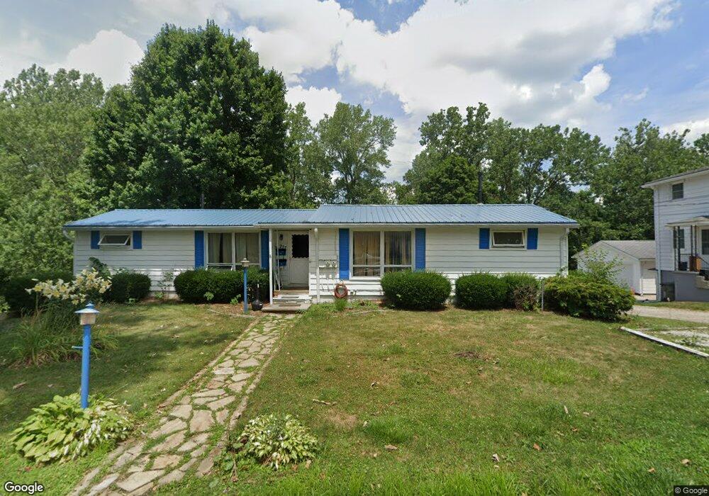
277 Devinney Ave Louisville, OH 44641
Estimated Value: $150,000 - $193,000
3
Beds
2
Baths
1,360
Sq Ft
$126/Sq Ft
Est. Value
About This Home
This home is located at 277 Devinney Ave, Louisville, OH 44641 and is currently estimated at $171,077, approximately $125 per square foot. 277 Devinney Ave is a home located in Stark County with nearby schools including Louisville High School and St. Thomas Aquinas High School & Middle School.
Ownership History
Date
Name
Owned For
Owner Type
Purchase Details
Closed on
Dec 2, 2011
Sold by
Fearn Athena
Bought by
Tucker Carl Richard
Current Estimated Value
Home Financials for this Owner
Home Financials are based on the most recent Mortgage that was taken out on this home.
Original Mortgage
$77,475
Interest Rate
4.02%
Mortgage Type
VA
Purchase Details
Closed on
Dec 29, 1993
Purchase Details
Closed on
Apr 24, 1991
Create a Home Valuation Report for This Property
The Home Valuation Report is an in-depth analysis detailing your home's value as well as a comparison with similar homes in the area
Home Values in the Area
Average Home Value in this Area
Purchase History
| Date | Buyer | Sale Price | Title Company |
|---|---|---|---|
| Tucker Carl Richard | $75,000 | Attorney | |
| -- | $72,000 | -- | |
| -- | $47,000 | -- |
Source: Public Records
Mortgage History
| Date | Status | Borrower | Loan Amount |
|---|---|---|---|
| Previous Owner | Tucker Carl Richard | $77,475 |
Source: Public Records
Tax History Compared to Growth
Tax History
| Year | Tax Paid | Tax Assessment Tax Assessment Total Assessment is a certain percentage of the fair market value that is determined by local assessors to be the total taxable value of land and additions on the property. | Land | Improvement |
|---|---|---|---|---|
| 2025 | -- | $37,110 | $12,780 | $24,330 |
| 2024 | -- | $37,110 | $12,780 | $24,330 |
| 2023 | $1,645 | $37,940 | $10,570 | $27,370 |
| 2022 | $1,651 | $37,940 | $10,570 | $27,370 |
| 2021 | $1,655 | $37,940 | $10,570 | $27,370 |
| 2020 | $1,370 | $34,060 | $9,520 | $24,540 |
| 2019 | $1,370 | $33,670 | $9,520 | $24,150 |
| 2018 | $1,355 | $33,670 | $9,520 | $24,150 |
| 2017 | $1,256 | $30,100 | $7,980 | $22,120 |
| 2016 | $1,282 | $30,100 | $7,980 | $22,120 |
| 2015 | $1,286 | $30,100 | $7,980 | $22,120 |
| 2014 | $1,226 | $26,670 | $7,070 | $19,600 |
| 2013 | $616 | $26,670 | $7,070 | $19,600 |
Source: Public Records
Map
Nearby Homes
- 300 Kennedy St
- 428 Honeycrisp Dr NE
- 3047 Mcintosh Dr NE
- 432 Honeycrisp Dr NE
- 2962 Mcintosh Dr NE
- 2963 Mcintosh Dr NE
- 430 Honeycrisp Dr NE
- 2957 Mcintosh Dr NE
- 614 Reno Dr
- 524 Glenbar St
- 0 Glenbar St
- 1149 Sturbridge Dr
- 1175 Sturbridge Dr
- 0 Brookridge Ave
- 316 E Reno Dr
- 5474 Ravenna Ave
- 325 Lincoln Ave
- 910 Crosswyck Cir
- 3580 Brookridge Ave Lot 15
- 1170 Winding Ridge Ave
- 273 Devinney Ave
- 265 Devinney Ave
- 270 Devinney Ave
- 259 Devinney Ave
- 264 Devinney Ave
- 245 Devinney Ave
- 280 Devinney Ave
- 1223 Faircliff St
- 1222 Faircliff St
- 246 Devinney Ave
- 241 Devinney Ave
- 1125 Johnson St
- 1240 Faircliff St
- 242 Devinney Ave
- 237 Devinney Ave
- 1239 Faircliff St
- 233 Devinney Ave
- 1243 Zwick Ave
- 303 Kennedy St
- 234 Devinney Ave