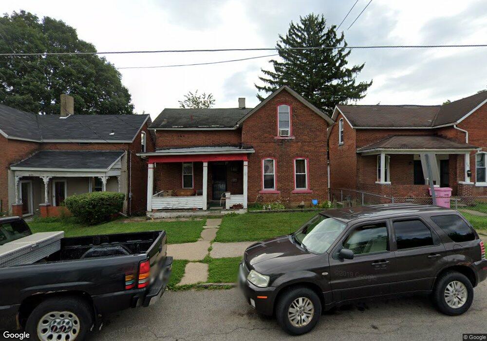
277 S Adams St Mansfield, OH 44902
Estimated Value: $45,000 - $72,000
3
Beds
1
Bath
1,216
Sq Ft
$51/Sq Ft
Est. Value
About This Home
This home is located at 277 S Adams St, Mansfield, OH 44902 and is currently estimated at $62,447, approximately $51 per square foot. 277 S Adams St is a home located in Richland County with nearby schools including St. Peter's Elementary/Montessori School, St. Peter's High School/Junior High, and Discovery School.
Ownership History
Date
Name
Owned For
Owner Type
Purchase Details
Closed on
Jun 18, 1999
Sold by
Tobin Jeffrey E
Bought by
Dukes Lee E Jones Clarence
Current Estimated Value
Home Financials for this Owner
Home Financials are based on the most recent Mortgage that was taken out on this home.
Original Mortgage
$44,000
Outstanding Balance
$11,614
Interest Rate
7.06%
Mortgage Type
New Conventional
Estimated Equity
$50,833
Purchase Details
Closed on
Jan 25, 1994
Sold by
Heffelfinger Mildred M
Bought by
Tobin Jeffrey A
Create a Home Valuation Report for This Property
The Home Valuation Report is an in-depth analysis detailing your home's value as well as a comparison with similar homes in the area
Home Values in the Area
Average Home Value in this Area
Purchase History
| Date | Buyer | Sale Price | Title Company |
|---|---|---|---|
| Dukes Lee E Jones Clarence | $55,000 | -- | |
| Tobin Jeffrey A | $24,500 | -- |
Source: Public Records
Mortgage History
| Date | Status | Borrower | Loan Amount |
|---|---|---|---|
| Open | Dukes Lee E Jones Clarence | $44,000 |
Source: Public Records
Tax History Compared to Growth
Tax History
| Year | Tax Paid | Tax Assessment Tax Assessment Total Assessment is a certain percentage of the fair market value that is determined by local assessors to be the total taxable value of land and additions on the property. | Land | Improvement |
|---|---|---|---|---|
| 2024 | $46 | $11,680 | $2,600 | $9,080 |
| 2023 | $88 | $11,680 | $2,600 | $9,080 |
| 2022 | $216 | $12,610 | $2,510 | $10,100 |
| 2021 | $217 | $12,610 | $2,510 | $10,100 |
| 2020 | $222 | $12,610 | $2,510 | $10,100 |
| 2019 | $129 | $10,770 | $2,130 | $8,640 |
| 2018 | $127 | $10,770 | $2,130 | $8,640 |
| 2017 | $124 | $10,770 | $2,130 | $8,640 |
| 2016 | $201 | $11,930 | $2,440 | $9,490 |
| 2015 | $192 | $11,930 | $2,440 | $9,490 |
| 2014 | $189 | $11,930 | $2,440 | $9,490 |
| 2012 | $174 | $11,930 | $2,570 | $9,360 |
Source: Public Records
Map
Nearby Homes
- 319 Altamont Ave
- 327 Hammond Ave
- 188 S Franklin Ave
- 259 S Main St
- 286 S Main St
- 212 S Main St
- 0 N Adams St
- 394 S Main St
- 175 S Mulberry St
- 137 Lexington Ave
- 186 S Mulberry St
- 305 Home Ave
- 96 Glenwood Heights
- 519 S Diamond St
- 261 Superior St
- 430 Beethoven St
- 172 -172 1 2 Lexington Ave
- 120 Grover St
- 209 Second
- 69 Reba Ave