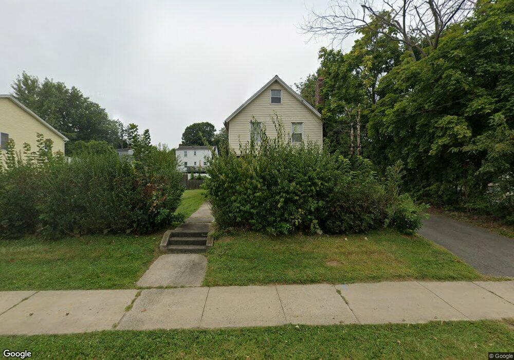
277 Silas Deane Hwy Wethersfield, CT 06109
Estimated Value: $316,000 - $379,000
3
Beds
2
Baths
1,312
Sq Ft
$259/Sq Ft
Est. Value
About This Home
This home is located at 277 Silas Deane Hwy, Wethersfield, CT 06109 and is currently estimated at $339,339, approximately $258 per square foot. 277 Silas Deane Hwy is a home located in Hartford County with nearby schools including Charles Wright School, Silas Deane Middle School, and Wethersfield High School.
Ownership History
Date
Name
Owned For
Owner Type
Purchase Details
Closed on
May 7, 2010
Sold by
Lasalle Bk
Bought by
Boykin Andria J
Current Estimated Value
Home Financials for this Owner
Home Financials are based on the most recent Mortgage that was taken out on this home.
Original Mortgage
$127,645
Outstanding Balance
$86,885
Interest Rate
5.37%
Mortgage Type
FHA
Estimated Equity
$252,454
Purchase Details
Closed on
Jun 26, 2009
Sold by
Randazzo Mary
Bought by
Lasalle Bank Na Tr
Purchase Details
Closed on
Feb 13, 2001
Sold by
Abbruzzese Michael
Bought by
Randazzo Paul E
Create a Home Valuation Report for This Property
The Home Valuation Report is an in-depth analysis detailing your home's value as well as a comparison with similar homes in the area
Home Values in the Area
Average Home Value in this Area
Purchase History
| Date | Buyer | Sale Price | Title Company |
|---|---|---|---|
| Boykin Andria J | $130,000 | -- | |
| Lasalle Bank Na Tr | -- | -- | |
| Randazzo Paul E | $102,000 | -- |
Source: Public Records
Mortgage History
| Date | Status | Borrower | Loan Amount |
|---|---|---|---|
| Open | Randazzo Paul E | $40,000 | |
| Open | Randazzo Paul E | $127,645 | |
| Previous Owner | Randazzo Paul E | $181,900 |
Source: Public Records
Tax History Compared to Growth
Tax History
| Year | Tax Paid | Tax Assessment Tax Assessment Total Assessment is a certain percentage of the fair market value that is determined by local assessors to be the total taxable value of land and additions on the property. | Land | Improvement |
|---|---|---|---|---|
| 2025 | $6,381 | $154,800 | $56,000 | $98,800 |
| 2024 | $5,307 | $122,780 | $48,080 | $74,700 |
| 2023 | $5,130 | $122,780 | $48,080 | $74,700 |
| 2022 | $5,044 | $122,780 | $48,080 | $74,700 |
| 2021 | $4,993 | $122,780 | $48,080 | $74,700 |
| 2020 | $4,996 | $122,780 | $48,080 | $74,700 |
| 2019 | $5,002 | $122,780 | $48,080 | $74,700 |
| 2018 | $5,208 | $127,700 | $47,400 | $80,300 |
| 2017 | $5,079 | $127,700 | $47,400 | $80,300 |
| 2016 | $4,922 | $127,700 | $47,400 | $80,300 |
| 2015 | $4,877 | $127,700 | $47,400 | $80,300 |
| 2014 | $4,692 | $127,700 | $47,400 | $80,300 |
Source: Public Records
Map
Nearby Homes
- 18 Avalon Place
- 7 Harmund Ct
- 9 Avalon Place
- 193 Wolcott Hill Rd Unit 195
- 14 Fernwood St
- 317 Garden St Unit 319
- 26 Tifton Rd
- 53 Wolcott Hill Rd Unit C23
- 24 Williams St
- 118 Church St
- 41 Hartford Ave
- 24 Stillman Rd
- 92 Reed Dr
- 493 Main St
- 70 Stillman Rd
- 442 Wolcott Hill Rd
- 80 Spruce St
- 55 Rutledge Rd
- 126 Tredeau St
- 11 Yale St
- 281 Silas Deane Hwy
- 283 Silas Deane Hwy
- 271 Silas Deane Hwy
- 70 Wright Rd
- 287 Silas Deane Hwy
- 76 Wright Rd
- 62 Wright Rd
- 282 Silas Deane Hwy Unit 284
- 265 Silas Deane Hwy
- 58 Wright Rd
- 82 Wright Rd
- 291 Silas Deane Hwy
- 266 Silas Deane Hwy
- 86 Wright Rd
- 00 Oxford St
- 54 Wright Rd
- 71 Wright Rd
- 75 Wright Rd
- 67 Wright Rd
- 274 Silas Deane Hwy